The dive site Blouklip, Bloukrans or Blousteen is a shoreline rocky reef in the Rooi-els area on the east side of False Bay, near Cape Town in the Western Cape province of South Africa.
Understand[edit]

This site is more protected than most in this area from the south westerly swell, and is accessible from the shore.
Position[edit]
- S34°16.439’ E018°50.163’ 1 Blouklip reefs (Entry and exit area)
This site is not in a Marine Protected Area. A permit is not required.
Name[edit]

Variously named "Blouklip", "Blousteen" and "Bloukrans" for the dark rock ridge of the "Tygerberg" formation at the entry point. The mountain range behind the site is known as the Blousteenberge, and the peak directly above it is Rooielsberg.
Depth[edit]
Maximum depth about 17 m
Visibility[edit]
Unlikely to be more than 10 m on a good day, but has more good days than most of the sites in the vicinity.
Topography[edit]
Inshore is moderate size boulders and outcrops. Further out they get lower until at 10 m there are fairly flat gravel beds. Further out are more outcrops, some flat shale reef, more gravel beds and yet more outcrops.There are also some little patches of sand amongst the rocks and gravel.
Geology: The area is noted for the conspicuous surface deposits of manganese ore. The dark rocks near sea level are outcrops of the Tygerberg formation of the Pre–Cambrian Malmesbury series, similar to those at Gordon’s Bay. The unconformity between this formation and the sandstones of the Graafwater formation is fairly close to the water here, and visible in places, though usually covered by scree.
Conditions[edit]
Best during or after south-easterly winds (summer). This area can be exposed to the south-easter at times when it blows parallel to the local shoreline from the Kogelbaai, and if strong this can push up a nasty chop. In these conditions the boulder beach to the south west of the outcrop will be sheltered from the wind and chop and will make a suitable alternative exit.
This site may have better visibility and flatter water than any of the other inshore sites on the east coast of False Bay, as it is sheltered from the south-westerly swell and has a short fetch in a south-easterly wind. It may be diveable when all the Gordon's Bay sites are too dirty, and the Rooi-els sites are too surgey. It is exposed to north westerlies.
Facilities[edit]
There is a paved off-road parking area about 90 m towards Kogelbaai (north east) from the top of the path.
Get in[edit]
Usual access is from the shore, as there is a long boat ride from the nearest publicly accessible launch site. Park at the side of Faure Marine drive (R44) at the paved parking bay. The path starts at the first of the wire-bound gabion retaining walls about 90 m to the south of the parking area and is rugged and fairly steep. Entry and exit at the large dark grey rock outcrop. Choose your own spot to suit the tide and sea state. There is a fairly sheltered spot on the north east side of the outcrop just inshore of the long ridge which extends to the right as a breakwater. The ledge in this angle is often a good entry and exit point if the tide is suitable. Alternative access by boat from Rooi-els slipway if you are a local resident, or from Gordon's Bay (about 15 km)
-
View from the bottom of the path to Blouklip
-
The north side of the Blouklip ridge from the bottom of the path
-
The alternative exit area to the south west of the ridge
See[edit]
Marine life[edit]
-
Gas flame nudibranchs
-
This sponge is more common as an encrusting morph
-
Scribbled nudibranch
-
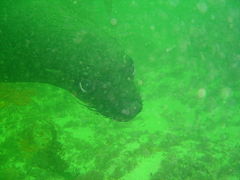
Cape fur seal
Photography[edit]
Macro photography is most likely to produce good results
Routes[edit]
No particular routes recommended.
Stay safe[edit]
Hazards[edit]
Shore access requires a long walk down a steep path and a slightly tricky entry and exit.
Skills[edit]
No special skills required. The area is suitable for snorkelling.
Equipment[edit]
No special equipment recommended.
Nearby[edit]
- 1 Blousteen Ridge
- 2 Whirlpool Cove
- 3 Percy’s Hole
- 4 Kruis
- 5 Rooi-els Point
- 6 Coral Gardens
- 7 Andre se Gat
- 8 Balcony
- 9 Ankers
- 10 Mike's Point
- 11 Container Bay
Back to the Alphabetical list of sites, or list of dive sites in the Rooi-els area
Other regional dive sites:


