File:15th Arrondissement of Paris as seen from Pont de Bir-Hakeim 140507 1.jpg

Original file (7,578 × 3,991 pixels, file size: 13.67 MB, MIME type: image/jpeg)
This is a file from the Wikimedia Commons and may be used by other projects. Information from its description page there is shown below.
Commons is a freely licensed media file repository. |
Summary
| Description |
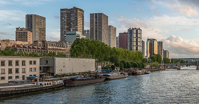
English: The 15th arrondissement of Paris as seen from the Pont de Bir-Hakeim, shortly before sunset.
Español: XV Distrito de París, Francia, visto desde el puente de Bir-Hakeim poco antes del atardecer.
|
||||
| Date | |||||
| Source | Own work | ||||
| Author | DXR |


| Camera location | | View this and other nearby images on: OpenStreetMap |
|---|
Assessment
|
This image has been selected as picture of the day on Wikimedia Commons for 7 May 2024. It will be captioned as follows: English: The 15th arrondissement of Paris as seen from the Pont de Bir-Hakeim, shortly before sunset. Other languages:
English: The 15th arrondissement of Paris as seen from the Pont de Bir-Hakeim, shortly before sunset. Español: XV Distrito de París, Francia, visto desde el puente de Bir-Hakeim poco antes del atardecer. Magyar: Párizs 15. kerülete a Pont de Bir-Hakeimről nézve, röviddel naplemente előtt Português: 15.º arrondissement de Paris, França, visto da Ponte de Bir-Hakeim pouco antes do pôr do sol. |
|
|
Panorama by DXR (Category)
The photograph above is a panoramic image which was created by me, Daniel Vorndran, and uploaded here as User:DXR.
Please note:
|


Licensing
- You are free:
- to share – to copy, distribute and transmit the work
- to remix – to adapt the work
- Under the following conditions:
- attribution – You must give appropriate credit, provide a link to the license, and indicate if changes were made. You may do so in any reasonable manner, but not in any way that suggests the licensor endorses you or your use.
- share alike – If you remix, transform, or build upon the material, you must distribute your contributions under the same or compatible license as the original.
File history
Click on a date/time to view the file as it appeared at that time.
| Date/Time | Thumbnail | Dimensions | User | Comment | |
|---|---|---|---|---|---|
| current | 21:51, 3 June 2014 | | 7,578 × 3,991 (13.67 MB) | DXR | Selective cloud brightening top right corner |
| 13:31, 2 June 2014 |  | 7,578 × 3,991 (13.67 MB) | DXR | Slight straightening | |
| 13:09, 8 May 2014 |  | 7,595 × 4,000 (14.38 MB) | DXR | Spots removed | |
| 12:59, 8 May 2014 |  | 7,595 × 4,000 (14.3 MB) | DXR | VicuñaUploader 1.20 |
File usage
The following page uses this file:
Global file usage
The following other wikis use this file:
- Usage on ast.wikipedia.org
- Usage on de.wikivoyage.org
- Usage on el.wikipedia.org
- Usage on es.wikipedia.org
- Usage on fr.wikipedia.org
- Usage on fr.wikivoyage.org
- Usage on hu.wikipedia.org
- Usage on id.wikipedia.org
- Usage on ko.wikipedia.org
- Usage on mk.wikipedia.org
- Usage on pt.wikipedia.org
- Usage on ro.wikipedia.org
- Usage on ru.wikipedia.org
- Usage on uk.wikipedia.org
- Usage on vep.wikipedia.org
- Usage on vi.wikipedia.org
- Usage on www.wikidata.org