File:Map-South Africa-Western Cape travel regions (2023).png
Jump to navigation
Jump to search
Size of this preview: 761 × 600 pixels. Other resolutions: 305 × 240 pixels | 609 × 480 pixels | 975 × 768 pixels | 1,141 × 899 pixels.
Original file (1,141 × 899 pixels, file size: 425 KB, MIME type: image/png)
This is a file from the Wikimedia Commons and may be used by other projects. Information from its description page there is shown below.
Commons is a freely licensed media file repository. |
.png)
Summary
| Description |
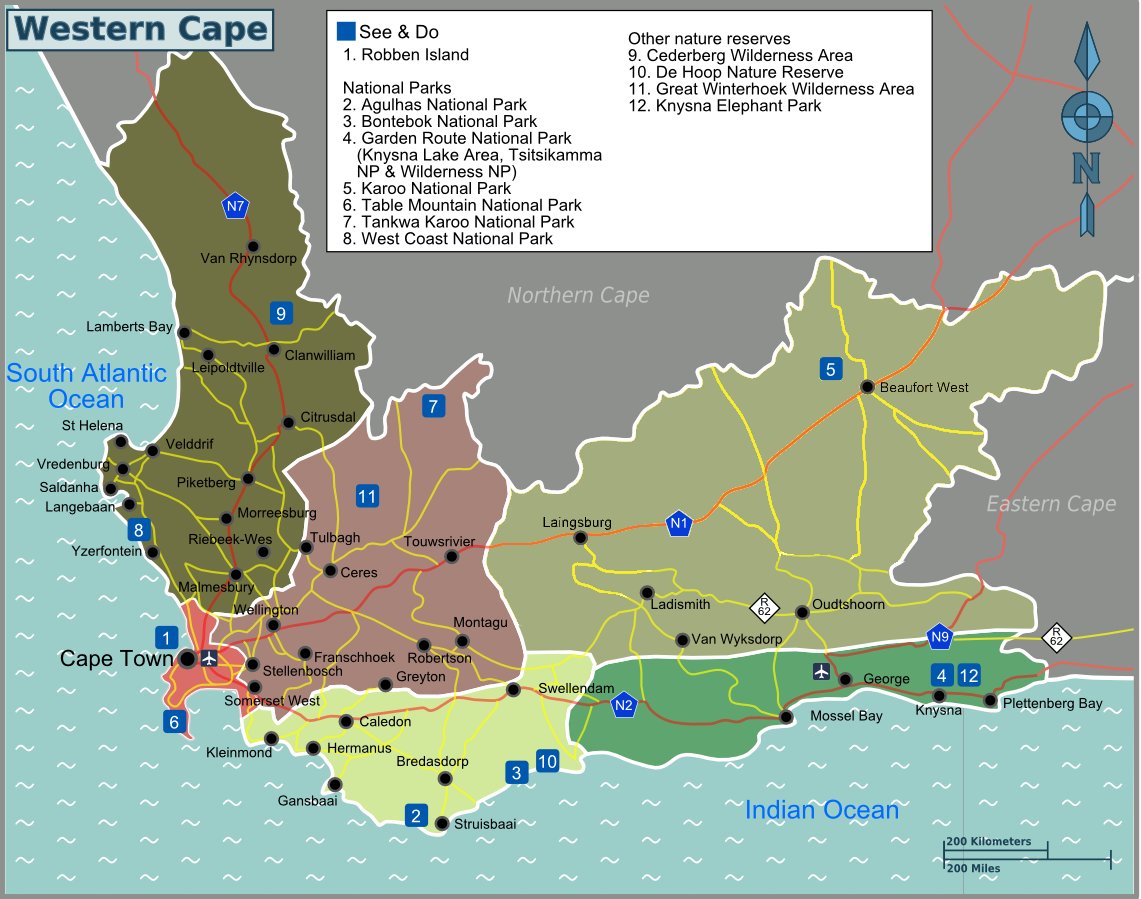
English: Wikivoyage-style map of Western Cape, showing travel regions, main cities and other significant destinations. Red lines denote national highways and yellow lines denote other highways. |
| Date | |
| Source | Derivative work of File:Map-South Africa-Western Cape02.png - map updated to reflect new regions structure at EN Wikivoyage |
| Author | Nick Roux (original); this revision by Shaundd |
Licensing
This file is licensed under the Creative Commons Attribution-Share Alike 3.0 Unported license.
- You are free:
- to share – to copy, distribute and transmit the work
- to remix – to adapt the work
- Under the following conditions:
- attribution – You must give appropriate credit, provide a link to the license, and indicate if changes were made. You may do so in any reasonable manner, but not in any way that suggests the licensor endorses you or your use.
- share alike – If you remix, transform, or build upon the material, you must distribute your contributions under the same or compatible license as the original.
File history
Click on a date/time to view the file as it appeared at that time.
| Date/Time | Thumbnail | Dimensions | User | Comment | |
|---|---|---|---|---|---|
| current | 17:08, 2 June 2023 | | 1,141 × 899 (425 KB) | Shaundd | Uploaded a work by Nick Roux (original); this revision by Shaundd from Derivative work of File:Map-South Africa-Western Cape02.png - map updated to reflect new regions structure at EN Wikivoyage with UploadWizard |
File usage
The following page uses this file:
.png)