File:WaddeneilandenNL.png
Jump to navigation
Jump to search
No higher resolution available.
WaddeneilandenNL.png (334 × 197 pixels, file size: 18 KB, MIME type: image/png)
This is a file from the Wikimedia Commons and may be used by other projects. Information from its description page there is shown below.
Commons is a freely licensed media file repository. |
| Description |
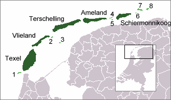
English: Map of West Frisian Islands
Nederlands: Kaartje van de Nederlandse Waddeneilanden |
| Date | |
| Source |
nl:Afbeelding:WaddeneilandenNL.png, history on nl: below: Geschiedenis van de afbeelding Verklaring: (huidig) = huidige afbeelding, (verw) = verwijder de oude versie, (herstel) = breng oude versie terug. Klik op het tijdstip om de versie van de afbeelding te zien die op dat tijdstip is geüpload.
|
| Author | Mtcv |
| Other versions |
 |
| This work has been released into the public domain by its author, Mtcv. This applies worldwide. In some countries this may not be legally possible; if so: |
File history
Click on a date/time to view the file as it appeared at that time.
| Date/Time | Thumbnail | Dimensions | User | Comment | |
|---|---|---|---|---|---|
| current | 20:09, 2 July 2006 | | 334 × 197 (18 KB) | Dani 7C3 | {{Information |Description={{en}}Map of West Frisian islands <br>{{nl}}Kaartje van de Nederlandse waddeneilanden |Source=nl:Afbeelding:WaddeneilandenNL.png |Date=31 January 2004 |Author=Mtcv |Permission=see below |other_versions= }} {{P |
File usage
There are no pages that use this file.
Global file usage
The following other wikis use this file:
- Usage on af.wikipedia.org
- Usage on ar.wikipedia.org
- Usage on br.wikipedia.org
- Usage on da.wikipedia.org
- Usage on de.wikipedia.org
- Usage on de.wikivoyage.org
- Usage on eo.wikipedia.org
- Usage on es.wikipedia.org
- Usage on es.wikibooks.org
- Usage on fi.wikipedia.org
- Usage on frr.wikipedia.org
- Usage on is.wikipedia.org
- Usage on it.wikipedia.org
- Usage on it.wikivoyage.org
- Usage on ja.wikipedia.org
- Usage on ka.wikipedia.org
- Usage on ko.wikipedia.org
- Usage on li.wikipedia.org
- Usage on nds-nl.wikipedia.org
- Usage on nl.wikipedia.org
- Usage on nn.wikipedia.org
- Usage on no.wikipedia.org
- Usage on pl.wikipedia.org
- Usage on sh.wikipedia.org
- Usage on simple.wikipedia.org
- Usage on stq.wikipedia.org
- Usage on sv.wikipedia.org
- Usage on vls.wikipedia.org
- Usage on zh.wikipedia.org