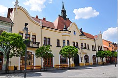
Topoľčany is a small town in Western Slovakia with a population of about 30,000, lying 100km north-east of Bratislava, the capital of Slovakia.

Get in
There are numerous bus and train connections from Bratislava. See Schedules in Slovakia
By bus
There are buses going at least every hour during the daytime from Bratislava's main bus terminal, AS Mlynske Nivy. The fare is approximately 6 EUR and the journey takes about 2 hours.
By train
There is a regular direct train connection running between Bratislava's main railway station (Hlavna stanica) and Topolcany twice daily, in the morning and in the evening. The fare is approximately 6 EUR and the journey takes about 2 hours.
Get around
See
- 1 Topoľčany Castle (In the village of Podhradie, 15km NW). Hilltop castle ruins
Do
Cycling - there are 4 cycle routes around the town stretching in the direction of the Povazsky Inovec mountains. Each of them has different sign color. The route map can be found in front of the church in the main town square.
Buy
Eat
Drink
Sleep
- Hotel Puk, Pushkin 1, ☏ +421 38 5326001. From €15.90 without breakfast.
- Hotel KOPAČKA, Dr. Adámiho 2, ☏ +421 38 5320097. 34 bed hotel next the football stadium/
Go next
- Tríbeč mountains - protected forest area in close proximity to the town

