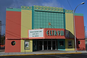
Baker City is a small city in Eastern Oregon located on the I-84 about 40 minutes south-east of La Grande.

Get in
Most people will arrive on the I-84 which runs from Portland through to Boise and beyond. Highway 7 runs west to John Day and Highway 86 goes east as the Hell's Canyon Scenic Highway.
Get around
See
- The Oregon Trail Interpretive Center, Highway 86 (6 miles (10 km) east of the town). Informative and interesting. You can see the old ruts from the wagon trains on the hills near the museum. The Center is a National Historic Site and there is an entrance fee although National Park passes may be used here.
Do
- The Hells Canyon Scenic Highway. This is the southern end of the Hells Canyon Scenic Highway which follows Rte 86 east of town to the Snake River on the Oregon-Idaho border. The Scenic drive can be followed as a big loop around to Joseph and La Grande further to the north. Be aware that driving the entire loop may not be possible during winter as some roads are not maintained and can be blocked by snow. This situation may exist well into spring (ie: late April). Some of the roads traverse high terrain where winter snows may linger longer than you might expect.

- Historic Building Walk. The town has numerous restored older buildings and there is a walking route around the downtown featuring many of these fine old structures.
- The Elkhorn Scenic Byway. A wonderful drive through the Elkhorn Mountains just outside of Baker City. It follows Highway 7 to Sumpter and around to Haines past Anthony Lakes Ski Area and the North Fork John Day River Wilderness. This route is also often tough in Winter.
- Anthony Lakes Ski Area. Some of the most powdery ski conditions in Oregon and is just 35 miles from Baker City.
- The Powder River and Phillips Reservoir. Great fishing opportunities both in Baker City and nearby.
- Miners Jubilee, Geiser Pollman Park. Miners Jubilee is an annual festival in July that features a parade, bull and bronc riding, a showing of the movie Paint Your Wagons (filmed in Baker City), gold panning championships, and other exciting events.
Buy
- Bella, Main St. Little kitchen store with enormous wine selection, gifts, coffee bar, kitchen gadgets and more.
Eat
- Barley Brown's Brewpub. Has excellent craft beers and good food.
- El Eradero. Mexican restaurant.
- Paizano's Pizza, 2940 10th St, ☏ +1 541 524-1000. 11AM-close. Gourmet pizzas, huge stromboli, over 65 different toppings, excellent salads, over 30 beers available, TVs, sports.
- Mad Matilda's Coffee, Main St. Great coffee shop in a historic downtown building.
Drink
Sleep
- Best Western Sunridge Inn, 1 Sunridge Ln, ☏ +1 541 523-6444, toll-free: +1 800 233-2368, fax: +1 541 523-6446.
- Baker Vacation Rentals, ☏ +1 541 406-0234. Beautifully decorated historic home and condo available for rent. www.BakerCityVacationRentals.com $79.
- Geiser Grand Hotel, 1996 Main St, ☏ +1 541 523-1889. Great historic hotel. Also has a stellar restaurant and bar.
Connect
The Baker County Library located near the downtown has Internet access with wireless capabilities. The Library is well-appointed and an attractive place to spend some time.
Go next
| Routes through Baker City |
| The Dalles ← La Grande ← | W |
→ Huntington → Boise |
| The Dalles ← La Grande ← | W |
→ Huntington → Boise |
