File:2013-10-05 Valbona, Albania 8806.jpg
Jump to navigation
Jump to search
Size of this preview: 800 × 533 pixels. Other resolutions: 320 × 213 pixels | 640 × 427 pixels | 1,024 × 683 pixels | 1,280 × 853 pixels | 2,560 × 1,707 pixels | 4,104 × 2,736 pixels.
Original file (4,104 × 2,736 pixels, file size: 8.27 MB, MIME type: image/jpeg)
This is a file from the Wikimedia Commons and may be used by other projects. Information from its description page there is shown below.
Commons is a freely licensed media file repository. |
Summary
| Description |
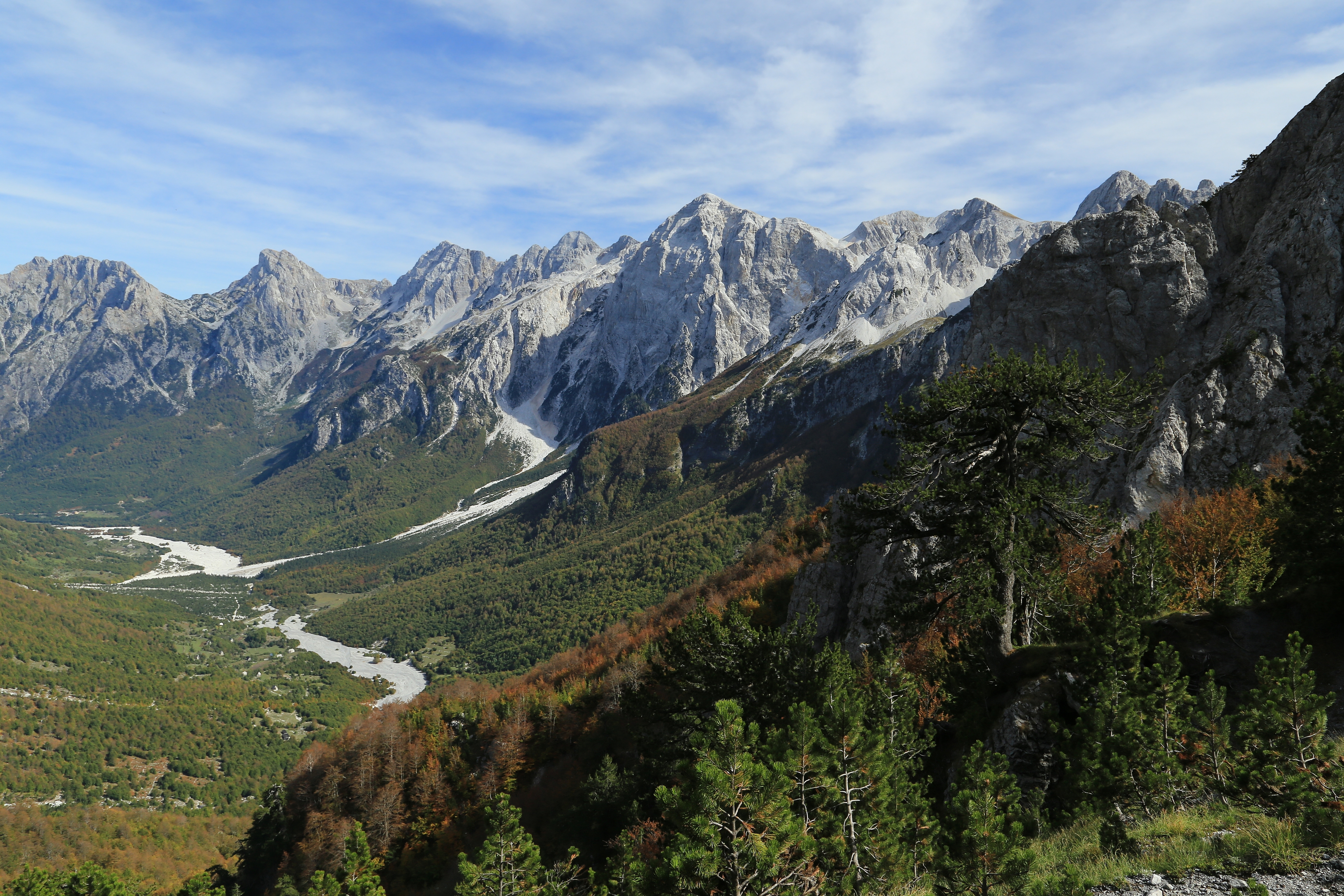
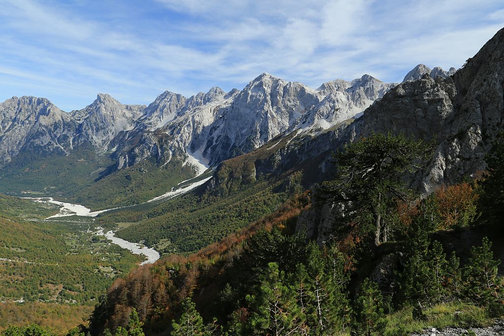
English: Photo from the Valbonë Valley National Park
The Qafa e Valbonës, or Valbona pass in Albania connects the town of Theth, located at Theth National Park in a valley formed by the Shalë river with the town of Valbonë in Valbonë Valley National Park. This photograph was taken in October 2013 on the Valbona side at about 2/3 of the ascent to the top of the pass. It shows the mountains surrounding Maja Grykat e Hapëta, which is one of the highest mountains of all of Albania. |
| Date | |
| Source | Own work |
| Author |
Tobias Klenze Deutsch: Weiterverwendung gemäß Lizenz mit dem folgenden Hinweis möglich:
Bild: Wikipedia / Tobias Klenze / CC-BY-SA 4.0. Die Lizenz muss verlinkt werden!English: You may re-use this image under the terms of the license using the following reference: Image: Wikipedia / Tobias Klenze / CC-BY-SA 4.0. The license must be a link! |
| Camera location | | View this and other nearby images on: OpenStreetMap |
|---|
Licensing
I, the copyright holder of this work, hereby publish it under the following licenses:

|
Permission is granted to copy, distribute and/or modify this document under the terms of the GNU Free Documentation License, Version 1.2 or any later version published by the Free Software Foundation; with no Invariant Sections, no Front-Cover Texts, and no Back-Cover Texts. A copy of the license is included in the section entitled GNU Free Documentation License. |
This file is licensed under the Creative Commons Attribution 3.0 Unported license.
- You are free:
- to share – to copy, distribute and transmit the work
- to remix – to adapt the work
- Under the following conditions:
- attribution – You must give appropriate credit, provide a link to the license, and indicate if changes were made. You may do so in any reasonable manner, but not in any way that suggests the licensor endorses you or your use.
You may select the license of your choice.
File history
Click on a date/time to view the file as it appeared at that time.
| Date/Time | Thumbnail | Dimensions | User | Comment | |
|---|---|---|---|---|---|
| current | 16:06, 11 January 2014 | | 4,104 × 2,736 (8.27 MB) | Iifar | +sharpness |
| 15:00, 19 December 2013 |  | 5,472 × 3,648 (6.87 MB) | Church of emacs |
File usage
The following page uses this file:
Global file usage
The following other wikis use this file:
- Usage on da.wikipedia.org
- Usage on de.wikipedia.org
- Usage on de.wikivoyage.org
- Usage on en.wikipedia.org
- Usage on es.wikipedia.org
- Usage on fi.wikipedia.org
- Usage on fr.wikipedia.org
- Usage on hr.wikipedia.org
- Usage on hu.wikipedia.org
- Usage on id.wikipedia.org
- Usage on it.wikivoyage.org
- Usage on mk.wikipedia.org
- Usage on ml.wikipedia.org
- Usage on nl.wikipedia.org
- Usage on sl.wikipedia.org
- Usage on sq.wikipedia.org
- Usage on sv.wikipedia.org
- Usage on www.wikidata.org