File:2013-10-06 Stone Bridge, Prizren, Kosovo 8649.jpg
Jump to navigation
Jump to search

Size of this preview: 800 × 531 pixels. Other resolutions: 320 × 212 pixels | 640 × 424 pixels | 1,024 × 679 pixels | 1,280 × 849 pixels | 2,560 × 1,698 pixels | 5,038 × 3,341 pixels.
Original file (5,038 × 3,341 pixels, file size: 4.29 MB, MIME type: image/jpeg)
This is a file from the Wikimedia Commons and may be used by other projects. Information from its description page there is shown below.
Commons is a freely licensed media file repository. |
Summary
| Description |
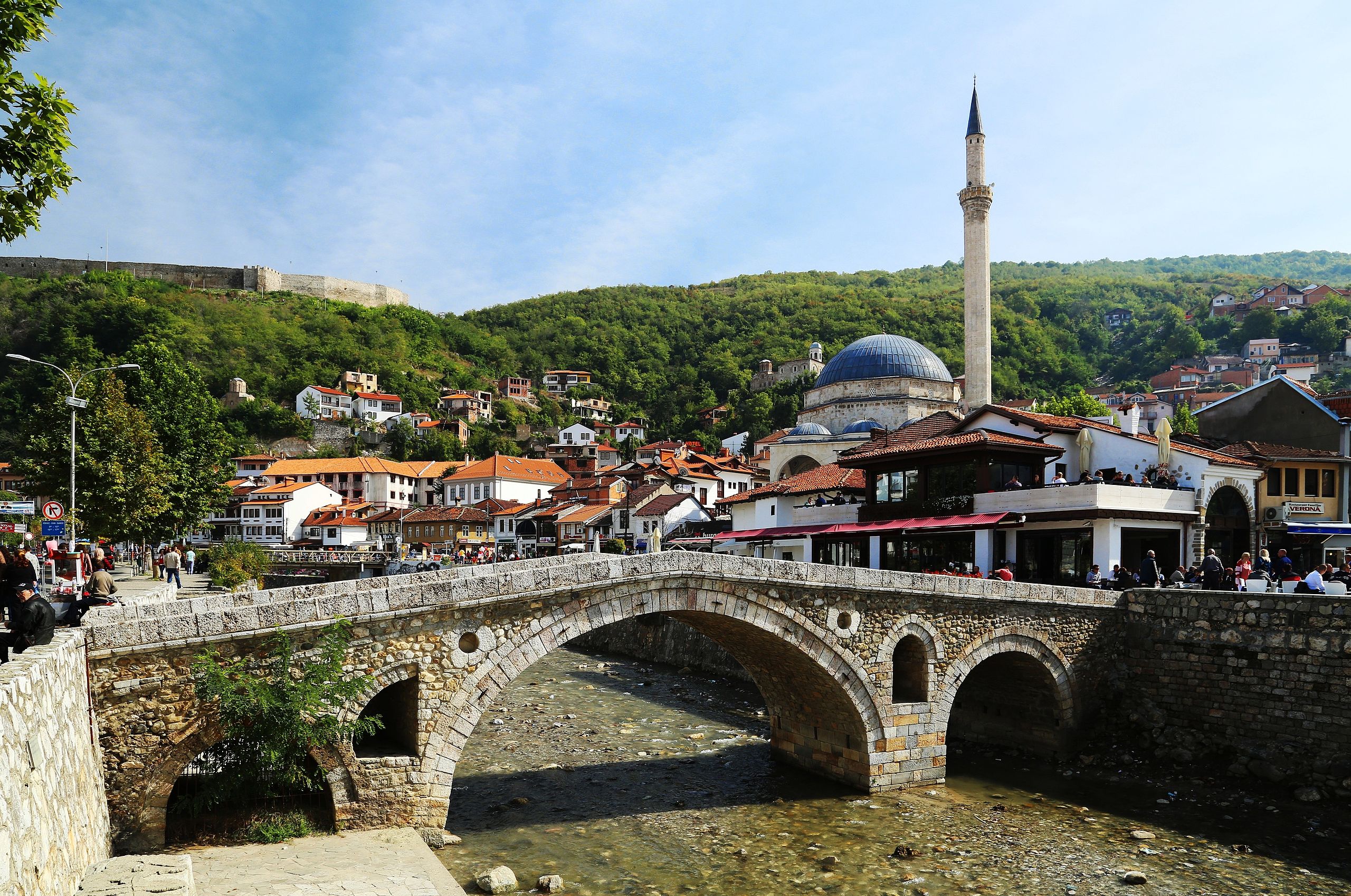
English: The Old Stone Bridge (alb. Ura e gurit; serb. Камеңи мост/Kameni most; turk. Taş köprüsu) is an Ottoman bridge and one of the landmarks of Prizren, Kosovo. It crosses the Prizrenska Bistrica (alb. Lumëbardh) river and is suspected to be from the late fifteenth century, although there are only few historical sources. The photograph displays the bridge, with the Sinan Pasha Mosque clearly being visible in the background. On the left side of the photo, the outer wall of Kaljaja, Prizren's Fortress can be seen. |
| Date | |
| Source | Own work |
| Author |
Tobias Klenze Deutsch: Weiterverwendung gemäß Lizenz mit dem folgenden Hinweis möglich:
Bild: Wikipedia / Tobias Klenze / CC-BY-SA 4.0. Die Lizenz muss verlinkt werden!English: You may re-use this image under the terms of the license using the following reference: Image: Wikipedia / Tobias Klenze / CC-BY-SA 4.0. The license must be a link! |
| Camera location | | View this and other nearby images on: OpenStreetMap |
|---|
Licensing
I, the copyright holder of this work, hereby publish it under the following licenses:

|
Permission is granted to copy, distribute and/or modify this document under the terms of the GNU Free Documentation License, Version 1.2 or any later version published by the Free Software Foundation; with no Invariant Sections, no Front-Cover Texts, and no Back-Cover Texts. A copy of the license is included in the section entitled GNU Free Documentation License. |
This file is licensed under the Creative Commons Attribution 3.0 Unported license.
- You are free:
- to share – to copy, distribute and transmit the work
- to remix – to adapt the work
- Under the following conditions:
- attribution – You must give appropriate credit, provide a link to the license, and indicate if changes were made. You may do so in any reasonable manner, but not in any way that suggests the licensor endorses you or your use.
You may select the license of your choice.
File history
Click on a date/time to view the file as it appeared at that time.
| Date/Time | Thumbnail | Dimensions | User | Comment | |
|---|---|---|---|---|---|
| current | 11:36, 25 January 2014 | | 5,038 × 3,341 (4.29 MB) | Church of emacs | cropped just a tiny bit at the bottom; + a tiny bit of JPG compression to get the filesize down |
| 11:07, 25 January 2014 |  | 5,040 × 3,423 (12 MB) | Church of emacs | perspective correction | |
| 10:45, 25 January 2014 |  | 5,427 × 3,537 (11.15 MB) | Church of emacs | sharpened a bit | |
| 10:39, 25 January 2014 |  | 5,427 × 3,537 (4.4 MB) | Church of emacs |
File usage
The following page uses this file:
Global file usage
The following other wikis use this file:
- Usage on arz.wikipedia.org
- Usage on ba.wikipedia.org
- Usage on be.wikipedia.org
- Usage on br.wikipedia.org
- Usage on ceb.wikipedia.org
- Usage on cs.wikipedia.org
- Usage on da.wikipedia.org
- Usage on de.wikipedia.org
- Usage on de.wikivoyage.org
- Usage on en.wikipedia.org
- Usage on eo.wikipedia.org
- Usage on gl.wikipedia.org
- Usage on hr.wikipedia.org
- Usage on lb.wikipedia.org
- Usage on lt.wiktionary.org
- Usage on lv.wikipedia.org
- Usage on pl.wikipedia.org
- Usage on pl.wikivoyage.org
- Usage on ru.wikipedia.org
- Usage on sq.wikipedia.org
- Usage on sr.wikipedia.org
- Usage on vo.wikipedia.org
- Usage on www.wikidata.org