File:Amsterdam-map.png
Jump to navigation
Jump to search

Size of this preview: 700 × 600 pixels. Other resolutions: 280 × 240 pixels | 560 × 480 pixels | 896 × 768 pixels | 1,195 × 1,024 pixels | 1,959 × 1,679 pixels.
Original file (1,959 × 1,679 pixels, file size: 1.95 MB, MIME type: image/png)
This is a file from the Wikimedia Commons and may be used by other projects. Information from its description page there is shown below.
Commons is a freely licensed media file repository. |
Summary
| Description |
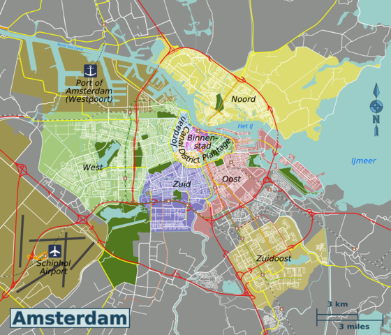
English: Map of Amsterdam. |
| Date | |
| Source | Own work based on OpenStreetMap.org. |
| Author | Globe-trotter |
| Other versions | Amsterdam-map.svg |
Licensing
This file is licensed under the Creative Commons Attribution-Share Alike 3.0 Unported license.
- You are free:
- to share – to copy, distribute and transmit the work
- to remix – to adapt the work
- Under the following conditions:
- attribution – You must give appropriate credit, provide a link to the license, and indicate if changes were made. You may do so in any reasonable manner, but not in any way that suggests the licensor endorses you or your use.
- share alike – If you remix, transform, or build upon the material, you must distribute your contributions under the same or compatible license as the original.
| This work contains information from OpenStreetMap, which is made available under the Open Database License (ODbL).
The ODbL does not require any particular license for maps produced from ODbL data. Prior to 1 August 2020, map tiles produced by the OpenStreetMap Foundation were licensed under the CC-BY-SA-2.0 license. Maps produced by other people may be subject to other licences. |
Original upload log
| This file was imported from Wikivoyage WTS. |
The original description page was here. All following user names refer to wts.wikivoyage-old.
- 2011-07-20 19:31 (WT-shared) Globe-trotter[dead link] 1880×1611 (1875672 bytes) {{Imagecredit|credit=Globe-trotter, based on work by OpenStreetMap.org contributors [http://openstreetmap.org]|captureDate=July 20, 2011|loc (Import from wikitravel.org/shared)
- 2011-09-29 19:35 (WT-shared) Globe-trotter[dead link] 2000×1714 (2076015 bytes) updated districts to reflect current situation (Import from wikitravel.org/shared)
- 2012-11-01 11:30 Globe-trotter[dead link] 1959×1679 (2043848 bytes) minor changes
File history
Click on a date/time to view the file as it appeared at that time.
| Date/Time | Thumbnail | Dimensions | User | Comment | |
|---|---|---|---|---|---|
| current | 21:39, 1 August 2013 | | 1,959 × 1,679 (1.95 MB) | Globe-trotter | district names |
| 23:39, 22 November 2012 |  | 1,959 × 1,679 (1.95 MB) | Globe-trotter | changed district names | |
| 03:44, 21 November 2012 |  | 1,959 × 1,679 (1.95 MB) | OgreBot | (BOT): Reverting to most recent version before archival | |
| 03:44, 21 November 2012 |  | 2,000 × 1,714 (1.98 MB) | OgreBot | (BOT): Uploading old version of file from wts.wikivoyage; originally uploaded on 2011-09-29 19:35:32 by (WT-shared) Globe-trotter | |
| 03:44, 21 November 2012 |  | 1,880 × 1,611 (1.79 MB) | OgreBot | (BOT): Uploading old version of file from wts.wikivoyage; originally uploaded on 2011-07-20 19:31:39 by (WT-shared) Globe-trotter | |
| 21:15, 17 November 2012 |  | 1,959 × 1,679 (1.95 MB) | MGA73bot2 | {{BotMoveToCommons|wts.oldwikivoyage|year={{subst:CURRENTYEAR}}|month={{subst:CURRENTMONTHNAME}}|day={{subst:CURRENTDAY}}}} == {{int:filedesc}} == {{Information |description=Map of Amsterdam. * Map of: Amsterdam¤ |date=July 20, 2011 |source={{wikivoya... |
File usage
The following 3 pages use this file:
Global file usage
The following other wikis use this file:
- Usage on ca.wikipedia.org
- Usage on el.wikivoyage.org
- Usage on es.wikipedia.org
- Usage on fr.wikivoyage.org
- Usage on ga.wikipedia.org
- Usage on gl.wikipedia.org
- Usage on he.wikivoyage.org
- Usage on it.wikivoyage.org
- Usage on ja.wikivoyage.org
- Usage on nl.wikivoyage.org
- Usage on oc.wikipedia.org
- Usage on www.wikidata.org