File:Bridge over Forest Way - geograph.org.uk - 1608776.jpg
Jump to navigation
Jump to search
No higher resolution available.
Bridge_over_Forest_Way_-_geograph.org.uk_-_1608776.jpg (640 × 428 pixels, file size: 171 KB, MIME type: image/jpeg)
This is a file from the Wikimedia Commons and may be used by other projects. Information from its description page there is shown below.
Commons is a freely licensed media file repository. |
Summary
| Description |
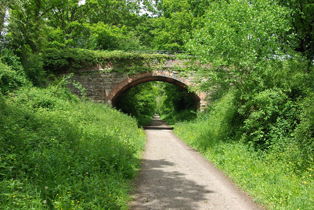
English: Bridge over Forest Way Luxfords Lane crosses the old East Grinstead to Tunbridge Wells railway, now the Forest Way trail. The section from Forest Row in the Medway valley up to the heights of East Grinstead was known as Brambletye Bank. The steady uphill incline is still a drag to cyclists, but easy going the other way, of course. |
| Date | |
| Source | From geograph.org.uk |
| Author | Robin Webster |
| Attribution (required by the license) | Robin Webster / Bridge over Forest Way / |
| Camera location | | View this and other nearby images on: OpenStreetMap |
|---|
_heading:337.00&language=en)
| Object location | | View this and other nearby images on: OpenStreetMap |
|---|
_heading:337.00&language=en)
Licensing

|
This image was taken from the Geograph project collection. See this photograph's page on the Geograph website for the photographer's contact details. The copyright on this image is owned by Robin Webster and is licensed for reuse under the Creative Commons Attribution-ShareAlike 2.0 license.
|
This file is licensed under the Creative Commons Attribution-Share Alike 2.0 Generic license.
Attribution: Robin Webster
- You are free:
- to share – to copy, distribute and transmit the work
- to remix – to adapt the work
- Under the following conditions:
- attribution – You must give appropriate credit, provide a link to the license, and indicate if changes were made. You may do so in any reasonable manner, but not in any way that suggests the licensor endorses you or your use.
- share alike – If you remix, transform, or build upon the material, you must distribute your contributions under the same or compatible license as the original.
File history
Click on a date/time to view the file as it appeared at that time.
| Date/Time | Thumbnail | Dimensions | User | Comment | |
|---|---|---|---|---|---|
| current | 05:51, 4 March 2011 | | 640 × 428 (171 KB) | GeographBot | == {{int:filedesc}} == {{Information |description={{en|1=Bridge over Forest Way Luxfords Lane crosses the old East Grinstead to Tunbridge Wells railway, now the Forest Way trail. The section from Forest Row in the Medway valley up to the heights of East G |
File usage
The following page uses this file: