File:Chicago districts map.png
Jump to navigation
Jump to search
Size of this preview: 571 × 600 pixels. Other resolutions: 229 × 240 pixels | 457 × 480 pixels | 731 × 768 pixels | 975 × 1,024 pixels | 2,518 × 2,644 pixels.
Original file (2,518 × 2,644 pixels, file size: 424 KB, MIME type: image/png)
This is a file from the Wikimedia Commons and may be used by other projects. Information from its description page there is shown below.
Commons is a freely licensed media file repository. |
Summary
| Description |
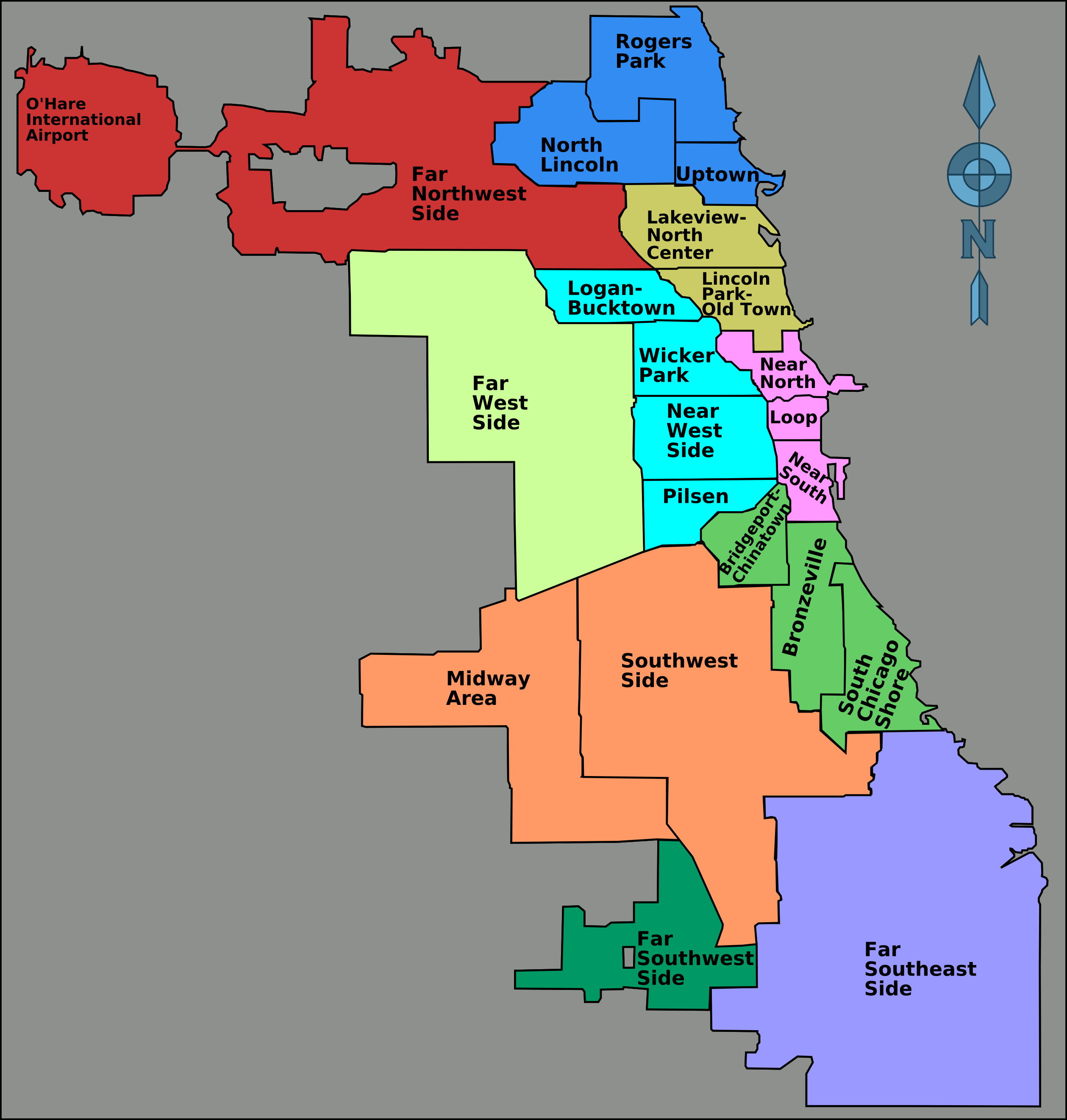
English: A Districts of Chicago Map Districts by color, subdivisions outlined and labeled. This map of "districts" was criticized in https://www.chicagotribune.com/news/local/breaking/ct-met-worst-chicago-neighborhood-map-ever-20181130-story.html |
| Date | 1/6/2007 |
| Source | http://wikitravel.org/shared/Image:Chicago_districts_map.png |
| Author | Peter Fitzgerald |
Licensing
| This work has been released into the public domain by its author, Peter Fitzgerald. This applies worldwide. In some countries this may not be legally possible; if so: Peter Fitzgerald grants anyone the right to use this work for any purpose, without any conditions, unless such conditions are required by law.
|
File history
Click on a date/time to view the file as it appeared at that time.
| Date/Time | Thumbnail | Dimensions | User | Comment | |
|---|---|---|---|---|---|
| current | 04:58, 5 July 2008 | | 2,518 × 2,644 (424 KB) | Astuishin | {{Information |Description={{en|1=A Districts of Chicago Map Districts by color, subdivisions outlined and labeled }} |Source=http://wikitravel.org/shared/Image:Chicago_districts_map.png |Author=Peter Fitzgerald |Date=1/6/2007 |Permission= |other_version |
File usage
The following page uses this file:
Global file usage
The following other wikis use this file: