File:Chimney Rock NE.jpg
Jump to navigation
Jump to search

Size of this preview: 800 × 533 pixels. Other resolutions: 320 × 213 pixels | 640 × 427 pixels | 1,024 × 683 pixels | 1,280 × 853 pixels | 2,560 × 1,707 pixels | 3,504 × 2,336 pixels.
Original file (3,504 × 2,336 pixels, file size: 1.6 MB, MIME type: image/jpeg)
This is a file from the Wikimedia Commons and may be used by other projects. Information from its description page there is shown below.
Commons is a freely licensed media file repository. |
| Description | |
| Date | |
| Source | Chimney Rock |
| Author | Mike Tigas from Columbia, MO, United States |
| Camera location | | View this and other nearby images on: OpenStreetMap |
|---|
Licensing
This file is licensed under the Creative Commons Attribution 2.0 Generic license.
- You are free:
- to share – to copy, distribute and transmit the work
- to remix – to adapt the work
- Under the following conditions:
- attribution – You must give appropriate credit, provide a link to the license, and indicate if changes were made. You may do so in any reasonable manner, but not in any way that suggests the licensor endorses you or your use.
| This image was originally posted to Flickr by Mike Tigas at https://www.flickr.com/photos/17362366@N00/3838579593. It was reviewed on 5 October 2009 by FlickreviewR and was confirmed to be licensed under the terms of the cc-by-2.0. |
File history
Click on a date/time to view the file as it appeared at that time.
| Date/Time | Thumbnail | Dimensions | User | Comment | |
|---|---|---|---|---|---|
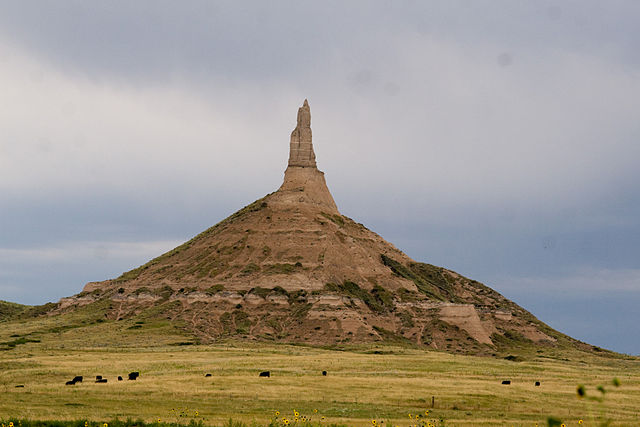
| current | 15:38, 5 October 2009 | | 3,504 × 2,336 (1.6 MB) | Jonesey | {{Information |Description={{en|{{w|Chimney Rock National Historic Site|Chimney Rock}} in {{w|Morrill County, Nebraska}}, USA}} |Source=[http://www.flickr.com/photos/17362366@N00/3838579593/ Chimney Rock] |Date=2009-08-16 17:59 |Author=[http://www.flickr. |
File usage
The following 9 pages use this file:
Global file usage
The following other wikis use this file:
- Usage on af.wikipedia.org
- Usage on ar.wikipedia.org
- Usage on ceb.wikipedia.org
- Usage on de.wikipedia.org
- Usage on en.wikipedia.org
- Oregon Trail
- Nauvoo, Illinois
- Garden Grove, Iowa
- Fort Bridger
- National Historic Site (United States)
- Scotts Bluff National Monument
- South Pass (Wyoming)
- Mormon Trail
- This Is the Place Heritage Park
- California Trail
- Winter Quarters (North Omaha, Nebraska)
- Independence Rock
- Chimney Rock National Historic Site
- Fort Laramie National Historic Site
- Martin's Cove
- Mount Pisgah, Iowa
- Courthouse and Jail Rocks
- Devil's Gate (Wyoming)
- Emigration Canyon, Utah
- Big Mountain Pass
- History Nebraska
- Nebraska Highway 92
- Register Cliff
- Names Hill
- Route of the Oregon Trail
- User:U52983/sandbox
- User:Chris Light/sandbox
- Template:Mormon Trail landmarks
- First Encampment Park
- Usage on es.wikivoyage.org
- Usage on gl.wikipedia.org
- Usage on ja.wikipedia.org
- Usage on ja.wikivoyage.org
- Usage on lt.wikipedia.org
- Usage on pt.wikipedia.org
- Usage on ru.wikipedia.org
- Usage on sv.wikipedia.org
- Usage on www.wikidata.org
- Usage on zh.wikipedia.org