File:Eastern end of bridge.jpg
Jump to navigation
Jump to search
Size of this preview: 800 × 532 pixels. Other resolutions: 320 × 213 pixels | 640 × 426 pixels | 1,024 × 681 pixels | 1,280 × 851 pixels | 2,560 × 1,702 pixels | 6,016 × 4,000 pixels.
Original file (6,016 × 4,000 pixels, file size: 6.02 MB, MIME type: image/jpeg)
This is a file from the Wikimedia Commons and may be used by other projects. Information from its description page there is shown below.
Commons is a freely licensed media file repository. |
|
This is an image of a place or building that is listed on the National Register of Historic Places in the United States of America. Its reference number is 04000789. |
| Camera location | | View this and other nearby images on: OpenStreetMap |
|---|
| Description |
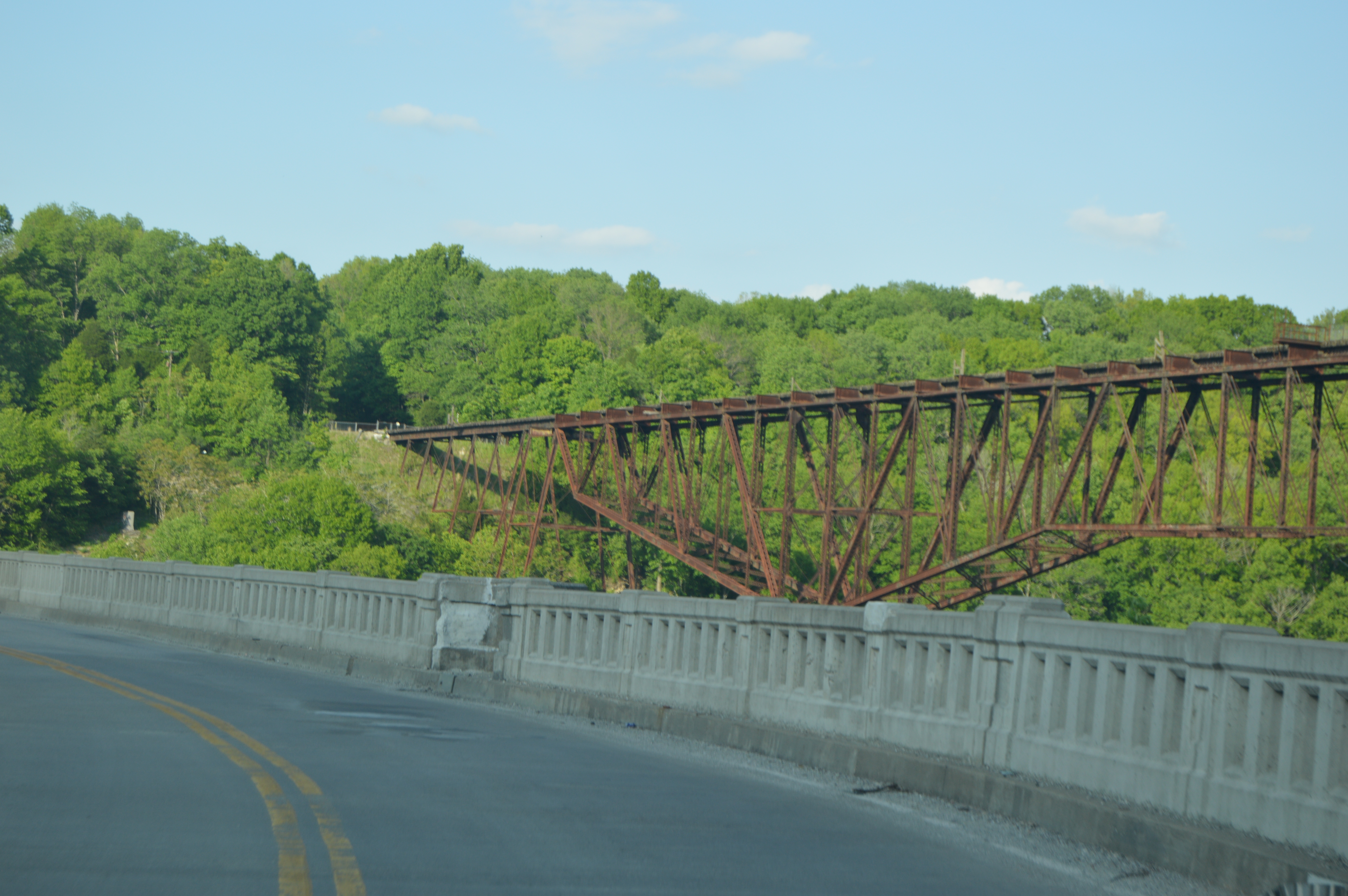
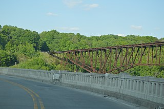
English: Northern side of the Tyrone Bridge, which formerly carried the Lexington Extension of the Louisville Southern Railroad over the Kentucky River between Lawrenceburg and Versailles in the U.S. state of Kentucky. Built in 1889, it is listed on the National Register of Historic Places along with the rest of the Lexington Extension. Photo is taken from the U.S. Route 62 bridge, immediately downstream. |
||
| Date | Taken on 17 May 2014 | ||
| Source | Own work | ||
| Author | Nyttend | ||
| Permission (Reusing this file) |
|
File history
Click on a date/time to view the file as it appeared at that time.
| Date/Time | Thumbnail | Dimensions | User | Comment | |
|---|---|---|---|---|---|
| current | 05:17, 24 May 2014 | | 6,016 × 4,000 (6.02 MB) | Nyttend | {{Location|38|10|25|N|85|50|45|W}} {{Information |Description={{en|Northern side of the Tyrone Bridge, which formerly carried the {{w|Lexington Extension of the Louisville Southern Railroad|Louisville Extension}} of the {{w|Louisville Southern Railroad... |
File usage
The following page uses this file:
Global file usage
The following other wikis use this file:
- Usage on en.wikipedia.org
- Usage on es.wikipedia.org
- Usage on www.wikidata.org