File:Fort Napoléon des Saintes 2010-03-30.jpg
Jump to navigation
Jump to search
Size of this preview: 800 × 533 pixels. Other resolutions: 320 × 213 pixels | 640 × 427 pixels | 1,024 × 683 pixels | 1,280 × 853 pixels | 3,000 × 2,000 pixels.
Original file (3,000 × 2,000 pixels, file size: 1.73 MB, MIME type: image/jpeg)
This is a file from the Wikimedia Commons and may be used by other projects. Information from its description page there is shown below.
Commons is a freely licensed media file repository. |
Summary
| Description |
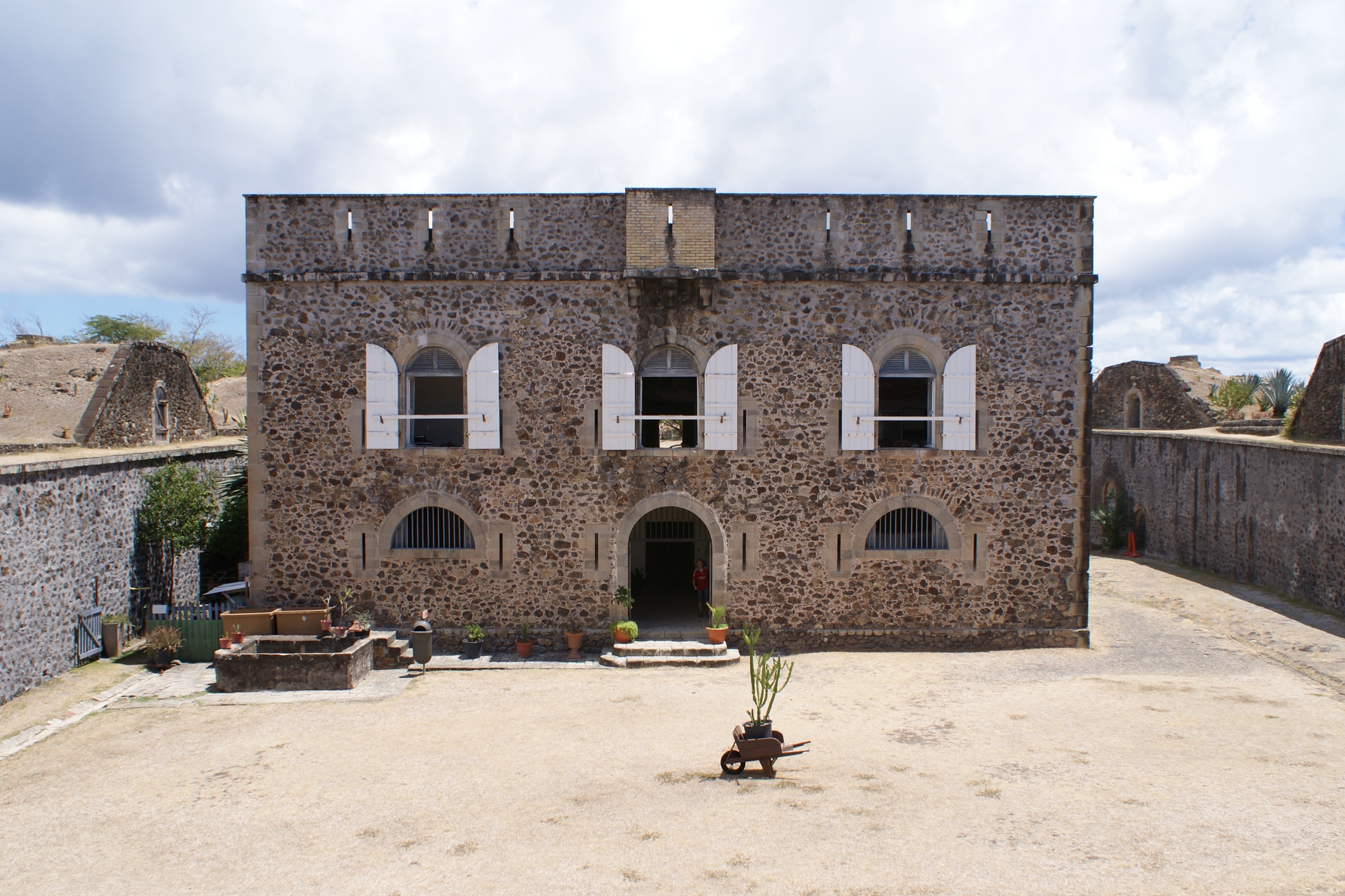
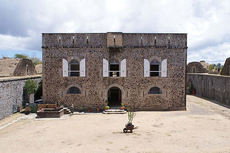
English: Facade of Fort Napoléon des Saintes, Terre-de-Haut Island, Îles des Saintes, Guadeloupe, France.
Français : La façade du Fort Napoléon des Saintes, à Terre-de-Haut, dans les Saintes (Guadeloupe, France). |
| Date | |
| Source | Own work |
| Author | Kim Hansen |
| Camera location | | View this and other nearby images on: OpenStreetMap |
|---|
Licensing
I, the copyright holder of this work, hereby publish it under the following licenses:
This file is licensed under the Creative Commons Attribution-Share Alike 3.0 Unported license.
- You are free:
- to share – to copy, distribute and transmit the work
- to remix – to adapt the work
- Under the following conditions:
- attribution – You must give appropriate credit, provide a link to the license, and indicate if changes were made. You may do so in any reasonable manner, but not in any way that suggests the licensor endorses you or your use.
- share alike – If you remix, transform, or build upon the material, you must distribute your contributions under the same or compatible license as the original.

|
Permission is granted to copy, distribute and/or modify this document under the terms of the GNU Free Documentation License, Version 1.2 or any later version published by the Free Software Foundation; with no Invariant Sections, no Front-Cover Texts, and no Back-Cover Texts. A copy of the license is included in the section entitled GNU Free Documentation License. |
You may select the license of your choice.

|
This image has been assessed under the valued image criteria and is considered the most valued image on Commons within the scope: Fort Napoléon des Saintes. You can see its nomination here. |
File history
Click on a date/time to view the file as it appeared at that time.
| Date/Time | Thumbnail | Dimensions | User | Comment | |
|---|---|---|---|---|---|
| current | 23:03, 16 October 2010 | | 3,000 × 2,000 (1.73 MB) | Slaunger | Corrected barrel distortion using GIMP |
| 19:28, 15 October 2010 |  | 3,610 × 2,009 (2.16 MB) | Slaunger | {{Information |Description={{en|Facade of en:Fort Napoléon des Saintes, en:Terre des Haut island, en:Îles des Saintes, en:Guadeloupe.}} |Source={{own}} |Date=2010-03-30 |Author=Kim Hansen |Permission=See below |othe |
File usage
The following page uses this file:
Global file usage
The following other wikis use this file:
- Usage on fr.wikipedia.org
- Usage on ms.wikipedia.org
- Usage on pl.wikivoyage.org