File:London Underground Overground DLR Crossrail map zone.pdf
Jump to navigation
Jump to search
Size of this JPG preview of this PDF file: 800 × 422 pixels. Other resolutions: 320 × 169 pixels | 640 × 338 pixels | 1,024 × 541 pixels | 1,280 × 676 pixels | 2,560 × 1,352 pixels | 5,208 × 2,750 pixels.
Original file (5,208 × 2,750 pixels, file size: 120 KB, MIME type: application/pdf)
This is a file from the Wikimedia Commons and may be used by other projects. Information from its description page there is shown below.
Commons is a freely licensed media file repository. |
| Description |
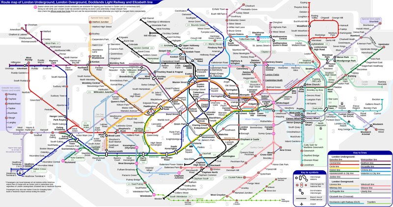
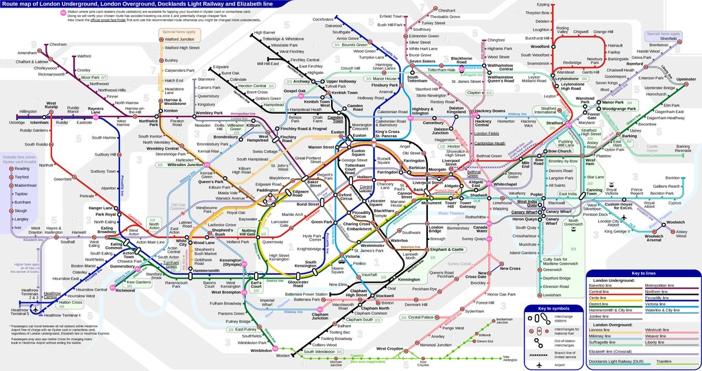
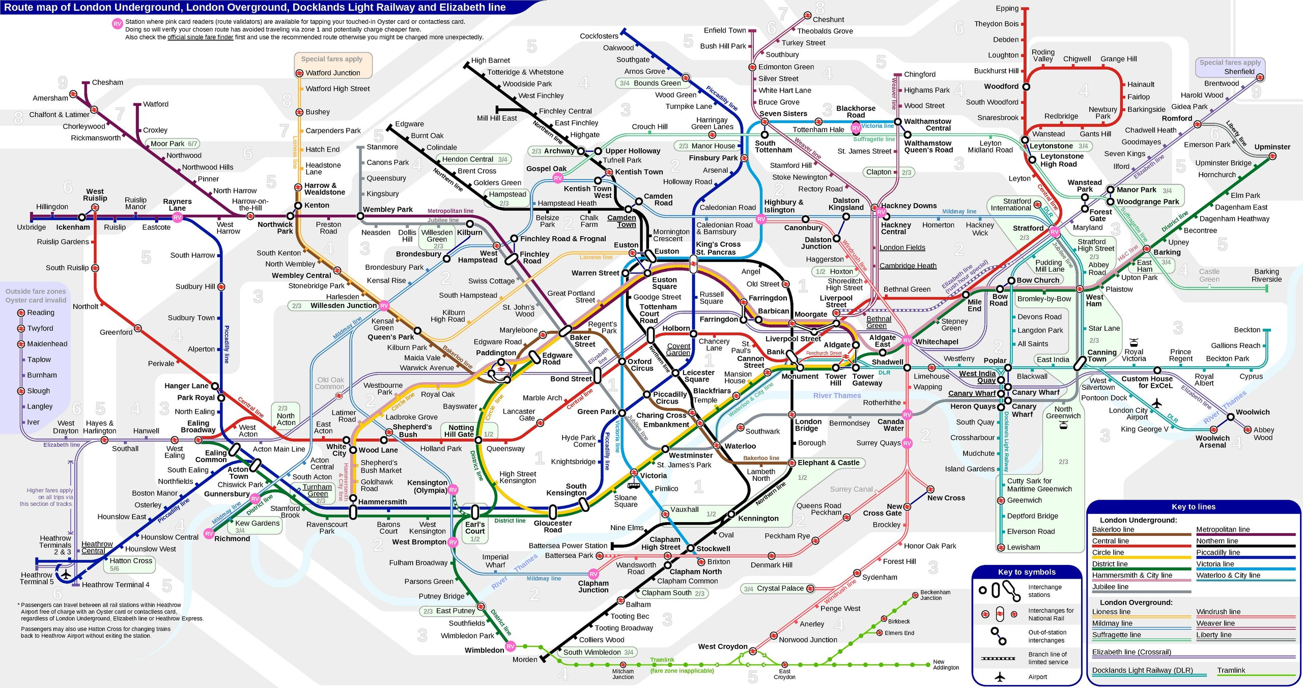
English: *Route map of London Underground, London Overground, Docklands Light Railway and Crossrail, including most green-lighted proposals.
|
|||
| Date | ||||
| Source | Own work | |||
| Author | Sameboat | |||
| Permission (Reusing this file) |
I, the copyright holder of this work, hereby publish it under the following license: This file is licensed under the Creative Commons Attribution-Share Alike 4.0 International license.
|
|||
| Other versions |
|


File history
Click on a date/time to view the file as it appeared at that time.
| Date/Time | Thumbnail | Dimensions | User | Comment | |
|---|---|---|---|---|---|
| current | 02:41, 8 April 2024 |  | 5,208 × 2,750 (120 KB) | Sameboat | |
| 01:46, 24 February 2020 | 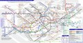 | 5,208 × 2,750 (120 KB) | Sameboat | ||
| 06:16, 10 February 2019 |  | 5,208 × 2,750 (120 KB) | Sameboat | labels adjustment: Highbury & Islington - Dalston Junction | |
| 09:01, 23 December 2018 | 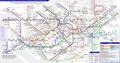 | 5,208 × 2,750 (120 KB) | Sameboat | ||
| 09:07, 16 December 2018 |  | 5,208 × 2,750 (120 KB) | Sameboat | ||
| 09:38, 5 August 2018 | 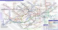 | 5,208 × 2,750 (120 KB) | Sameboat | ||
| 07:40, 26 May 2018 | 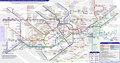 | 5,208 × 2,750 (121 KB) | Sameboat | fix some zone number positions | |
| 00:08, 25 May 2018 | 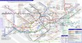 | 5,208 × 2,750 (121 KB) | Sameboat | TfL Rail Heathrow fare details | |
| 13:37, 20 May 2018 |  | 5,208 × 2,750 (120 KB) | Sameboat | ||
| 01:12, 20 May 2018 | 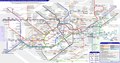 | 5,208 × 2,750 (120 KB) | Sameboat |
File usage
There are no pages that use this file.