File:Mapa-RMSP-subregions.svg
Jump to navigation
Jump to search

Size of this PNG preview of this SVG file: 800 × 480 pixels. Other resolutions: 320 × 192 pixels | 1,024 × 614 pixels | 1,280 × 768 pixels | 2,560 × 1,536 pixels.
Original file (SVG file, nominally 1,000 × 600 pixels, file size: 72 KB)
This is a file from the Wikimedia Commons and may be used by other projects. Information from its description page there is shown below.
Commons is a freely licensed media file repository. |
Summary
| Description |
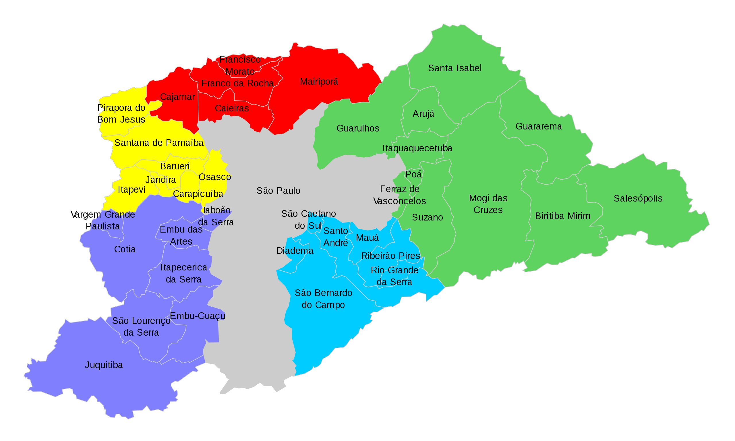
Português: Mapa dos municípios que compõem a Região Metropolitana de São Paulo dividos por sub-regiões, conforme Lei Complementar 1.139/2011, de 16 de junho de 2011:
Município de São Paulo (integra todas as sub-regiões);
Sub-região norte;
Sub-região leste;
Sub-região sudeste;
Sub-região sudoeste;
Sub-região oeste; |
| Date | |
| Source | File:Mapa-RMSP.svg, own work |
| Author |
by Marcos Elias de Oliveira Júnior talk! + (contact here) |
| Permission (Reusing this file) |
This file is licensed under the Creative Commons Attribution 3.0 Unported license.
|
File history
Click on a date/time to view the file as it appeared at that time.
| Date/Time | Thumbnail | Dimensions | User | Comment | |
|---|---|---|---|---|---|
| current | 19:45, 28 August 2012 | | 1,000 × 600 (72 KB) | Marquinhos | User created page with UploadWizard |
File usage
The following page uses this file:
Global file usage
The following other wikis use this file:
- Usage on ca.wikipedia.org
- Usage on de.wikipedia.org
- Usage on pt.wikipedia.org
- Cotia
- Região Metropolitana de São Paulo
- Paranapiacaba
- Jundiapeba
- Jordanésia
- Cidade Kemel
- Ouro Fino Paulista
- Brás Cubas (Mogi das Cruzes)
- César de Sousa
- Sabaúna
- Taiaçupeba
- Quatinga
- Jardim Silveira
- Jardim Presidente Dutra
- Caucaia do Alto
- Aldeia de Carapicuíba
- Cipó-Guaçu
- Riacho Grande
- Plano de Desenvolvimento Urbano Integrado da Região Metropolitana de São Paulo
- Polvilho (Cajamar)
- Vila Dirce
- Santa Margarida Paulista
- Santo Antônio Paulista
- Boa Vista Paulista
- Palmeiras de São Paulo
- Capuava (Santo André)
- Nossa Senhora do Remédio
- Jardim Santa Luzia
- Aldeia (Barueri)
- Jardim Belval
- Barnabés
- Terra Preta (Mairiporã)
- Biritiba Ussu
- Predefinição:Distritos da Região Metropolitana de São Paulo
- Predefinição:Distritos da Região Metropolitana de São Paulo (Sub-região Leste)
- Conselho de Desenvolvimento da Região Metropolitana de São Paulo
- Usage on pt.wikivoyage.org