File:Playa de Poniente (La Línea de la Concepción) with the Rock of Gibraltar in the background.jpg
Jump to navigation
Jump to search

Size of this preview: 800 × 533 pixels. Other resolutions: 320 × 213 pixels | 640 × 427 pixels | 1,024 × 683 pixels | 1,280 × 853 pixels | 2,560 × 1,707 pixels | 3,456 × 2,304 pixels.
Original file (3,456 × 2,304 pixels, file size: 3.37 MB, MIME type: image/jpeg)
This is a file from the Wikimedia Commons and may be used by other projects. Information from its description page there is shown below.
Commons is a freely licensed media file repository. |
_with_the_Rock_of_Gibraltar_in_the_background.jpg)
| Description |
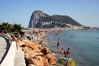
Gibraltar |
| Date | |
| Source | Flickr |
| Author | J RAWLS |
| Reviewer | Andre Engels |
| Camera location | | View this and other nearby images on: OpenStreetMap |
|---|
_with_the_Rock_of_Gibraltar_in_the_background.jpg¶ms=036.163528_N_-005.359083_E_globe:Earth_type:camera__&language=en)
Licensing
This file is licensed under the Creative Commons Attribution 2.0 Generic license.
- You are free:
- to share – to copy, distribute and transmit the work
- to remix – to adapt the work
- Under the following conditions:
- attribution – You must give appropriate credit, provide a link to the license, and indicate if changes were made. You may do so in any reasonable manner, but not in any way that suggests the licensor endorses you or your use.
| This image, originally posted to Flickr, was reviewed on 16 October 2011 by the administrator or reviewer Denniss, who confirmed that it was available on Flickr under the stated license on that date. |
File history
Click on a date/time to view the file as it appeared at that time.
| Date/Time | Thumbnail | Dimensions | User | Comment | |
|---|---|---|---|---|---|
| current | 08:38, 23 October 2008 | | 3,456 × 2,304 (3.37 MB) | FlickrLickr | {{flickr| |title=Gibraltar |description= |photographer=J RAWLS |photographer_location= |photographer_url=http://flickr.com/photos/94571281@N00 |flickr_url=http://flickr.com/photos/94571281@N00/25781229 |taken=2005-07-14 00:30:38 |reviewer=Andre Engels }} |
File usage
The following page uses this file:
Global file usage
The following other wikis use this file:
- Usage on arz.wikipedia.org
- Usage on azb.wikipedia.org
- Usage on be.wikipedia.org
- Usage on ceb.wikipedia.org
- Usage on en.wikipedia.org
- Usage on es.wikipedia.org
- Usage on uk.wikipedia.org
- Usage on www.wikidata.org
_with_the_Rock_of_Gibraltar_in_the_background.jpg)