File:Sraidhiort.jpg
Jump to navigation
Jump to search
No higher resolution available.
Sraidhiort.jpg (640 × 480 pixels, file size: 94 KB, MIME type: image/jpeg)
This is a file from the Wikimedia Commons and may be used by other projects. Information from its description page there is shown below.
Commons is a freely licensed media file repository. |
Summary
| Description |
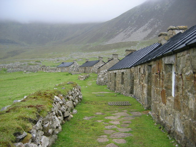
English: Main Street, the village, Hirta St Kilda. Abandoned homes, some of which have been restored with new roofs. |
| Date | |
| Source | Geograph |
| Author | Phillip Hughes |
| Camera location | | View this and other nearby images on: OpenStreetMap |
|---|
Licensing

|
This image was taken from the Geograph project collection. See this photograph's page on the Geograph website for the photographer's contact details. The copyright on this image is owned by Phillip Hughes and is licensed for reuse under the Creative Commons Attribution-ShareAlike 2.0 license.
|
This file is licensed under the Creative Commons Attribution-Share Alike 2.0 Generic license.
Attribution: Phillip Hughes
- You are free:
- to share – to copy, distribute and transmit the work
- to remix – to adapt the work
- Under the following conditions:
- attribution – You must give appropriate credit, provide a link to the license, and indicate if changes were made. You may do so in any reasonable manner, but not in any way that suggests the licensor endorses you or your use.
- share alike – If you remix, transform, or build upon the material, you must distribute your contributions under the same or compatible license as the original.
File history
Click on a date/time to view the file as it appeared at that time.
| Date/Time | Thumbnail | Dimensions | User | Comment | |
|---|---|---|---|---|---|
| current | 15:04, 23 May 2007 | | 640 × 480 (94 KB) | MacRusgail | {{Information |Description=Main Street, the village, Hirta St Kilda. Abandoned homes, some of which have been restored with new roofs |Source=This image was taken from the Geograph project collection. See this photograph's page on the Geograph website |
File usage
The following page uses this file:
Global file usage
The following other wikis use this file:
- Usage on br.wikipedia.org
- Usage on de.wikipedia.org
- Usage on fo.wikipedia.org
- Usage on fr.wikipedia.org
- Usage on gl.wikipedia.org
- Usage on he.wikipedia.org
- פורטל:חינוך/הידעת?/קטעי הידעת
- סנט קילדה
- פורטל:הממלכה המאוחדת/הידעת?/קטעי הידעת?
- פורטל:נצרות/הידעת?/קטעי הידעת
- פורטל:דת/הידעת?/קטעי הידעת
- פורטל:אישים/הידעת?/קטעי הידעת? - 2
- פורטל:אישים/הידעת?/106
- פורטל:מדעי החברה/הידעת?/קטעי הידעת? - 2
- פורטל:מדעי החברה/הידעת?/187
- ויקיפדיה:הידעת?/מנובמבר 2021
- פורטל:דת/הידעת?/31
- פורטל:חינוך/הידעת?/38
- פורטל:הממלכה המאוחדת/הידעת?/73
- פורטל:נצרות/הידעת?/53
- פורטל:המורשת העולמית/הידעת?/קטעי הידעת?
- פורטל:המורשת העולמית/הידעת?/77
- Usage on it.wikipedia.org
- Usage on ja.wikipedia.org
- Usage on lt.wikipedia.org
- Usage on pl.wikipedia.org
- Usage on ru.wikipedia.org