File:Wayne County Michigan labels.png
Jump to navigation
Jump to search

Size of this preview: 800 × 516 pixels. Other resolutions: 320 × 206 pixels | 640 × 413 pixels | 825 × 532 pixels.
Original file (825 × 532 pixels, file size: 175 KB, MIME type: image/png)
This is a file from the Wikimedia Commons and may be used by other projects. Information from its description page there is shown below.
Commons is a freely licensed media file repository. |
Summary
| Description |
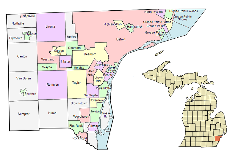
English: Colorized and labeled version of map of Wayne County, in southeastern Michigan. |
| Date | (UTC) |
| Source | Own work (Original text: I (Notorious4life (talk)) created this work entirely by myself.) |
| Author | Notorious4life (talk) |
Licensing
| This work has been released into the public domain by its author, Notorious4life at English Wikipedia. This applies worldwide. In some countries this may not be legally possible; if so: Notorious4life grants anyone the right to use this work for any purpose, without any conditions, unless such conditions are required by law. |
Original upload log
The original description page was here. All following user names refer to en.wikipedia.
- 2010-08-09 08:41 Notorious4life 825×532 (179146 bytes) {{PD-self|date=August 2010}} {{Information |Description = Colorized and labeled version of Wayne County map |Source = I (~~~) created this work entirely by myself. |Date = ~~~~~ |Author = ~~~ |other_versions = }}
File history
Click on a date/time to view the file as it appeared at that time.
| Date/Time | Thumbnail | Dimensions | User | Comment | |
|---|---|---|---|---|---|
| current | 22:37, 1 January 2012 | | 825 × 532 (175 KB) | BotMultichillT | {{BotMoveToCommons|en.wikipedia|year={{subst:CURRENTYEAR}}|month={{subst:CURRENTMONTHNAME}}|day={{subst:CURRENTDAY}}}} == {{int:filedesc}} == {{Information |description={{en|1=Colorized and labeled version of Wayne County map}} |date=08:41, 9 August 2010 |
File usage
The following page uses this file: