File:Wyspa św. Jerzego w Peraście 02.jpg
Jump to navigation
Jump to search

Size of this preview: 800 × 451 pixels. Other resolutions: 320 × 180 pixels | 640 × 360 pixels | 1,024 × 577 pixels | 1,280 × 721 pixels | 2,862 × 1,612 pixels.
Original file (2,862 × 1,612 pixels, file size: 5.93 MB, MIME type: image/jpeg)
This is a file from the Wikimedia Commons and may be used by other projects. Information from its description page there is shown below.
Commons is a freely licensed media file repository. |
Summary
| Description |
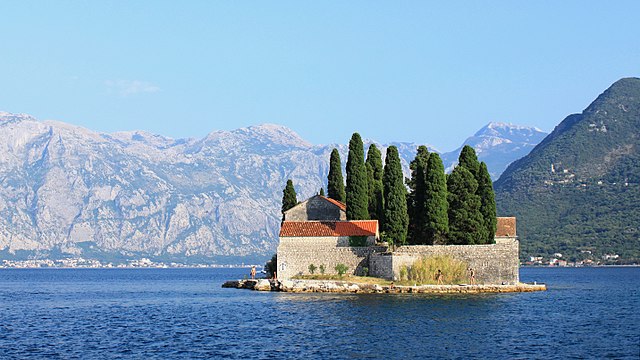
English: Sveti Đorđe - view from the Gospa od Škrpjela (Our Lady of the Rocks islet). Perast, Montenegro.
Українська: Острів Святого Георгія (Sveti Đorđe) - вид з острова Gospe od Škrpjela. Пераст, Чорногорія. |
| Date | |
| Source | Own work |
| Author | Marcin Konsek |
| Attribution (required by the license) | Photo: Marcin Konsek / Wikimedia Commons / |
| Camera location | | View this and other nearby images on: OpenStreetMap |
|---|
Assessment
|

|
This image has been assessed under the valued image criteria and is considered the most valued image on Commons within the scope: Sveti Đorđe Island, Perast, Montenegro. View from N-W.. You can see its nomination here. |
Licensing
I, the copyright holder of this work, hereby publish it under the following license:
This file is licensed under the Creative Commons Attribution-Share Alike 4.0 International license.
- You are free:
- to share – to copy, distribute and transmit the work
- to remix – to adapt the work
- Under the following conditions:
- attribution – You must give appropriate credit, provide a link to the license, and indicate if changes were made. You may do so in any reasonable manner, but not in any way that suggests the licensor endorses you or your use.
- share alike – If you remix, transform, or build upon the material, you must distribute your contributions under the same or compatible license as the original.
File history
Click on a date/time to view the file as it appeared at that time.
| Date/Time | Thumbnail | Dimensions | User | Comment | |
|---|---|---|---|---|---|
| current | 21:16, 21 November 2014 | | 2,862 × 1,612 (5.93 MB) | Halavar | crop to format 16:9 |
| 22:03, 17 February 2014 |  | 2,862 × 1,792 (4.51 MB) | Halavar | better crop | |
| 17:11, 31 January 2014 |  | 2,864 × 1,906 (4.43 MB) | Halavar | User created page with UploadWizard |
File usage
The following page uses this file:
Global file usage
The following other wikis use this file:
- Usage on az.wikipedia.org
- Usage on ca.wikipedia.org
- Usage on de.wikipedia.org
- Usage on de.wikivoyage.org
- Usage on en.wikipedia.org
- Usage on en.wikibooks.org
- Usage on es.wikipedia.org
- Usage on he.wikivoyage.org
- Usage on hr.wikipedia.org
- Usage on incubator.wikimedia.org
- Usage on it.wikipedia.org
- Usage on lt.wikipedia.org
- Usage on nn.wikipedia.org
- Usage on pl.wikipedia.org
- Sveti Đorđe
- Wikipedysta:Halavar
- Wikipedia:Propozycje do Ilustracji na Medal/Wyspa św. Jerzego w Peraście 02.jpg
- Dyskusja pliku:Wyspa św. Jerzego w Peraście 02.jpg
- Szablon:Ilustracja na medal/2014-03-13
- Wikipedysta:The Polish/Nieużywane szablony/Ilustracja na medal/1001-1500
- Portal:Geografia/Zdjęcie/11
- Wikiprojekt:Wyróżniona zawartość Wikipedii/rozpiska
- Wikipedia:Ilustracje na Medal/architektura/budynki
- Szablon:Ilustracja na medal/2024-04-16
- Usage on pl.wiktionary.org
- Usage on pt.wikipedia.org
- Usage on ru.wikipedia.org
- Usage on shn.wikibooks.org
- Usage on sr.wikipedia.org
- Usage on uk.wikipedia.org
- Usage on www.wikidata.org
- Usage on zh.wikipedia.org