File:Zion National Park (2332579061).jpg

Original file (3,008 × 2,000 pixels, file size: 7.36 MB, MIME type: image/jpeg)
This is a file from the Wikimedia Commons and may be used by other projects. Information from its description page there is shown below.
Commons is a freely licensed media file repository. |
.jpg)
Summary
| Description |
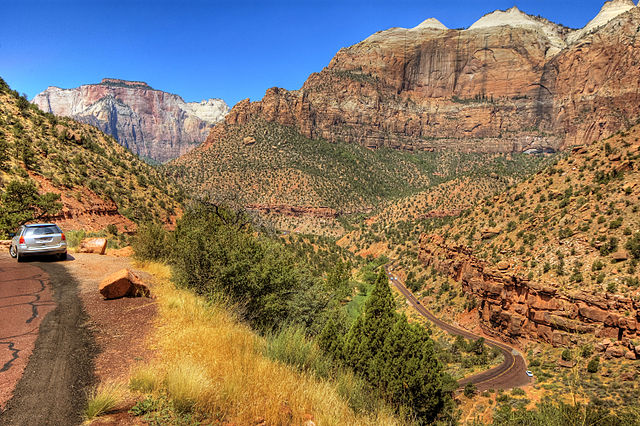
Zion National Park is a United States National Park located in the Southwestern United States, near Springdale, Utah. A prominent feature of the 229-square-mile (593 km²) park is Zion Canyon, 15 miles (24 km) long and up to half a mile (800 m) deep, cut through the reddish and tan-colored Navajo Sandstone by the North Fork of the Virgin River. Located at the junction of the Colorado Plateau, Great Basin, and Mojave Desert regions, this unique geography and variety of life zones allow for unusual plant and animal diversity. A total of 289 bird species, 75 mammals (including 19 species of bat), 32 reptiles and numerous plant species inhabit the park's four life zones: desert, riparian, woodland, and coniferous forest. Notable megafauna include Mountain Lions, Mule Deer and Golden Eagles, along with reintroduced California Condors and Bighorn Sheep. Common plant species include Cottonwood, Cactus, Datura, Juniper, Pine, Boxelder, Sagebrush and various willows. Human habitation of the area started about 8,000 years ago with small family groups of Native Americans; the semi-nomadic Basketmaker Anasazi (300 CE) stem from one of these groups. In turn, the Virgin Anasazi culture (500 CE) developed as the Basketmakers settled in permanent communities. A different group, the Parowan Fremont, lived in the area as well. Both groups moved away by 1300 and were replaced by the Parrusits and several other Southern Paiute subtribes. The canyon was discovered by Mormons (Latter-day Saints) in 1858 and was settled by that same group in the early 1860s. Mukuntuweap National Monument was established in 1909 to protect the canyon, and by 1919 the monument was expanded to become Zion National Park (Zion is an ancient Hebrew word meaning a place of refuge or sanctuary). The Kolob section was proclaimed a separate Zion National Monument in 1937, but was incorporated into the park in 1956. The geology of the Zion and Kolob canyons area includes nine formations that together represent 150 million years of mostly Mesozoic-aged sedimentation. At various periods in that time, warm, shallow seas, streams, ponds and lakes, vast deserts and dry near-shore environments covered the area. Uplift associated with the creation of the Colorado Plateaus lifted the region 10,000 feet (3000 m) starting 13 million years ago.
|
| Date | |
| Source | Zion National Park |
| Author | Wolfgang Staudt from Saarbruecken, Germany |
Licensing
- You are free:
- to share – to copy, distribute and transmit the work
- to remix – to adapt the work
- Under the following conditions:
- attribution – You must give appropriate credit, provide a link to the license, and indicate if changes were made. You may do so in any reasonable manner, but not in any way that suggests the licensor endorses you or your use.
| This image, originally posted to Flickr, was reviewed on 29 January 2013 by the administrator or reviewer File Upload Bot (Magnus Manske), who confirmed that it was available on Flickr under the stated license on that date. |
File history
Click on a date/time to view the file as it appeared at that time.
| Date/Time | Thumbnail | Dimensions | User | Comment | |
|---|---|---|---|---|---|
| current | 17:40, 29 January 2013 | | 3,008 × 2,000 (7.36 MB) | File Upload Bot (Magnus Manske) | Transferred from Flickr by User:russavia |
File usage
The following 2 pages use this file:
.jpg)