
The old Tibetan Empire had three provinces — Ü-Tsang, Amdo and Kham. The names are still sometimes used, the three regions still have different dialects, and the Dalai Lama's Tibetan government-in-exile in Dharamsala still claims all three as parts of Tibet. However, large parts of them have not actually been ruled by Tibet since the Qing Dynasty (Manchu rulers of China 1644-1912) expanded its borders into the area in the early 18th century.
Both the Repulic of China (1911-1949) and the People's Republic (1949-date) kept most of the Qing setup, so the current political and administrative boundaries are quite different from the old provinces.
- What was once Ü-Tsang province plus a large chunk of Kham are now the Tibetan Autonomous Region or TAR. The Chinese name for the region, Xizang (西康省) is their rendering of the Tibetan word which we transliterate as Ü-Tsang. This is what the term "Tibet" typically refers to in current English usage, and the area that our main Tibet article covers. Its dialect is the subject of our Tibetan phrasebook.
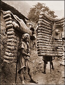
- Kham was historically controlled by a couple of dozen tribes and small kingdoms (not all Tibetan) who fought each other often. Some places that are major tourist destinations today, such as Dali and Lijiang, were regional capitals in that era. Both Beijing and Lhasa tried for some centuries, and with some success, to control the area, but there were rebellions against both.
- The Qing put the eastern parts of Kham under the jurisdiction of the Chinese provinces Yunnan and Sichuan, and they still are. In the 1950s, the western part was incorporated into the TAR. In the current administrative system, Kham has no role; all of its old territory is now part of other administrative divisions. However, the locals still call themselves Khampas and speak a somewhat different dialect of Tibetan.
- Amdo is a Tibetan term; the area is known as Kokonor in Mongolian and Qinghai in Chinese. Geographically, the area is part of the Tibetan Plateau with an average elevation over 3,000 m. Ethnically it is quite mixed; Tibetans were historically the largest group but now it is just over 50% Han (ethnic Chinese). The Qing established the province of Qinghai, roughly corresponding to historic Amdo, and it has been retained by later governments. We also have an Amdo Tibetan phrasebook.
None of the current boundaries correspond exactly with the older ones; the above is just a general guide.
