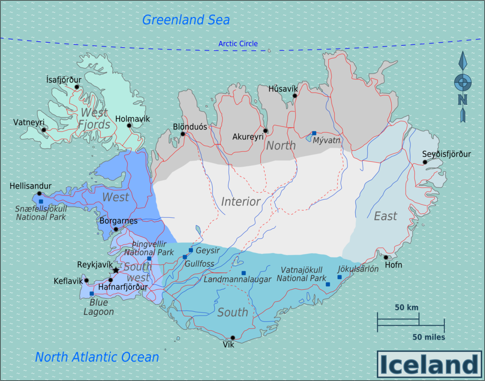
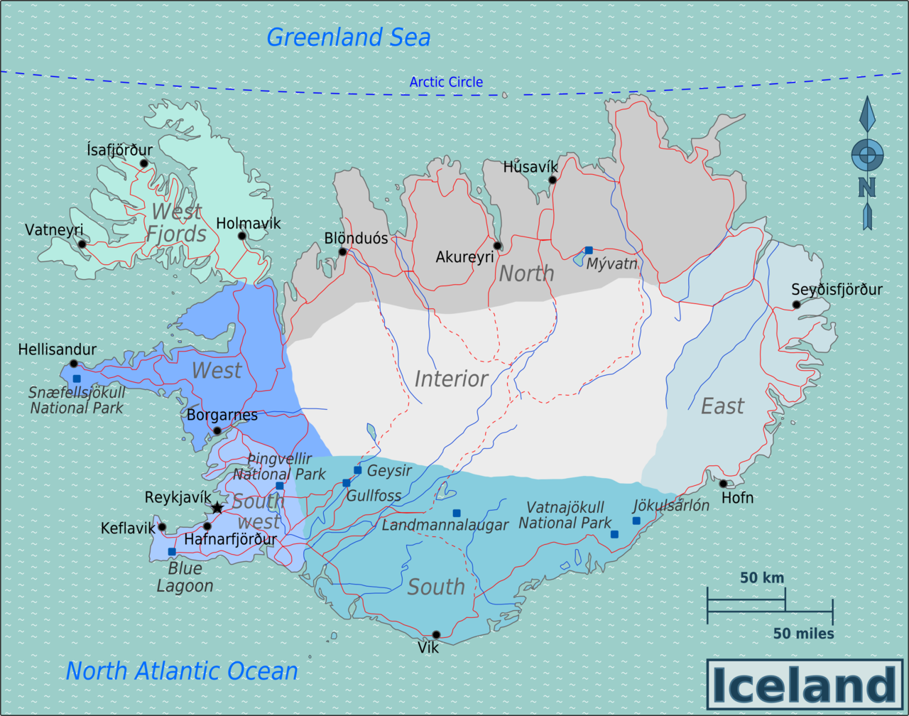
File:Iceland Regions map.png
Jump to navigation
Jump to search

Size of this preview: 762 × 600 pixels. Other resolutions: 305 × 240 pixels | 610 × 480 pixels | 976 × 768 pixels | 1,280 × 1,008 pixels | 2,501 × 1,969 pixels.
Original file (2,501 × 1,969 pixels, file size: 1.07 MB, MIME type: image/png)
This is a file from the Wikimedia Commons and may be used by other projects. Information from its description page there is shown below.
Commons is a freely licensed media file repository. |
Summary
| Description | Travel map of Iceland for use on Wikivoyage, English version (obsolete) |
| Date | |
| Source | Own work based on Perry-Castañeda Library Map Collection Iceland Maps and other PD imagery |
| Author | Burmesedays |
| Other versions |
.png)
Licensing
This file is licensed under the Creative Commons Attribution 3.0 Unported license.
- You are free:
- to share – to copy, distribute and transmit the work
- to remix – to adapt the work
- Under the following conditions:
- attribution – You must give appropriate credit, provide a link to the license, and indicate if changes were made. You may do so in any reasonable manner, but not in any way that suggests the licensor endorses you or your use.
Original upload log
| This file was imported from Wikivoyage WTS. |
The original description page was here. All following user names refer to wts.wikivoyage-old.
- 2010-04-16 17:00 (WT-shared) Burmesedays[dead link] 2501×1969 (1123409 bytes) {{Imagecredit|credit=[[user:burmesedays]], [http://http://lib.utexas.edu/maps/iceland.html Perry-Castañeda Library Map Collection Iceland M (Import from wikitravel.org/shared)
File history
Click on a date/time to view the file as it appeared at that time.
| Date/Time | Thumbnail | Dimensions | User | Comment | |
|---|---|---|---|---|---|
| current | 00:07, 18 November 2012 | | 2,501 × 1,969 (1.07 MB) | MGA73bot2 | {{BotMoveToCommons|wts.oldwikivoyage|year={{subst:CURRENTYEAR}}|month={{subst:CURRENTMONTHNAME}}|day={{subst:CURRENTDAY}}}} == {{int:filedesc}} == {{Information |description=Map of Iceland. Map of Iceland, Iceland * Map of: Iceland¤ |date=April 16th 2... |
File usage
The following page uses this file:
Global file usage
The following other wikis use this file:
- Usage on de.wikipedia.org
- Usage on en.wikipedia.org
- Usage on zh.wikipedia.org