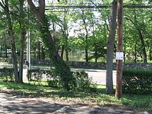
Darien is a town in Connecticut.

Understand
[edit]Darien is a wealthy community that mostly consists of private houses.
Get in
[edit]By train
[edit]Metro North's New Haven Line serves the town.
By car
[edit]I-95 goes right through town. The Merritt Parkway, which barely bypasses the northern city limits, is a good alternate.
US Route 1 (Boston Post Road) is the main street, other than the aforementioned limited-access highways.
Get around
[edit]See
[edit]
- 1 Pond-Weed House, 2591 Post Rd. Historic house, built in 1696 at the corner of the old Boston Post Road and Hollow Tree Ridge Road.
- 2 St. John Church, 1986 Post Rd, ☏ +1 203 655 1145.
- Convent of St Birgitta.
Do
[edit]
Buy
[edit]Eat
[edit]Drink
[edit]Sleep
[edit]Connect
[edit]Go next
[edit]| Routes through Darien |
| New Haven ← Norwalk ← | N |
→ Stamford → New York City |
| New Haven ← Norwalk ← | N |
→ Stamford → New York City |
| New York City ← Stamford ← | SW |
→ Norwalk → New Haven |

