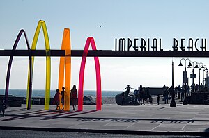
Imperial Beach is a city in San Diego County in Southern California.
Understand
Talk
English is the dominant language spoken in Imperial Beach and you should have no trouble making it around only speaking this language. Spanish is spoken mostly by the Hispanic residents of the city. You're likely to hear some Spanish in this city, due mostly to its proximity to the United States-Mexico border.
Get in
State Route 75 connects I-5 with Coronado, and passes through the city of Imperial Beach.
SDMTS runs an bus between San Diego and Iris every 20 minutes, stopping at several places in Imperial Beach.
Get around
See
- 1 Imperial Beach Pier. Centerpiece of four miles of beach
- 2 The Spirit of Imperial Beach. A plaza with an 18-foot bronze statue honoring the surfing and sandcastle culture of Imperial Beach
- 3 Tijuana River National Estuarine Research Reserve. A large park that overlaps parts of Imperial Beach and San Ysidro. It is divided into the Tijuana Slough National Wildlife Refuge on the north, and Border Field State Park in the south.
- 4 Tijuana Estuary Visitor Center. Provides access to hiking trails north of the Tijuana River
- 5 International Friendship Park, Monument Rd. Perhaps slightly misnamed, visiting this park is a good opportunity to get up and personal with the wall that separates Mexico and the US. The adjacent Monument Mesa picnic area is open 7 days a week; the International Friendship Park itself is between the primary and secondary border fences, and is only open for a few hours on weekends. The entrance gate to Border Field State Park is only open weekends when the road is not flooded, but the park is still open and Monument Mesa is accessible via a 1.6-mile hike.
Do

- Bayshore Bikeway. A 25-mile bikeway along the shore of the San Diego Bay that is a very popular and scenic route. The level of difficulty is low as there are no major hills on this route, and it is also one of the safest bike routes. The 2.5-hour ride takes cyclists along the bay past golf courses, lagoons, piers and numerous places to stop for a rest and a drink of water. The route also features a nine-mile stretch that follows the former Coronado Branch of the San Diego and Arizona Eastern Railroad.
- Silver Strand State Beach, Silver Strand (on SR-75 between Coronado and Imperial Beach), ☏ +1 619 435-5184. Daily 8AM-7PM. An excellent beach to swim or surf at. RV camping and fishing are allowed here.
- Tijuana Estuary, 301 Caspian Way, ☏ +1 619 575-3613. Park: Sunrise-Sunset. Visitor Center: W-Su 10AM-5PM. A small coastal estuary, south of Imperial Beach, and one of the few salt marshes remaining in Southern California. Next to the estuary at the USA-Mexico border is Border Field State Park, which covers the extreme southwestern corner of the United States, where the USA-Mexico border meets the ocean. Border Patrol officials keep a close eye on this area. $5 per vehicle.
- U.S. Open Sandcastle Competition. Takes place every July, and is a great chance to see professional sand castle crafters at work.
Buy
Eat
Drink
Sleep
- 1 Pier South Resort, Autograph Collection, 800 Seacoast Dr, ☏ +1 619-621-5900.

