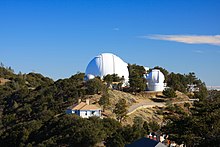
Lick Observatory, at the peak of Mount Hamilton, is in California.
Understand
[edit]Lick Observatory is an observatory and small community near the top of Mount Hamilton, a 4,000-foot mountain several miles from the city of San Jose. The main observatory building is open to the public, and visitors can take a tour of the main observatory or do a self-guided tour of the community.
Get in
[edit]Getting to Lick Observatory is definitely possible, but it is difficult. The main road, CA-130 (Mount Hamilton Road), gets extremely twisty and steep near the top. The road is also very narrow, and has two lanes but no bicycle lane.
Mines Road goes south from Livermore. However, the road is one lane much of the way, and includes numerous mountain passes.
Del Puerto Canyon Road goes from the central valley, and merges with Mines Road into San Antonio Valley Road several miles from Mount Hamilton.
Get around
[edit]Lick Observatory is all within walking distance of Mount Hamilton. The far end of the Observatory region, on Mount Copernicus, is still less than a mile away.
See
[edit]- 1 Lick Observatory (Lick Observatory Main Building), 7281 Mt Hamilton Rd (Follow Mount Hamilton Road and turn right at the observatory entrance). At the top of Mount Hamilton (Lick Observatory is at the top of the mountain) are beautiful views of the region. One of the main observatories is also located at the top, which has since been repainted and improved thanks to help from Google.
- 2 Shane Reflector, San Antonio Valley Road (Follow Mount Hamilton Road and turn right at the observatory entrance and park; then walk along San Antonio Valley Road to the observatory). It's the other major observatory near Mount Hamilton.
Do
[edit]- Cycle up Mount Hamilton (CA-130). For cyclists who want a real workout, this is a good place to cycle, although there is no proper cycle lane on the Mount Hamilton Road, and there are various banks and steep slopes off the side of the road.
- San Antonio Valley Drive (Drive east from Mount Hamilton). The long drive along San Antonio Valley Road includes some of the Diablo Range's best scenery and the area's wildest countryside.


Buy
[edit]- 1 Lick Observatory Gift Shop, 1781 Mount Hamilton Road (In the Lick Observatory Main Building).
Eat and drink
[edit]It's best to bring your own food if you're going to the mountain. However, there are some restaurants around the mountain.
- Mount Hamilton Grandview Restaurant (Near San Jose along Mount Hamilton Road).
- The Junction Restaurant (At the junction of Mines Road and San Antonio Valley Road). This restaurant is truly in the middle of nowhere. However, it is a popular restaurant destination and is fairly close to Mount Hamilton - although it's a slow drive there, following the mountainous route of San Antonio Valley Road.
Sleep
[edit]Although people live at Lick Observatory, there are no hotels. There are, however, several hotels in the fairly close city of San Jose. There is also a camping site at the Joseph D. Grant Park, which is close to Mount Hamilton.
Go next
[edit]- San Jose - major city to the west of Mount Hamilton
- Del Valle Regional Park - parkland to the north of Mount Hamilton
- Henry W. Coe State Park - large state park to the south of Mount Hamilton
- Joseph D. Grant County Park - large county park to the west of Mount Hamilton


