Appearance

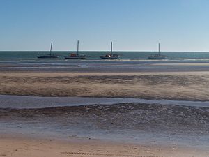
Banc d'Arguin National Park[dead link] is in Coastal Mauritania, south of Nouadhibou. It's inscribed on the UNESCO World Heritage list and is home to the Imraguen people.
Understand
[edit]History
[edit]Landscape
[edit]Flora and fauna
[edit]The park is a breeding site for many different species of migratory birds, including flamingos, pelicans, terns and sandpipers. Millions of shorebirds from northern Europe stay here during the Northern Hemisphere winter.
Climate
[edit]Get in
[edit]Banc d'Arguin stretches along the Atlantic coast between Nouakchott and Nouadhibou.
Fees and permits
[edit]Get around
[edit]
See
[edit]- 1 Arguin Island. 24 hours daily. Arid island and popular attraction because of the remains of 18th and 19th century fortifications dating back to French colonisation. The island is surrounded by beautiful reefs that are ideal for snorkelling and diving. Free.
Do
[edit]- 1 La Méduse. 24 hours daily. 19th century French frigate wreck, and a popular destination for diving excursions. Free.


