Zagori, also called Zagorochoria (The Zagori Villages) is a historical area and a municipality in Epirus, Greece, with an area of some 1,000 km², including 46 villages. Since 2023 the Zagori Cultural Landscape has been a ![]() UNESCO World Heritage Site.
UNESCO World Heritage Site.
Towns and villages
[edit]- 1 Ano Pedinais one of the best preserved villages in Zagori with a rich tourist infrastructure. It is ideal for a number of gentle hiking trails. Important sights are the Monastery of Evangelistria, the Monastery of Agia Paraskevi and the central church of the village, dedicated to Agios Demetrios.
- 2 Aristi – The main attractions of the village are, the Monastery of Panagia Speleotissa (Our Lady in Caves) (16th century), built in a beautiful location, inside and around a natural rock and its neighboring that forms at the end of Vikos Canyon. The monastery church stands near the entrance to a cave. The Aristi Central Church, is a worth visiting religious building, with exquisite wall paintings and wood carved iconostasis.
- 3 Dikorfo – Dikorfo is built on the slopes of , the mountain that lies between the Ioannina basin and Zagori. It has very well-preserved traditional houses, many of which have rich interior decoration with frescoes and is built in an exceptional landscape. Above the village is the Monastery of Agios Ioannis with an excellent view of the settlement, the central Zagori and the sequence of peaks of Mt Tymphe and the Vikos Canyon.
- 4 Dilofo – The village (altitude 880 m) is built amphitheatrically on the slopes of two hills. The distinct Arhontiko Makropoulou (Makropoulos mansion) is the starting point for entering the village and to trails leading to the picturesque chapels of the village. Dilofo is one of the best preserved architecturally Zagori villages.
- 5 Elati – Elati is built on the slopes of Mt Mitsikeli and offers excellent views of Central Zagori and Mt Tymphe. Despite the fact that it was largely destroyed by the Wehrmacht during World War II, it has recovered much of its architectural look and is today one of the most developed tourist villages of Zagori.
- 6 Kaloutas – The traditional village is known for its old churches, a "must see" triple arch stone bridge and the Despotis Spring which is located nearby. Also the Vissikon Monastery at a distance of about 4.5 km N of Kaloutas is worth visiting.
- 7 Kipoi – The very popular traditional village (altitude 800 m) is worth seeing, especially for its more than 5 spectacular old stone bridges made with 1 to 3 arcs around the village. Most of the bridges are signposted and close to the road.
- 8 Konitsa – Not part of the 46 villages but at the edge of Zagori with an impressive arched stone bridge and spectacular Aoos Gorge, offering various breathtaking hikes.
- 9 Koukouli – A traditional village with beautiful mansion houses and fountains of exceptional local architecture.
- 10 Monodendri – One of the nicest villages of the area (altitude 1,060 m), build in the traditional style with stone houses, stone roofs and stone paved streets. It is one of the main attractions of the Zagori area and a good place to stay in one of tits numerous hotels. Several restaurants offer their service too. During the day the central square is a nice place to rest in one of its two restaurants or the nearby cafes and under the shade of the enormous plane tree. Many of its hotel rooms offer a fireplace, for the colder seasons. Most visitors prefer Monodendri as their starting point for crossing the Vikos Canyon. Walking through the small cobbled streets of the village, is a delight. From the main square next to the Agios Athanasios church a large, a 800 m long cobblestone street leads to the Convent of Agia Paraskevi (15th century). The convent and its little church are nestled between rocks in a fantastic natural setting, on the edge of the Vikos Canyon, is listed as the deepest gorge in the world by the Guinness Book of Records, due to its depth to width ratio, with a length of about 38 km, depth ranging between 120–1350 m, and a width ranging from 2000 m to only a few meters at its narrowest part. Enjoy the scenery from the convent area and walk along the path which begins just above the church. The path leads directly to a path winding next to the steep rock of the Vikos cliffs, without any protective infrastructure. It is therefore not advised as a hike for people with fear of heights or not physically fit. Leaving Monodendri on the west side, the road leads to the Stone Forest after about 5km. Stones are naturally placed horizontally on top of each other, forming impressive stone pillars, in an extended area on top of Mt Stouros. Continuing another 2km further you will reach the Oxia viewpoint, offering spectacular aerial views to Vikos Canyon and its contributary Megas Lakkos Gorge.
- 11 Papingo – Papingo consists of two separate villages, The Megalo Papingo (altitude 960 m) and the Mikro Papingo, both stone build villages in local architectural style, in a fantastic mountainous scenery. Both have nice traditional taverns, hotels and guest houses. The old elementary school in Mikro Papingo houses the Zagori Nature and Culture Information Center. One of the best viewpoints of the Vikos gorge and the Astraka Towers is at the Taxiaches Church yard, in Mikro Papingo. Before you reach the villages via a narrow winding road, you cross a mountain river. The Voidomatis River even in mid-summer is so cold that you can swim only a few seconds in it. From a parking lot at the bridge you can reach many places along the river that invite you for a picnic in the beautiful surroundings. This is the perfect place to rest at hot summer days. Another attraction are the Papingo Rock Pools, situated between the two Papingo village neighborhoods.During the warmest months, locals with a minor intervention create a natural flow water pool, fit for swimming. The formations in the rocks are truly beautiful and it is a lovely place to cool off and have a picnic.
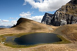
- 12 Tsepelovo – A traditional village (altitude 1,080 m) with a picturesque cobblestone square. The church of Agios Nikolaos (18th century) is worth visiting. A starting point for some of the best hikes to Mt Tymphe and its Dragonlake. Tsepelovo is the largest Zagori village and has numerous hotels and taverns.
- 13 Tristeno – A beautiful mountain village (altitude 940 m) with its plentiful running waters, springs and a watermill from the 19th century and the Aghios Georgios church is sight to see.
- 14 Vikos – The little village (altitude 770 m) is worth seeing especially do to its viewpoint where you have one of the best views over the Vikos canyon. The springs of the Voidomatis River can be reached in 30 minutes on hiking trail from the village.
- 15 Vovousa – One of the most beautiful villages of Eastern Zagori, built on the banks of the Aoos River. Its most important sights are the famous Bridge of Vovousa, the central church of Agios Georgios and the bridge of La Pountika. Vovousa is an ideal starting point for a number of mountaineering and cycling routes in the beautiful landscape around the village and in the neighboring Valia Kalda, one of the National Forests of Greece. It hosts the excellent Vovousa Festival, every summer. Vovousa is one of the dozens of villages in Zagori that were burned by the Wehrmacht in retaliation for the inhabitants' help to the resistance against the occupiers, during World War II. Vovousa offers accommodation and restaurants.
- 16 Vrysochori – A Zagori village (altitude 940 m) with plenty of streams running through it and stunning views to the scenery and its Tsouka Rossa summit.
Other destinations
[edit]- 1 Northern Pindos National Park - It is named after the two major gorges of the area. It is a steep mountainous terrain with numerous rivers, lakes, caves, deep canyons, dense forests
Understand
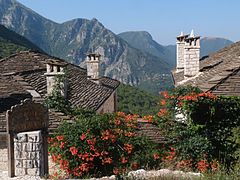
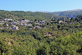
[edit]Zagori is the name of a historical district of the Region of Epirus, north of Ioannina, dotted with 46 villages in traditional style. The impressive landscape with high mountains, dense barely inhabited forests and impressive gorges and the wild beauty of the Zagori mountain villages captures every visitor. The houses and streets of the small typical mountain villages are built of stone. The same applies to the many monasteries and churches. Another attraction are the stone arch bridges which are true masterpieces of traditional bridge construction. They all date back to the Ottoman era. It is a destination suitable for eco-tourism lovers.
Most developed with touristic infrastructure is the western part but also consider visiting eastern Zagori, which is far less developed in a touristic sense but just as impressive.
A problem for tourism is the unsteady climate due to the mountainous climate with often rain and low temperatures, unexpected by many visitors that know Greece only from sunny hot beaches. Each of the four seasons is suitable for a visit to the Zagori region. Winter, despite being characterized by inclement weather, allows you to enjoy the spectacle of snow-covered villages, giving them a fairy tale atmosphere and out of time. Walking through the alleys in stone you will perceive the pungent smell of wood burning in the chimneys of houses and taverns where the locals meet and the rare tourists in convivial youth accompanied by wine and often of tsipuro. Already at the end of February snow in the nearby mountains starts to melt. Especially pleasant are the short walks along the course of rivers and streams where the water returns to flow impetuously, interspersed with pieces of ice. The summer is, like everywhere in Europe, the season that sees a greater influx of tourists, which partly contributes to depress the magic of the villages of Zagori. However, visitors are not so numerous and weather is more stable and warm enough for a bath in rivers or lakes. Finally, autumn is also a good season for a visit attributed to the foliage that takes on very bright colors between red, copper and vermilion. With the advance of autumn the leaves irrevocably fall covering the paths of a thick multicolored carpet.
Get in
[edit]By car
[edit]Most visitors come by (rental) car from Ioannina.
By bus
[edit]Buses from Ioanina Ktel[dead link] to the Zagori villages run not on a regular schedule.
Get around
[edit]The best way to explore this region is by car, hiking from village to village or using a mountain bike or e-bike. Public transport is available but far too time consuming and buses do not stop at the many viewpoints or other points of interest in-between the villages. For people who are good on foot there are also many signposted hiking trails that lead to the many attractions. For people with disabilities, the area is rather difficult to move and the attractions hardly accessible.
See
[edit]The main thing to see is the stunning landscape and the old style villages with their old stone bridges.
- Konitsa Stone bridge
- Papingo
- Vikos Gorge
- Monodendri
- Bridge near Kipoi
- Mountain path at Monodendri
- Old stone bridge near Kipoi
- Dragonlake
- Papigo
- Μοnodendri
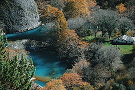
- Voidomatis River
- 1 Agia Paraskevi (Convent of Saint Paraskevi). An abanconed convent situated on the cliffs of Vikos Canyon, with a fantastic view.
- 2 [dead link] Drakolimni. It is a beautiful alpine lake at 2,100 m reachable by a demanding hike from Papingo. It takes around 3 hr from the village to the Astraka refuge and another 1½ hr to the lake. The route to the lake is a bit easier than to the refuge. As it is a rather long walk for one day it is advisable to stay at the refuge overnight. The view at each point of the climbing is stunning.
- 3 Konitsa Stone bridge (Γεφύρι Κόνιτσας). Impressive ancient stone bridge and start of a nice hike into the Aoos Gorge.
- 4 Monument to Zagorian Women. The monument is dedicated to the Zagorian women in memory of their help in the fight against the invading Italian troops in the fall of 1940. The statue was erected in 1993 and has a height of 6, Women of Zagoria in the 1940 war actively participated in the fight and participated in the supply of Greek forces who fought to stop the fascist invasion that was trying to reach Metsovo through the Aoos valley.
- 5 Panagia Speleotissa Monastery. In a landscape of rare natural beauty in the Aristi area, above the Voidomatis River.
- 6 The Vradeto Steps (Skala of Vradeto). A moderate hiking trail of 3 km in the footsteps of the old builders of this stairs that you can climb from the village of Kapesovo to the village of Vradeto and continue 1 km to the Beloi hike starting point Very beautiful nature. For those who do not want to climb stairs and rocks you can go from the top site of mountain in Vradeto and have just a view of the whole path from there.
- 7 Waterfall of Iliohori. A steep 2-km path leads down to the waterfall, but it is well worth to go and to have a bath in summer in the ice cold water.
Do
[edit]Activities in this region include
- Hiking
- Rafting
- Touring Ski
- Horse riding
- Mountain biking, and
- Canyoning.
Check out these outdoor companies:
- Active Nature
- Zagori Outdoor
- ... many more can be found—always compare prices.
Buy
[edit]Best things to buy are agricultural products of the area that includes honey, herbs, herbal teas, Feta cheese and hard cheese and goat or sheep meat.
Eat
[edit]A speciality of the area are Pittas, which are pies filled with cheese (Tiropita), Spinach (Spanakopita), wild greenstuff (Hortopita), pumpkin (Kolokothopita - which can be either sweet or salty) or Spinach plus feta cheese (Tirospanakopita). Also try goat and sheep meat of the area. The meat has very good taste as the animals graze freely and eat many different grasses.
Drink
[edit]Try the wines from the region and the Tsipouro, a pomace brandy. During wine production, after pressing the grapes, the pomace falls as a waste product, which is then fermented and distilled. The more often it is distilled, the better the schnapps. Standard is a 2 times distillation. This is Tsipouro (also called Raki or Tsikoudia). If anise or fennel is added to the distillation, the Tsipouro tastes like ouzo. At the Zagori region normally no anis is added and the taste is pure. It's the same product that is called Grappa in Italy.
Sleep
[edit]Most visitors stay in one of the many hotels and guesthouses in Monodendri, Papingo, Aristi, Tsepelovo, Ano Pedina, Vitsa, Elati or Kipi. In these villages is also few nightlife, while in the smaller villages this is less. Almost all hotels or guest houses are built and furnished in the traditional style and are listed and rated in the well-known Internet booking sites.
Stay safe
[edit]The area is very safe in terms of crime and the only real danger is the wild nature with steep slopes, lonely forests where an injured hiker can not be found immediately. It is recommended to inform someone if you want to go a secluded trail. Not everywhere the mobile net is good to get emergency help.
Go next
[edit]


