File:1933 HMS Norfolk Summer cruise map.jpg
Jump to navigation
Jump to search

Size of this preview: 377 × 599 pixels. Other resolutions: 151 × 240 pixels | 302 × 480 pixels | 483 × 768 pixels | 644 × 1,024 pixels | 1,289 × 2,048 pixels | 4,171 × 6,627 pixels.
Original file (4,171 × 6,627 pixels, file size: 3.62 MB, MIME type: image/jpeg)
This is a file from the Wikimedia Commons and may be used by other projects. Information from its description page there is shown below.
Commons is a freely licensed media file repository. |
Summary
| Description |
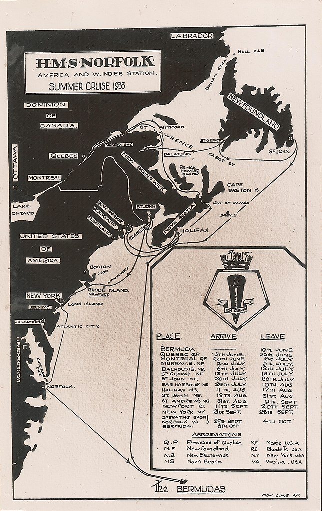
English: A map of the 1933 summer cruise of HMS Norfolk, beginning and ending at its base at the Royal Naval Dockyard on Ireland Island in Bermuda. Visits were made to various ports in Dominion of Canada, the Dominion of Newfoundland, and the United States of America. |
| Date | |
| Source | Self-scanned |
| Author | AB Don Coke, Royal Navy |
Licensing
This work created by the United Kingdom Government is in the public domain.
This is because it is one of the following:
HMSO has declared that the expiry of Crown Copyrights applies worldwide (ref: HMSO Email Reply)
|
 |
File history
Click on a date/time to view the file as it appeared at that time.
| Date/Time | Thumbnail | Dimensions | User | Comment | |
|---|---|---|---|---|---|
| current | 14:33, 30 January 2021 | | 4,171 × 6,627 (3.62 MB) | Aodhdubh | Uploaded a work by AB Don Coke, Royal Navy from Scan from original with UploadWizard |
File usage
There are no pages that use this file.
Global file usage
The following other wikis use this file:
- Usage on en.wikipedia.org
- Usage on he.wikipedia.org