File:Aa oldcroydonairport.jpg
Jump to navigation
Jump to search
Size of this preview: 564 × 599 pixels. Other resolutions: 226 × 240 pixels | 452 × 480 pixels | 700 × 744 pixels.
Original file (700 × 744 pixels, file size: 123 KB, MIME type: image/jpeg)
This is a file from the Wikimedia Commons and may be used by other projects. Information from its description page there is shown below.
Commons is a freely licensed media file repository. |
Summary
| Description |
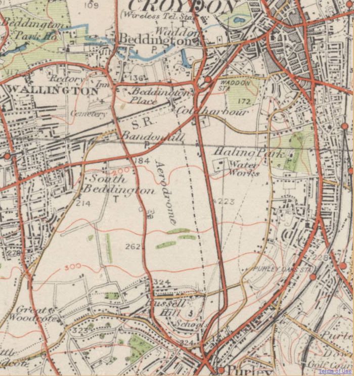
English: Area around Croydon Airport, England, as it was in the 1920's or 1930's |
| Date | |
| Source |
Transferred from en.wikipedia to Commons by SreeBot.
|
| Author |
Ordnance Survey |
| Permission (Reusing this file) |
Ran out of copyright: see http://www.ponies.me.uk/maps/osmap.html |
Licensing
This work created by the United Kingdom Government is in the public domain.
This is because it is one of the following:
HMSO has declared that the expiry of Crown Copyrights applies worldwide (ref: HMSO Email Reply)
|
 |
Original upload log
The original description page was here. All following user names refer to en.wikipedia.
Upload date | User | Bytes | Dimensions | Comment
- 2011-09-20 13:38 (UTC) | Anthony Appleyard | 126454 (bytes) | 700×744 | {{Information |Description = Area around [[Croydon Airport]], England, as it was in the 1920s or 1930s |Source = Old Ordnance Survey maps: see http://www.ponies.me.uk/maps/osmap.html |Date = ~~~~~ |Author = |Permission = Ran out of copyright: see http://www.ponies.me.uk/maps/osmap.html |other_versions = }}
File history
Click on a date/time to view the file as it appeared at that time.
| Date/Time | Thumbnail | Dimensions | User | Comment | |
|---|---|---|---|---|---|
| current | 16:37, 22 September 2011 | | 700 × 744 (123 KB) | SreeBot | (Original text) : {{Information |Description = Area around Croydon Airport, England, as it was in the 1920's or 1930's |Source = Old Ordnance Survey maps: see http://www.ponies.me.uk/maps/osmap.html |Date = ~~~~~ |Author |
File usage
There are no pages that use this file.
Global file usage
The following other wikis use this file:
- Usage on en.wikipedia.org
- Usage on fr.wikipedia.org