File:Abidjan-Niger-Railway.png
Jump to navigation
Jump to search
Size of this preview: 378 × 598 pixels. Other resolutions: 151 × 240 pixels | 303 × 480 pixels | 485 × 768 pixels | 647 × 1,024 pixels | 1,754 × 2,777 pixels.
Original file (1,754 × 2,777 pixels, file size: 981 KB, MIME type: image/png)
This is a file from the Wikimedia Commons and may be used by other projects. Information from its description page there is shown below.
Commons is a freely licensed media file repository. |
Summary
| Description |
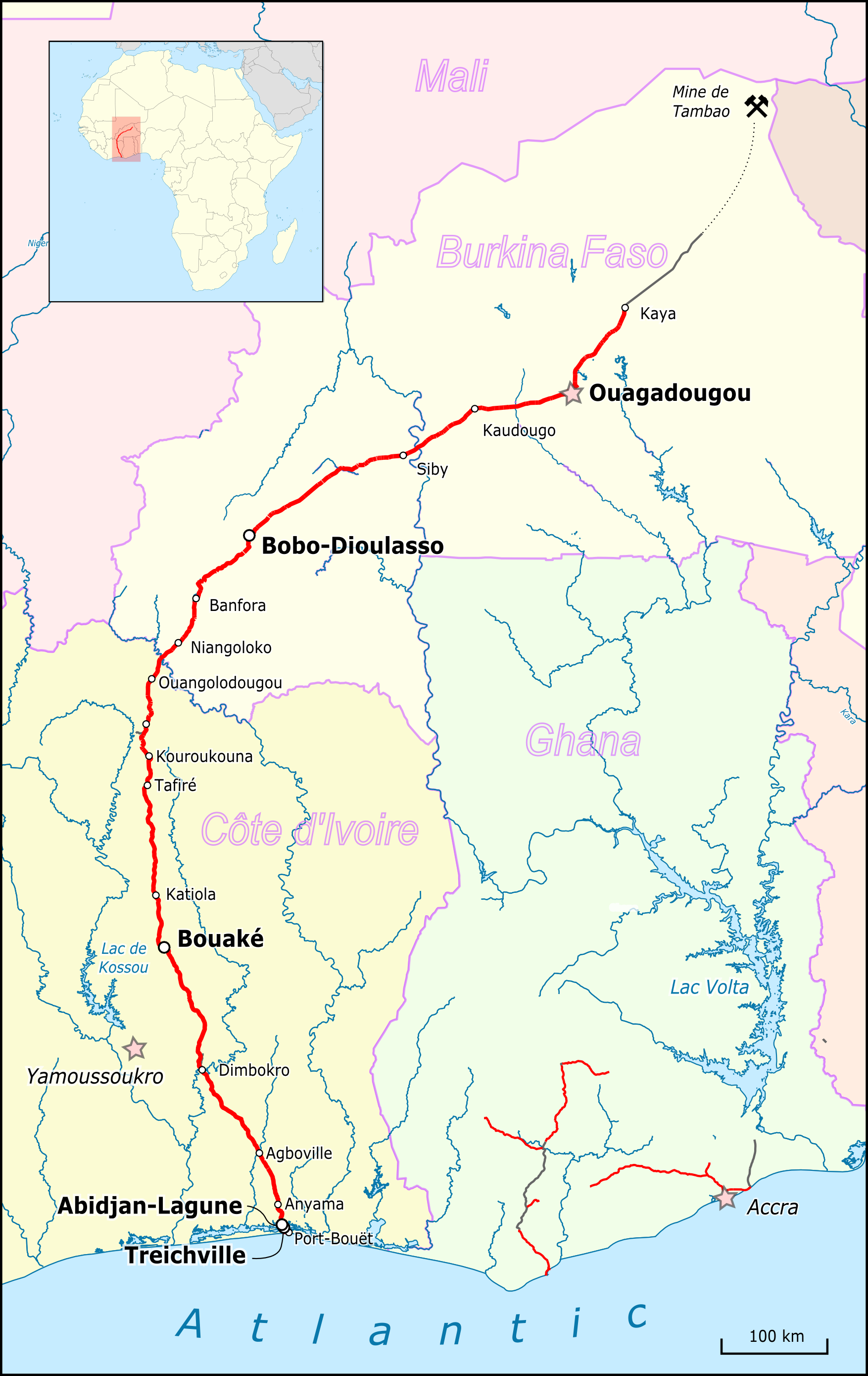
English: Map of Abidjan Niger Railway Deutsch: Karte der Abidjan-Niger-Bahn |
| Date | |
| Source |
Map was created using:
|
| Author |
|
Licensing
Peter Christener, the copyright holder of this work, hereby publishes it under the following licenses:

|
Permission is granted to copy, distribute and/or modify this document under the terms of the GNU Free Documentation License, Version 1.2 or any later version published by the Free Software Foundation; with no Invariant Sections, no Front-Cover Texts, and no Back-Cover Texts. A copy of the license is included in the section entitled GNU Free Documentation License. |
This file is licensed under the Creative Commons Attribution-Share Alike 3.0 Unported license.
Attribution: Peter Christener
- You are free:
- to share – to copy, distribute and transmit the work
- to remix – to adapt the work
- Under the following conditions:
- attribution – You must give appropriate credit, provide a link to the license, and indicate if changes were made. You may do so in any reasonable manner, but not in any way that suggests the licensor endorses you or your use.
- share alike – If you remix, transform, or build upon the material, you must distribute your contributions under the same or compatible license as the original.
You may select the license of your choice.
| This work is licensed under the Open Database License (summary). |
File history
Click on a date/time to view the file as it appeared at that time.
| Date/Time | Thumbnail | Dimensions | User | Comment | |
|---|---|---|---|---|---|
| current | 14:24, 27 April 2017 | | 1,754 × 2,777 (981 KB) | Pechristener | attempt to make it better readable with a different font |
| 14:16, 27 April 2017 |  | 1,754 × 2,777 (974 KB) | Pechristener | {{Information |Description={{en|Map of Abidjan Niger Railway}} |Source=Map was created using: *[http://www.openstreetmap.org/ Open Street Map] *{{f|Africa location map.svg}} for location map |Date=2017-04-27 |Author= *Map data: OSM-contributors *Loca... |
File usage
There are no pages that use this file.
Global file usage
The following other wikis use this file:
- Usage on de.wikipedia.org
- Usage on de.wikivoyage.org
- Usage on en.wikipedia.org
- Usage on es.wikipedia.org
- Usage on fi.wikipedia.org
- Usage on fr.wikipedia.org
- Usage on it.wikipedia.org
- Usage on it.wikivoyage.org
- Usage on ja.wikipedia.org
- Usage on ka.wikipedia.org
- Usage on ru.wikipedia.org
- Usage on ru.wikivoyage.org
- Usage on www.wikidata.org