File:Annobon map.png
Jump to navigation
Jump to search
Size of this preview: 474 × 599 pixels. Other resolutions: 190 × 240 pixels | 380 × 480 pixels | 608 × 768 pixels | 810 × 1,024 pixels | 2,150 × 2,716 pixels.
Original file (2,150 × 2,716 pixels, file size: 581 KB, MIME type: image/png)
This is a file from the Wikimedia Commons and may be used by other projects. Information from its description page there is shown below.
Commons is a freely licensed media file repository. |
Summary
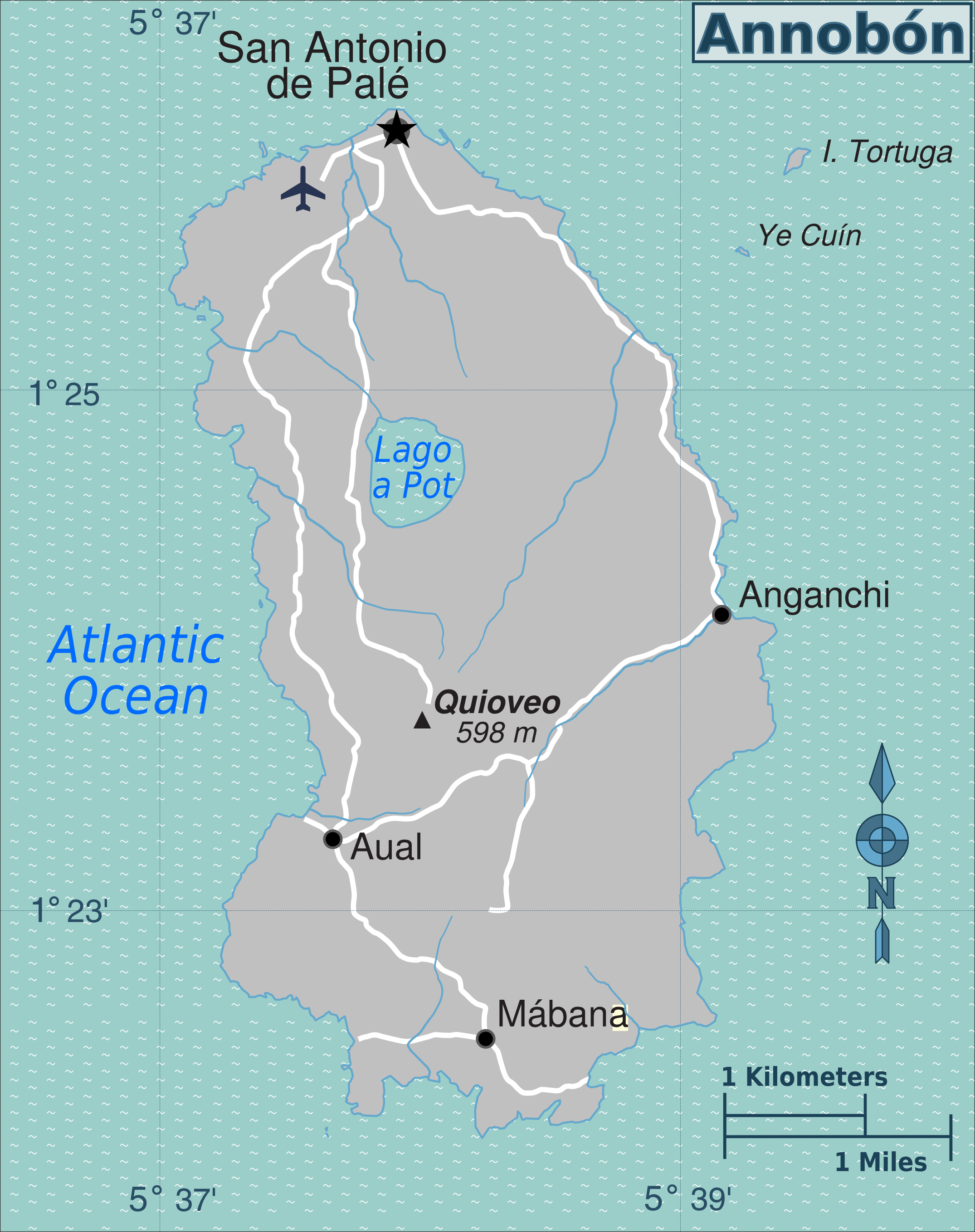
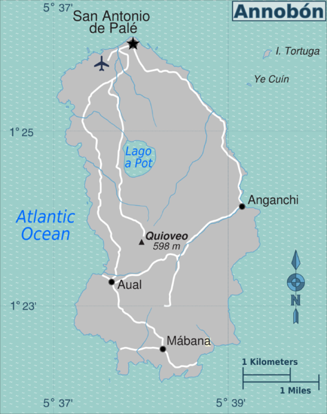
| Description | Map of Annobón (Equatorial Guinea) for use on Wikivoyage | ||||
| Date | |||||
| Source |
Own work based on:
|
||||
| Author | Peter Fitzgerald | ||||
| Other versions | SVG source |
Licensing
This file is licensed under the Creative Commons Attribution 3.0 Unported license.
- You are free:
- to share – to copy, distribute and transmit the work
- to remix – to adapt the work
- Under the following conditions:
- attribution – You must give appropriate credit, provide a link to the license, and indicate if changes were made. You may do so in any reasonable manner, but not in any way that suggests the licensor endorses you or your use.
Original upload log
| This file was imported from Wikivoyage WTS. |
The original description page was here. All following user names refer to wts.wikivoyage-old.
- 2010-01-29 00:18 (WT-shared) Peterfitzgerald archive copy at the Wayback Machine 2150×2716 (858502 bytes) == Summary == {{Imagecredit|credit=Peter Fitzgerald|captureDate=28 January 2010|location=Equatorial Guinea|source=[[:Image:Annobon map.svg]] (Import from wikitravel.org/shared)
File history
Click on a date/time to view the file as it appeared at that time.
| Date/Time | Thumbnail | Dimensions | User | Comment | |
|---|---|---|---|---|---|
| current | 23:24, 10 August 2015 | | 2,150 × 2,716 (581 KB) | Cmdrjameson | Compressed with pngout. Reduced by 256kB (30% decrease). |
| 21:20, 17 November 2012 |  | 2,150 × 2,716 (838 KB) | MGA73bot2 | {{BotMoveToCommons|wts.oldwikivoyage|year={{subst:CURRENTYEAR}}|month={{subst:CURRENTMONTHNAME}}|day={{subst:CURRENTDAY}}}} == {{int:filedesc}} == {{Information |description=Annobón regions map. English version, Equatorial Guinea * Map of: Equatorial ... |
File usage
The following page uses this file:
Global file usage
The following other wikis use this file: