File:Bay of Kotor map 1862.jpg
Jump to navigation
Jump to search

Size of this preview: 596 × 600 pixels. Other resolutions: 239 × 240 pixels | 477 × 480 pixels | 820 × 825 pixels.
Original file (820 × 825 pixels, file size: 500 KB, MIME type: image/jpeg)
This is a file from the Wikimedia Commons and may be used by other projects. Information from its description page there is shown below.
Commons is a freely licensed media file repository. |
Summary
| Description |
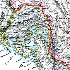
English: Map of the Bay of Kotor in 1862, extracted from Das Fürstentum Montenegro im Jahre 1862 |
| Date | |
| Source | File:Montenegro.JPG |
| Author | Heinrich Kiepert |
Licensing
|
This work is in the public domain in its country of origin and other countries and areas where the copyright term is the author's life plus 100 years or fewer. | |
| This file has been identified as being free of known restrictions under copyright law, including all related and neighboring rights. | |
File history
Click on a date/time to view the file as it appeared at that time.
| Date/Time | Thumbnail | Dimensions | User | Comment | |
|---|---|---|---|---|---|
| current | 16:50, 3 April 2015 | | 820 × 825 (500 KB) | Prioryman | User created page with UploadWizard |
File usage
There are no pages that use this file.
Global file usage
The following other wikis use this file:
- Usage on en.wikipedia.org
- Usage on uk.wikipedia.org