File:Burma Bago locator map.png
Jump to navigation
Jump to search
Size of this preview: 285 × 599 pixels. Other resolutions: 114 × 240 pixels | 228 × 480 pixels | 1,000 × 2,100 pixels.
Original file (1,000 × 2,100 pixels, file size: 476 KB, MIME type: image/png)
This is a file from the Wikimedia Commons and may be used by other projects. Information from its description page there is shown below.
Commons is a freely licensed media file repository. |
Summary
| Description |
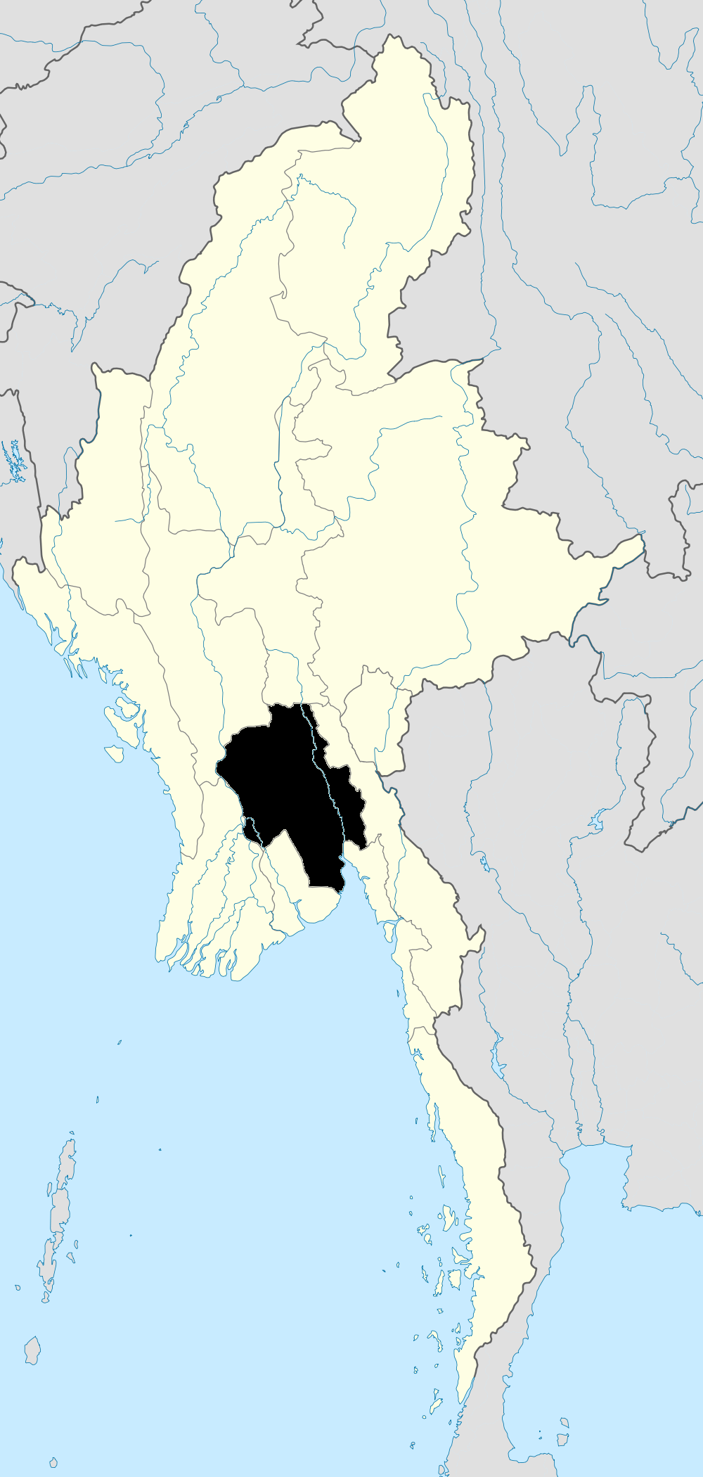
English: Map showing Bago in Burma |
| Date | |
| Source | Based on File:Myanmar location map.svg. Made with Natural Earth. Free vector and raster map data @ naturalearthdata.com and Microsoft Paint. |
| Author | Dr. Blofeld based on work by Uwe Dedering |
Licensing
I, the copyright holder of this work, hereby publish it under the following licenses:
This file is licensed under the Creative Commons Attribution-Share Alike 3.0 Unported license.
- You are free:
- to share – to copy, distribute and transmit the work
- to remix – to adapt the work
- Under the following conditions:
- attribution – You must give appropriate credit, provide a link to the license, and indicate if changes were made. You may do so in any reasonable manner, but not in any way that suggests the licensor endorses you or your use.
- share alike – If you remix, transform, or build upon the material, you must distribute your contributions under the same or compatible license as the original.

|
Permission is granted to copy, distribute and/or modify this document under the terms of the GNU Free Documentation License, Version 1.2 or any later version published by the Free Software Foundation; with no Invariant Sections, no Front-Cover Texts, and no Back-Cover Texts. A copy of the license is included in the section entitled GNU Free Documentation License. |
You may select the license of your choice.
File history
Click on a date/time to view the file as it appeared at that time.
| Date/Time | Thumbnail | Dimensions | User | Comment | |
|---|---|---|---|---|---|
| current | 12:53, 26 September 2010 | | 1,000 × 2,100 (476 KB) | Blofeld Dr. | {{Information |Description={{en|1=h}} |Source=h |Author=h |Date=h |Permission= |other_versions= }} |
File usage
There are no pages that use this file.
Global file usage
The following other wikis use this file:
- Usage on en.wikipedia.org
- Bago Region
- Pyuntaza
- Bago, Myanmar
- Pyay
- Taungoo
- Tharrawaddy, Myanmar
- Pyu
- Template:Bago Region
- Bago District
- Taungoo District
- Tharrawaddy District
- Pyay District
- Kyaukkyi Township
- Kyaukkyi, Bago
- Thanatpin
- Tantabin Township
- Pyu Township
- Bago Township
- Category:Townships of the Bago Region
- Kawa Township
- Thanatpin Township
- Waw Township
- Daik-U Township
- Nyaunglebin Township
- Shwegyin Township
- Pyay Township
- Paukkaung Township
- Thegon Township
- Shwedaung Township
- Pandaung Township
- Paungde Township
- Nattalin Township
- Zigon Township
- Taungoo Township
- Oktwin Township
- Yedashe Township
- Kyauktaga Township
- Tharrawaddy Township
- Gyobingauk Township
- Letpadan Township
- Minhla Township, Bago
- Monyo Township
- Okpho Township
- Okpho
- Alanzu
- Gyobingauk
- Minhla, Bago
- Yedashe
- Zigon
- Kadok, Daik-U Township
View more global usage of this file.