File:Laponia-Karte.png
Jump to navigation
Jump to search
Size of this preview: 800 × 588 pixels. Other resolutions: 320 × 235 pixels | 640 × 470 pixels | 1,024 × 752 pixels | 1,280 × 940 pixels | 1,719 × 1,263 pixels.
Original file (1,719 × 1,263 pixels, file size: 2.66 MB, MIME type: image/png)
This is a file from the Wikimedia Commons and may be used by other projects. Information from its description page there is shown below.
Commons is a freely licensed media file repository. |
Summary
| Description |
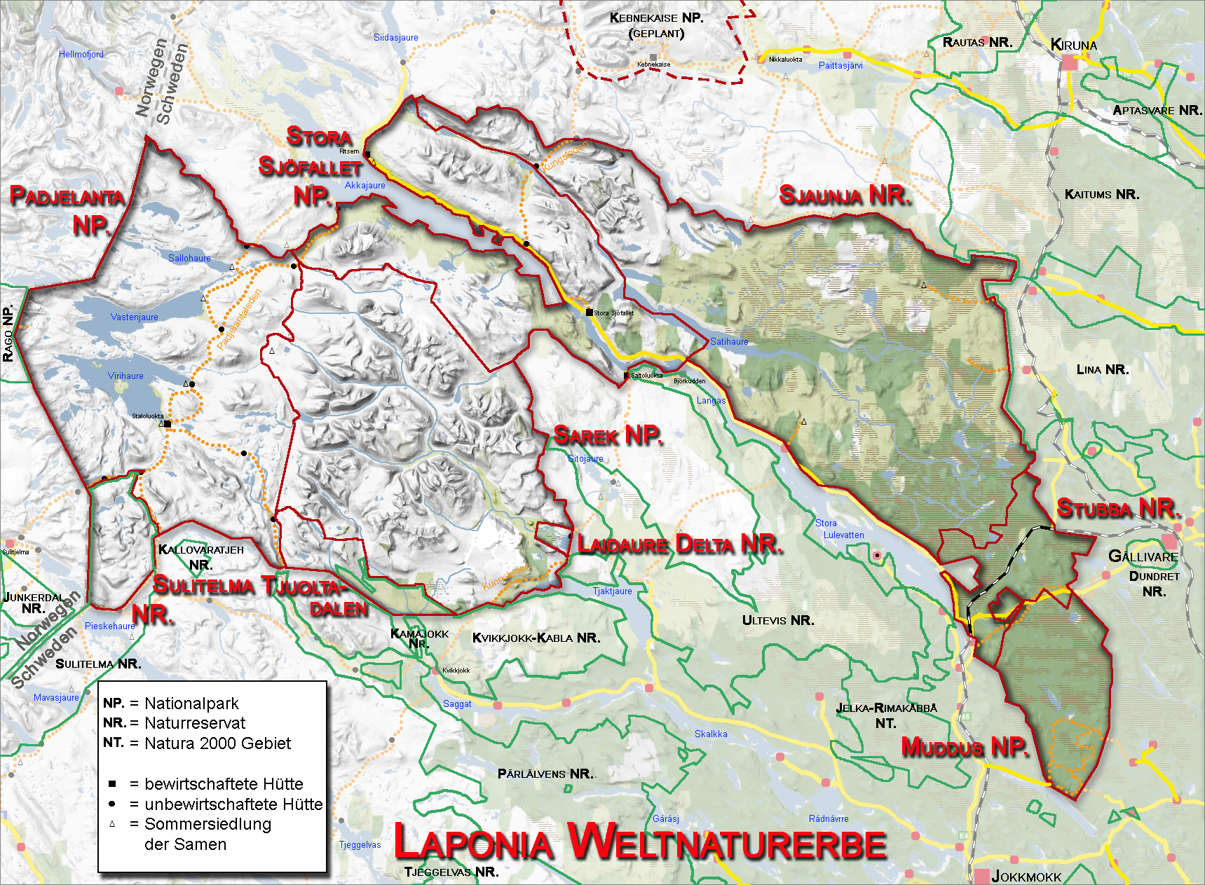
Deutsch: Karte des Weltnaturerbes Laponia mit den Schutzgebieten |
| Date | |
| Source |
Own work Deutsch: Kartengrundlage maps-for-free.com – public domain; weitere Kartendaten von Länsstyrelsen Norrbotten (http://www.bd.lst.se/Startpage.aspx) |
| Author | Ökologix |
Licensing
| This work has been released into the public domain by its author, Ökologix. This applies worldwide. In some countries this may not be legally possible; if so: |
Original upload log
Transferred from de.wikipedia to Commons.
The original description page was here. All following user names refer to de.wikipedia.
- 2008-09-24 21:22 Ökologix 1719×1263 (2793141 bytes) {{Information |Beschreibung = Karte des Weltnaturerbes Laponia mit umliegenden Schutzgebieten |Quelle = * Kartengrundlage [http://www.maps-for-free.com/ maps-for-free.com] - public domain * weitere Kartendaten von Länsstyrelsen Norrbotten (http://www.b
File history
Click on a date/time to view the file as it appeared at that time.
| Date/Time | Thumbnail | Dimensions | User | Comment | |
|---|---|---|---|---|---|
| current | 12:21, 11 May 2009 | | 1,719 × 1,263 (2.66 MB) | Urdangaray | {{Information |Description={{de|Karte des Weltnaturerbes Laponia mit umliegenden Schutzgebieten}} |Source=Transferred from [http://de.wikipedia.org de.wikipedia]<br/> (Original text : ''* Kartengrundlage [http://www.maps-for-free.com/ maps-for-free.com] |
File usage
The following page uses this file:
Global file usage
The following other wikis use this file:
- Usage on da.wikipedia.org
- Usage on de.wikipedia.org
- Usage on eo.wikipedia.org
- Usage on fr.wikipedia.org
- Usage on nl.wikipedia.org
- Usage on vi.wikipedia.org