File:NPS lassen-volcanic-map-2020.jpg
Jump to navigation
Jump to search

Size of this preview: 800 × 476 pixels. Other resolutions: 320 × 190 pixels | 640 × 381 pixels | 1,024 × 609 pixels | 1,280 × 761 pixels | 2,560 × 1,522 pixels | 4,500 × 2,676 pixels.
Original file (4,500 × 2,676 pixels, file size: 2.42 MB, MIME type: image/jpeg)
This is a file from the Wikimedia Commons and may be used by other projects. Information from its description page there is shown below.
Commons is a freely licensed media file repository. |
Summary
Summary
| Description |
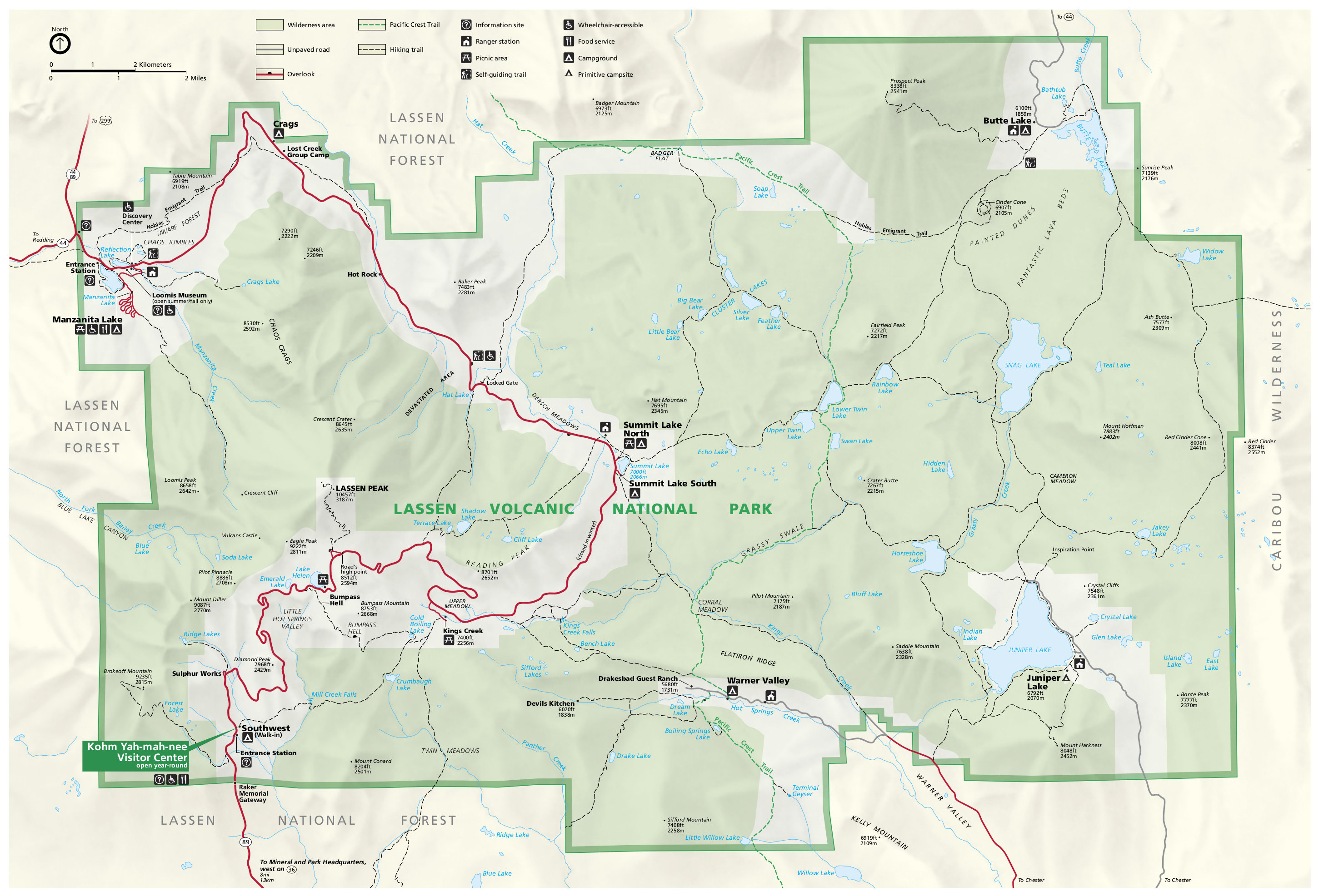
English: Official Lassen Volcanic map from the brochure, showing the roads, campgrounds, and trails. |
| Date | |
| Source | U.S. National Park Service (http://npmaps.com/wp-content/uploads/lassen-volcanic-map.jpg) |
| Author | U.S. National Park Service, restoration/cleanup by Matt Holly |
Licensing
| This image or media file contains material based on a work of a National Park Service employee, created as part of that person's official duties. As a work of the U.S. federal government, such work is in the public domain in the United States. See the NPS website and NPS copyright policy for more information. |
File history
Click on a date/time to view the file as it appeared at that time.
| Date/Time | Thumbnail | Dimensions | User | Comment | |
|---|---|---|---|---|---|
| current | 20:12, 15 July 2022 | | 4,500 × 2,676 (2.42 MB) | Ductwork | =={{int:filedesc}}== {{Information |description= {{en|1=Official Lassen Volcanic map from the brochure, showing the roads, campgrounds, and trails.}} |date= 2020-07-17 |source= U.S. National Park Service (http://npmaps.com/wp-content/uploads/lassen-volcanic-map.jpg) |author= {{Creator:NPS/Matt Holly}} |permission= |other versions= }} =={{int:license-header}}== {{NPS Maps}} Category:Maps of Lassen Volcanic National Park |
File usage
There are no pages that use this file.
Global file usage
The following other wikis use this file:
- Usage on en.wikipedia.org