File:Open pit iron mine, Labrador.jpg
Jump to navigation
Jump to search
Size of this preview: 800 × 600 pixels. Other resolutions: 320 × 240 pixels | 640 × 480 pixels | 1,024 × 768 pixels | 1,280 × 960 pixels | 1,600 × 1,200 pixels.
Original file (1,600 × 1,200 pixels, file size: 807 KB, MIME type: image/jpeg)
This is a file from the Wikimedia Commons and may be used by other projects. Information from its description page there is shown below.
Commons is a freely licensed media file repository. |
Summary
| Description |
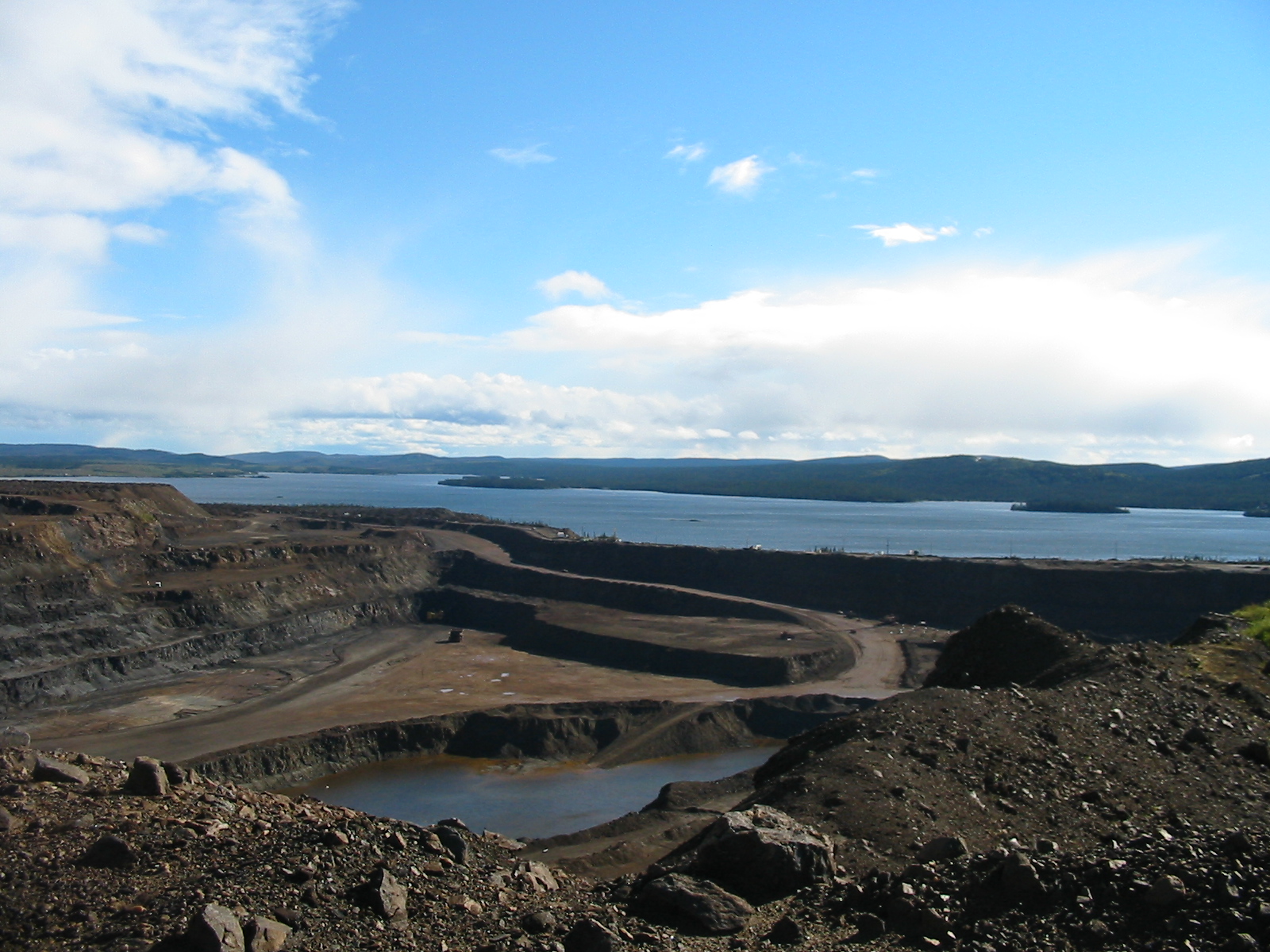
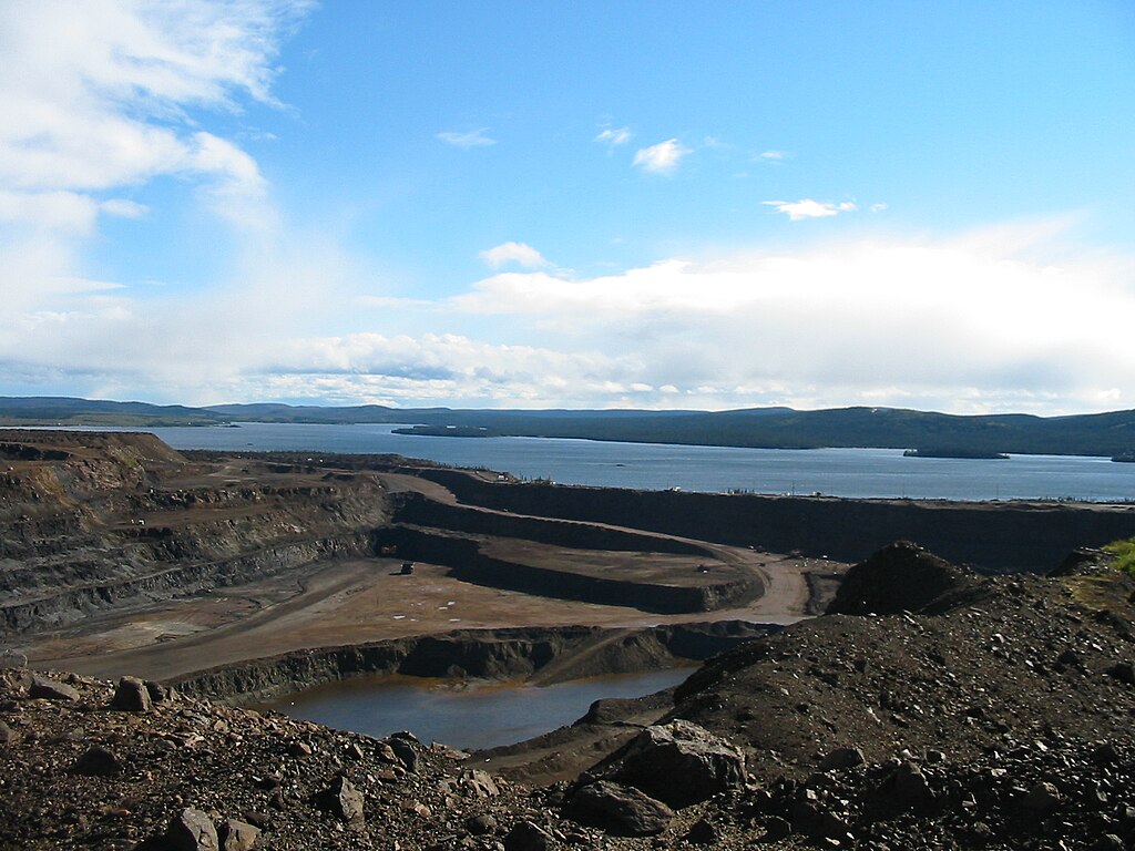
The following is the author's description of the photograph quoted directly from the photograph's Flickr page. "The iron mine is much deeper than the lake next door, and they're constantly having to keep pumping the water out. The contrast between the stunning natural beauty of the area, and the scars of industry, is quite visible here. 1 September 2003 " |
||
| Date | |||
| Source |
originally posted to Flickr as Labrador Contrasts Français : L'extraction du minerais de cette mine de fer est située du côté nord et à proximité du lac Knoll, à Wabush (Newfoundland) Español: La extracción de mineral de esta mina de hierro se encuentra en el lado norte y cerca del lago Knoll, en Wabush (Terranova)
|
||
| Author | Neil Carey | ||
| Permission (Reusing this file) |
This file is licensed under the Creative Commons Attribution-Share Alike 2.0 Generic license.
|
| Camera location | | View this and other nearby images on: OpenStreetMap |
|---|
File history
Click on a date/time to view the file as it appeared at that time.
| Date/Time | Thumbnail | Dimensions | User | Comment | |
|---|---|---|---|---|---|
| current | 05:30, 19 September 2009 | | 1,600 × 1,200 (807 KB) | Geo Swan | {{Information |Description=The following is the author's description of the photograph quoted directly from the photograph's Flickr page.<br/>"The iron mine is much deeper than the lake next door, and they're constantly having to keep pumping the water ou |
File usage
The following 2 pages use this file:
Global file usage
The following other wikis use this file:
- Usage on en.wikipedia.org
- Usage on fr.wikipedia.org
- Usage on fr.wikivoyage.org
- Usage on fy.wikipedia.org
- Usage on nl.wikipedia.org
- Usage on sv.wikipedia.org