File:Relief map of Italien Latium.png
Jump to navigation
Jump to search

Size of this preview: 550 × 599 pixels. Other resolutions: 220 × 240 pixels | 440 × 480 pixels | 705 × 768 pixels | 940 × 1,024 pixels | 1,879 × 2,048 pixels | 3,190 × 3,476 pixels.
Original file (3,190 × 3,476 pixels, file size: 8.69 MB, MIME type: image/png)
This is a file from the Wikimedia Commons and may be used by other projects. Information from its description page there is shown below.
Commons is a freely licensed media file repository. |
Summary
| Description |
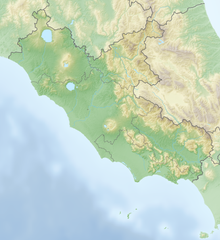
Deutsch: Positionskarte von Latium (Italien) English: Location map of Lazio region (Italy) Español: Mapa de localización de la Región de Lacio (Italia).
Equirectangular projection, N/S stretching 115 %. Geographic limits of the map:
|
| Date | |
| Source | Own work |
| Author | Tschubby |
Licensing
I, the copyright holder of this work, hereby publish it under the following licenses:

|
Permission is granted to copy, distribute and/or modify this document under the terms of the GNU Free Documentation License, Version 1.2 or any later version published by the Free Software Foundation; with no Invariant Sections, no Front-Cover Texts, and no Back-Cover Texts. A copy of the license is included in the section entitled GNU Free Documentation License. |
This file is licensed under the Creative Commons Attribution-Share Alike 3.0 Unported license.
- You are free:
- to share – to copy, distribute and transmit the work
- to remix – to adapt the work
- Under the following conditions:
- attribution – You must give appropriate credit, provide a link to the license, and indicate if changes were made. You may do so in any reasonable manner, but not in any way that suggests the licensor endorses you or your use.
- share alike – If you remix, transform, or build upon the material, you must distribute your contributions under the same or compatible license as the original.
You may select the license of your choice.
File history
Click on a date/time to view the file as it appeared at that time.
| Date/Time | Thumbnail | Dimensions | User | Comment | |
|---|---|---|---|---|---|
| current | 11:07, 22 March 2019 | | 3,190 × 3,476 (8.69 MB) | Tschubby | == {{int:filedesc}} == {{Information |description={{de|Positionskarte von Latium (Italien)}}{{en|Location map of Lazio region (Italy)}}{{es|1=Mapa de localización de la Región de Lacio (Italia).}} Equirectangular projection, N/S stretching 115 %. Geographic limits of the map: * N: 42.9230222 ° N * S: 40.6956638° N * W: 11.3490194° E * E: 14.1319861° E Topographischer Hintergrund: [http://www2.jpl.nasa.gov/srtm NASA Shuttle Radar Topography Missio... |
File usage
There are no pages that use this file.
Global file usage
The following other wikis use this file:
- Usage on als.wikipedia.org
- Usage on ar.wikipedia.org
- Usage on be.wikipedia.org
- Usage on bg.wikipedia.org
- Рим
- Тиволи
- Марино (Италия)
- Блера
- Витербо
- Фонтана Лири
- Риети
- Чивитавекия
- Итри
- Алатри
- Латина
- Норба
- Черветери
- Фраскати
- Анцио
- Неми
- Кастел Гандолфо
- Арича
- Велетри
- Фрозиноне
- Касино
- Ардеа
- Тарквиния
- Атина (Италия)
- Остия
- Сутри
- Ланувио
- Аквино
- Аузония (Лацио)
- Фонди
- Помеция
- Минтурно
- Формия
- Гаета
- Сабаудия
- Априлия
- Арпино
- Палестрина
- Болсена
- Терачина
- Вентотене
- Ладисполи
- Кори (Италия)
- Сора
- Субиако
- Пинятаро Интерамна
View more global usage of this file.