File:Subcarpathian Voivodeship Relief location map.svg
Jump to navigation
Jump to search

Size of this PNG preview of this SVG file: 505 × 599 pixels. Other resolutions: 202 × 240 pixels | 405 × 480 pixels | 647 × 768 pixels | 863 × 1,024 pixels | 1,726 × 2,048 pixels | 870 × 1,032 pixels.
Original file (SVG file, nominally 870 × 1,032 pixels, file size: 1.88 MB)
This is a file from the Wikimedia Commons and may be used by other projects. Information from its description page there is shown below.
Commons is a freely licensed media file repository. |
Summary
| Description |
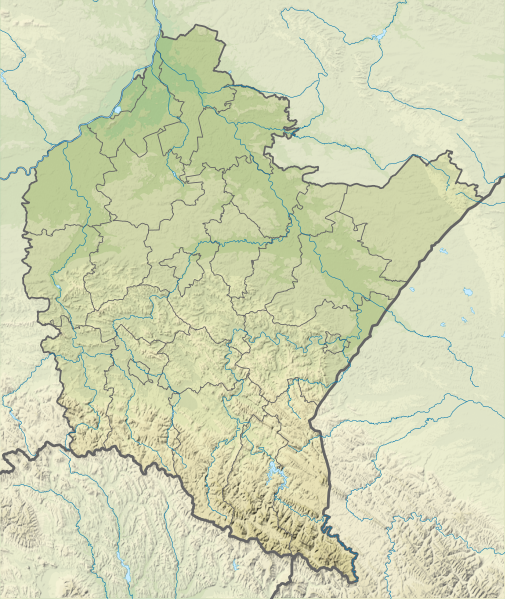
English: Relief ocation map of Podkarpackie Voivodeship. Geographic limits of the map:
|
| Date | |
| Source | Own work |
| Author | SANtosito |
Licensing
I, the copyright holder of this work, hereby publish it under the following license:
This file is licensed under the Creative Commons Attribution-Share Alike 4.0 International license.
- You are free:
- to share – to copy, distribute and transmit the work
- to remix – to adapt the work
- Under the following conditions:
- attribution – You must give appropriate credit, provide a link to the license, and indicate if changes were made. You may do so in any reasonable manner, but not in any way that suggests the licensor endorses you or your use.
- share alike – If you remix, transform, or build upon the material, you must distribute your contributions under the same or compatible license as the original.
File history
Click on a date/time to view the file as it appeared at that time.
| Date/Time | Thumbnail | Dimensions | User | Comment | |
|---|---|---|---|---|---|
| current | 17:31, 11 February 2021 | | 870 × 1,032 (1.88 MB) | SANtosito | Border update; topo vectorized |
| 23:11, 17 September 2018 |  | 815 × 967 (2.74 MB) | SANtosito | Corrected projection | |
| 23:51, 24 April 2018 |  | 2,261 × 2,605 (2.64 MB) | SANtosito | User created page with UploadWizard |
File usage
There are no pages that use this file.
Global file usage
The following other wikis use this file:
- Usage on de.wikipedia.org
- Usage on en.wikipedia.org
- Usage on eo.wikipedia.org
- Usage on fa.wikipedia.org
- Usage on frr.wikipedia.org
- Usage on fr.wikipedia.org
View more global usage of this file.