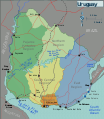
File:Uruguay Tourist Regions map.svg
Appearance

Size of this PNG preview of this SVG file: 522 × 600 pixels. Other resolutions: 209 × 240 pixels | 418 × 480 pixels | 668 × 768 pixels | 891 × 1,024 pixels | 1,783 × 2,048 pixels | 1,445 × 1,660 pixels.
Original file (SVG file, nominally 1,445 × 1,660 pixels, file size: 1.39 MB)
File history
Click on a date/time to view the file as it appeared at that time.
| Date/Time | Thumbnail | Dimensions | User | Comment | |
|---|---|---|---|---|---|
| current | 14:53, 11 May 2017 |  | 1,445 × 1,660 (1.39 MB) | ZrbtWm | Corrijo división entre las regiones "Norte" y "Pájaros pintados". |
| 22:40, 7 February 2017 |  | 1,445 × 1,660 (1.38 MB) | ZrbtWm | {{Information |Description ={{en|1=Uruguay tourist regions map, fixed according to the tourist regions described by the Minisitry of Tourism of Uruguay (http://turismo.gub.uy/index.php/en/places-to-go).}} {{es|1=Mapa de regiones turísticas del Urug... |
File usage
The following page uses this file:
Global file usage
The following other wikis use this file:
- Usage on es.wikipedia.org
- Usage on es.wikivoyage.org

