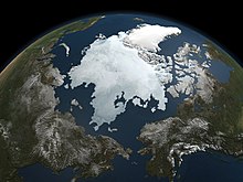
The Arctic is the area around the North Pole, including the Arctic Ocean and nearby land.
The Arctic is formally defined as either the area within the Arctic Circle (at 66° 34′ N), or all northern areas normally colder than 10°C (50°F), year-round. The latter definition includes inland areas south of the Arctic Circle, and excludes some areas north of it. Unlike Antarctica around the South Pole, the Arctic is sea covered in a floating ice sheet surrounded by dry land. In Antarctica the situation is exactly reversed.
Countries
[edit]The northern edges of North America, Europe and Asia are within the Arctic Circle.
- United States: Arctic Alaska
- Canada: Northern Canada (Yukon, Northwest Territories and Nunavut)
- Most of Greenland
- Norway: Northern Norway, Svalbard and Jan Mayen
- Sweden: Norrbotten County
- Finland: Finnish Lapland
- Russia: Northwestern Russia, Krasnoyarsk Krai, Yakutia and Chukotka
- Islands of the Arctic Ocean
Cities
[edit]
The Arctic is sparsely populated. Many settlements are or have historically been associated with fishing, whaling (now sometimes replaced by whale-watching), mining and other resource extraction, the military or research. Some major centers of population are:
- 1 Bodø – seat of Nordland county, Norway
- 2 Fairbanks – Alaska's second-largest city, junction of several major highways
- 3 Iqaluit – capital of Nunavut, Canada
- 4 Kiruna — a mining town, Sweden
- 5 Murmansk — largest city in the Arctic and important military harbor, Russia
- 6 Nuuk — capital of Greenland
- 7 Rovaniemi — the capital of Finnish Lapland
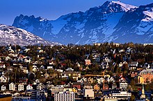
- 8 Tromsø – historically a starting point for many Arctic expeditions and one of the biggest cities so far north, Norway
- 9 Utqiaġvik — the northernmost town in the USA
Other destinations
[edit]

- 1 Dalton Highway — Alaska's highway to the Arctic Ocean
- 2 Lofoten — one of the most beautiful areas in Norway
- 3 Northeast Greenland National Park — the largest national park in the world
- 4 North Pole — there's not much here, as – unlike the South Pole – it sits on ever shifting sea ice
- 5 Pallas-Yllästunturi National Park — one of Finland's best national parks
- 6 Quttinirpaaq National Park — Canada's northernmost national park
- 7 Svalbard — you're in luck as you won't need a visa getting there (though you might need one to get to Norway where almost all flights here depart from
- 8 Wrangel Island — the last wooly mammoths lived on this desolate island some four thousand years ago
- 9 Putoransky Nature Reserve — almost two million hectares of pristine nature in an isolated mountain range
Understand
[edit]
The Arctic is antipodal to Antarctica. And to get this out of the way: Polar bears: Arctic. Penguins: Antarctica and other places in the Southern Hemisphere. Both: Nowhere but zoos.
Within the Arctic Circle, the sun stays above the horizon during parts of summer (Midnight Sun), and beneath the horizon during parts of winter (Arctic/Polar Night).
Anywhere north of the Arctic Circle is suitable to see the Midnight Sun in Midsummer (all summer if close enough to the poles) – unless a hill is covering the view – and most of the accessible Arctic is good for seeing the Northern Lights during winter.
The sun is low also when seen, 47° above the horizon at noon in Midsummer at the Arctic Circle, 23.5° at the North Pole. There are few truly warm days and temperatures below freezing (32°F or 0°C) are possible even in the summer. Winters are extreme in many areas.
The climate differs significantly by latitude – but also by longitude. Due to the Gulf Stream (from the Sargasso Sea), Scandinavia has a much warmer climate than Alaska, Northern Canada or Siberia at the same latitudes. In fact, the coldest temperatures aren't experienced at the North Pole, but at the Pole of Cold, slightly south of the Arctic Circle in the Russian Far East.
Much of the vegetation is tundra, where only the uppermost layer of soil thaws in summer and no deep-rooted plants can thrive. As evaporation is low in the cool, bogs, mires and lakes are common. There are also areas with just lichen and other hardy species growing on the rocks – and areas covered in perennial ice. Still, in the short summer, there can be an amazing wealth of flowers, insects and birds, and some regions are home to caribou, reindeer, musk oxen and the like, a number of smaller mammals like the lemmings, and Arctic foxes, wolves and bears.
In contrast to Antarctica which is terra nullius, virtually all dry land in the Arctic is national territory.
Talk
[edit]English is the dominant language at international expeditions. Besides national languages (English, Norwegian, Swedish, Finnish and Russian) there are several indigenous languages such as Greenlandic, Inuktitut, the Sami languages, Nenets and Sakha. People in the Nordic countries are famously excellent at foreign languages and many Canadians speak a bit of the other national language of their country, even though full bilingualism is rare. Russians rarely speak anything but Russian. Speakers of indigenous languages increasingly speak the metropole language and often a foreign one, too; see minority cultures of Russia.
Get in
[edit]
There are regular flights to most towns – and regional flights also to many minor settlements. Some towns, such as Murmansk, have connections by rail, and some regions have decent road connections. Many railways were built with mining goods in mind, not people, so you may be in for a slow and bumpy if usually picturesque ride. There are even four EuroVelo cycling routes to the Barents Sea (to Nordkapp and Kirkenes).
As of 2022, Russia has strict border controls, and most direct flights between Russia and Western countries are shut down.
The only guarded borders in the Arctic are Russia's border to Finland, Norway and USA, and the Alaska-Canada border. You should still check formalities.
Get around
[edit]Scheduled transportation through the Arctic is limited, and travellers need to rely on chartered or private vehicles in most areas. Many places – even what qualifies for cities so far north – are only accessible by boat or plane and even that may be possible only seasonally. Prices tend to reflect that, even where direct or indirect subsidies keep a service alive that would otherwise not be commercially viable.
Arctic Europe is generally significantly easier to get around in than Arctic Asia or North America.
See
[edit]
- Northern lights
- Whale watching — in regions of the seas that are not frozen
- Midnight sun — in the northern parts of the Arctic, the sun does not set for most of the summer (of course, the downside is that it doesn't rise in the winter)
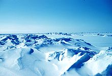
- Ice and snow — in many parts of the Arctic, ice and snow is present year-round.
- Eurasian wildlife or North American wildlife
- Norrbotten Megasystem
- Arctic wildlife
History
[edit]Sir John Franklin's 1845 lost expedition perished trying to map the Northwest Passage from the North Atlantic to the Bering Strait. Between 1903 and 1906, Norwegian explorer Roald Amundsen was the first to complete the journey.
- 1 Gjoa Haven, southeast coast of King William Island, Nunavut, Canada. Amundsen stayed in what he called "the finest little harbor in the world" for nearly two years.
Do
[edit]- Cross-country skiing
- Wilderness backpacking
- Ice breaker cruises. There are tours from Murmansk to the North Pole (perhaps late summer only) and shorter tours through sea ice in Kemi, Finnish Lapland (in winter). Kemi is not in the Arctic, but perhaps close enough.
Eat
[edit]Traditional cuisines rely heavily on fish and meat (including seal and whale in many places), vegetarians beware. Most other food has to be imported from the south, so prices tend to be high. There are still berries growing locally, some of which may be new acquaintances, and edible herbs such as the Norwegian angelica.
Drink
[edit]Alcohol has been a problem in many communities in the Arctic, when brought in from the south, and it may be strictly regulated.
In the real cities, such as Murmansk, Rovaniemi and Tromsø, there is nightlife as in other cities. Resort towns have seasonal nightlife. However, elsewhere it is often lame because of sparse populations – look for occasional parties you could join instead.
In much of the Arctic there is plenty of potable water, as evaporation and microbial activity are low in the cold. That's not the full picture though: the water may be spoiled locally for natural reasons or because of human activities, such as mining and oil industry.
Stay safe
[edit]- See also: Cold weather, Winter driving
The cold, polar bears and desolation are the main dangers. Despite the cold temperatures you can get sunburn too, especially when snow and ice are reflecting the sunlight. Sun on snow can cause snow blindness.
Go next
[edit]The only way out of the Arctic is south.

