

Cobblers Reef is very apparent along the whole 16 km of the south east coast of Barbados, and local divers and fishermen dive and fish it a great deal, but they generally publish very little. Standard diving publications regarding Barbados hardly ever mention it, in spite of its visual prominence. This guide was prepared on the basis of 17 years of study and diving with local divers in an aim to fill in as many of the gaps in published knowledge as possible. It is ongoing. Please add but don't subtract.
Please click on icons to enlarge and obtain more information about images.

Cobblers Reef is a complex coral reef off the South East Coast of Barbados, Caribbean, an island with five separate coastlines. The reef runs parallel to the south east coast for approximately 15 km from South Point, north east past Kittridge point, in the direction of East Point Lighthouse round the corner on Ragged Point. There is an inner reef on top of which the ocean waves break 800 m off the shore. The shallowest coral is often less than 3 m deep and its presence is easily seen from the beaches and cliffs along the whole length of the reef except in the very calmest of weather. The outer portion is rarely visible from the cliffs, but can usually be seen easily from a boat sited above it, in doubt a mask and snorkel will solve the issue. It lies about 1.6 km off the beach and tops at about 12 to 15 m depth.
 Southpoint Lighthouse from south western end of Cobblers Reef.
 The reef stretches for kilometres past Silver Rock.
 Way past Inch Marlowe Point aka Surfer's Point.
 On the horizon past Long Beach and the Airport.
 From Inch Marlowe, right background, to Salt Cave Point, left foreground viewed from Green Point.
 Past the old Crane Beach Hotel.
 Past Sam Lords Castle, back left.
 North east from Sam Lords to Bottom Bay.
 North east of Bottom Bay.
 Past Palmetto Bay.
 Don't try to swim ashore or land a boat near Kitridge Point.
 Kitridge Point from northern portion of Cobblers Reef with East Point Lighthouse in the background.


Understand
[edit]The gross topography of the reef is well represented in the British Admiralty Chart of the area. Much of the data is based on information derived in the 19th Century. This would have involved lead-line depth soundings, and horizontal sextant angle position fixes using a light craft. A larger more complete version can be viewed and downloaded from here .
The inner reef is easily seen in these satellite views. In the southern view South Point is bottom left, with Long Beach and the Airport next. Then at the top right of the northern view there follows Foul Bay, Crane Beach, Sam Lords Castle, Long Bay, Bottom Bay and Kitridge Point. Ragged point lies north west of Kitridge Point. In both of the views the top of the Outer Reef or "Fathom" can be seen as a lighter strip about the same distance from the top of the inner reef as the beaches and cliffs are on the inside.
 British Admiralty Chart of Cobblers Reef.
 Satellite View of the southern part of Cobblers Reef by NASA.
 Satellite View of the northern part of Cobblers Reef by NASA.


Position
[edit]Inside N13°08.956' W59°25.031' to N13°02.391' W59°31.995'
Outside N13°08.515' W59°23.785' to N13°01.407' W59°31.185'
Name
[edit]In Barbados long spined, black Sea Urchins (not usually eaten by humans) were traditionally known as Cobblers. Conversely, edible and much appreciated white Sea Urchins, sometimes considered an aphrodisiac, are known locally as "Sea Eggs". It is (as of 2015) illegal to take the edible Sea Eggs. There was a 2-week open season in September 2004 for taking them but since then they have become increasingly rare throughout the island. The photographer who had seen none inside Cobblers Reef off Crane Beach for two or three years was encouraged to find five or six juvenile white urchins in an area of about five metres square and about 50 m inside the top of the Inner Reef. Cobblers are alleged to feed on algae that harm the live coral but Sea Eggs seem to eat seaweed living on coral rubble or dead rocks. Perhaps the Sargassum weed down here is helping to nourish a revival, although Sargassum floats and urchins graze the sea bed. In practice both types of Urchin may live on the same terrain on Cobblers Reef as this sandy shot shows.
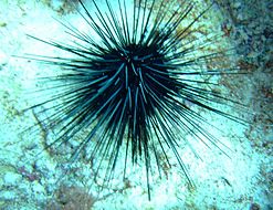 A Cobbler or black Sea Urchin.
 One of a group of six juvenile sea eggs or white sea urchins seen in a 5 m square area about 50 m inside the top of Inner Cobblers Reef in February 2015.
 In practice both types of Urchin may live on the same terrain on Cobblers reef as this sandy shot shows.


Depth
[edit]Coral reef down to 40 m, sand bottom at about 45 m
Visibility
[edit]
Underwater visibility typically ranges between 15 and 25 m. This seems to be due to a combination of swirling chaotic water movement, freshwater run-off and plankton and other reef particles and sand. When 30 m plus visibility occurs it appears to be due to a combination of a powerful and persistent non-tidal oceanic current with a prolonged dry spell, both of which are more common in the winter months, or a prolonged calm spell, which is more likely in the summer months.
Topography
[edit]The outer side of the inner reef is known by local divers and fishermen as the "Back side". Near the top its gradient is less steep, but at about 25 m it forms an "Edge" which drops at an angle of about 45-50⁰ to the horizontal, down to the sand at 45 m. In the northern section of the reef the Back side is wider and penetrates further into the ocean than in the southern section.
Local divers and fishermen refer to the outer reef as the "Fathom". The inside of the Fathom is generally the steepest part of Cobblers reef, lying at an angle of 50-55⁰ to the horizontal, from about 20 m down to 40 m depth. It is also the darkest part of an otherwise very sunny and bright reef. Its steepness, but more importantly its north-north-westerly aspect means that the sun does not get around to this face till after 15:00 when it is already relatively low in the sky prior to setting at about 18:00. Moreover it is sheltered from the most powerful of the Atlantic swells and currents so it may appear to the diver as somewhat "dusty".
By contrast the outer side of the Fathom initially slopes more gently, but like the Backside forms a steeper "Edge" dropping at 45-50⁰ from 30-45 m before running out onto sand which plunges hundreds of metres into the Atlantic Ocean.
These two components of the reef are illustrated the diagram of the profile of Cobblers Reef.
In places there seem to be coral bridges or islands between the fathom and the back side. These are not charted by the British Admiralty and are too deep to be represented on the current publicly available satellite images, but they are known to some of the local divers. It is not possible to see from the bottom of one reef to the other, but an island may visible from both and so can be followed across.
In certain conditions of wind, tide, current, sea state and light, turbulence may be seen on top of inner and outer reefs.
Local divers classify currents as "up", to the north east, "down" to the south west, "in", "out" or combinations eg "down and out". The prevailing current is down and can often be too fast to swim against.
 Profile of Cobblers Reef from the south
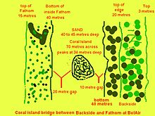 Submarine coral islands occur intermittently between the inner and outer reefs.
 Abram on the submarine island at 38 m. He continued and crossed to the Fathom. The photographer went left and finished on the Inner Reef, which can just be discerned in the left background.
 Rarely lines of turbulence may be seen over inner and outer reefs.


Conditions
[edit]


In August and September the ocean is relatively calm, except when tropical depressions roll in from West Africa. For eight to ten months of the year wind and currents nearly always come in from an easterly quadrant from the Atlantic Ocean, where the nearest land lies thousands of kilometres away in Africa. These are the trade winds that brought Columbus to the New World. At this time the Backside is pounded by surf and ocean surge that swirls and bubbles both horizontally and vertically. The motion is much less 15 to 20 m below the surface at the top of the Fathom.
The direction of the prevailing currents and the distance to the nearest land ensures that there is very little pollution. Very occasionally a dust storm will blow across from the Sahara to the Caribbean so that dust might land on the reef, sometimes Sargassum weed lands on the beaches from the Sargasso sea, and algae from the Orinoco River in South America has been known to partially asphyxiate the reef temporarily. In the early 2000s an oil spill on the east coast beaches was attributed to a foreign tanker washing out its tanks illegally out of sight of land. Heavy rain might wash agricultural mud from the north of the island into the ocean to be carried down over the reef. However the main stressors of the fauna come from the mechanical energy of the water and they generally cope well with that.
In the later hurricane season (August to November) the ocean is usually so flat that kayaking outside the reef is generally straightforward. During August and September the lack of wind driven seas and major oceanic swells seems to accentuate the tidal (or lunar) currents. These tidal currents can be extremely powerful especially at full or new moon, and they reverse direction about every 6 hours. Even when the wind and the ocean currents are calm the tidal currents can set the shallow parts of the reef "boiling", pile surf against the cliffs, and carry unwitting swimmers or divers and small boats into danger. During the tourist season when the Trade winds predominate, the reef is often too rough for safe scuba diving for ordinary recreational divers.
If a boat failed to pick up a diver the situation may be hazardous as jagged coral cliffs battered by surf comprise about 80 percent of the coastline inshore of Cobblers Reef, and the prevailing current at the southern end of the reef would take a drifting diver out away from the South Coast Beaches. If you see the Hilton Hotel at the end of the island swim to the right.
Many visiting divers would prefer to avoid alcohol the night before an early morning Cobblers Reef dive.
Water temperature below the surface ranges from 27° C. in January to 29° in September. Air temperatures in the shade vary in January from 24° early morning to 30° C. mid afternoon. In August or September when the Trade Winds die back there is little fluctuation throughout the 24 hours and on the beaches or Ocean the air temperature will be 30° to 31° C. plus humid. In January or February wind chill factor can operate. Driving a boat into big seas creates constant spray, and the boat speed plus wind speed may create a combined wind speed of 40 km/h or more. A waterproof top is recommended over your wet suit. While some Canadians laugh at the idea of being cold in Barbados, Alistair Reynolds and his party "could not wait to return to the calm, warm waters of the west" [dead link].
In reality the south east coast is one of the most wonderful round-the-year environments and climates for humans thanks to the Trade Winds, which moderate the immense power of the almost perennially overhead mid-day sun, but one of the most destructive for electronic devices, electrical gadgets and other man-made objects due to the salt-laden atmosphere. Many savvy Bajans would not consider living over here for this last reason, so most of the inhabitants are either people who are "still here", or those so wealthy they enjoy the salubrious climate and can afford to replace their possessions very frequently, or the average local Bajan who values his human ambience more than the need for transient gadgets. Visitors should avoid direct exposure to the sun on naked flesh between 11:00 and 15:00 where possible and take advantage of the ample shade and delightful breezes. Don't expose your gadgets to the salty breezes more than you need too or you will be cleaning salt and sand off them some time after you return home.
In June 2014 there was a recurrence of the deposition of Sargassum Weed on the beaches inside Cobblers Reef. By February 2015 there is a significant arrival of the weed on the inshore beaches, with more floating in as can be seen.

Sadly it makes the beaches unattractive to many visiting tourists upon whom the island significantly depends. When swimming out to the reef it is only the first 150 metres that seem to be affected by poor visibility and the annoying weed wrapping itself around the diver's neck, trunk and limbs. It does not appear to contain stinging creatures. The weed seems to be a natural phenomenon that comes and hopefully goes. Most British and many Atlantic North American beaches exhibit seaweed.

Further out the visibility and life appear unaffected.
How thick is the layer of weed
[edit]Booms have been proposed to control the deposition of weed on beaches. But how thick is the layer and hence the required depth of such a boom?. The first picture was taken quite close up on a calm day in November 2014 off Crane Beach. The Weed appears coherent, organised and fairly compact. But there is no scale.
To cope with this calculation weed was photographed in a pool against a standard credit card, the two pictures scaled approximately equally and pasted together. It can be seen that the card fits about ten times into the layer of weed which is thus about half a metre deep.
But what about using a 1-m wooden scale held by Rob, a 2-m diver from Ottawa, in the more normal rougher conditions and strong current in March 2015.
This is trickier because visibility becomes much worse, and the complicated and high energy water movement rolls the weed, the model and the photographer in different and unpredictable directions, so that view-finding is almost impossible. In this shot Rob's head is out of the water but weed is swirling round the scale and his legs to at least a metre below the surface.
 Sargassum weed was photographed in a pool against a standard credit card, the two pictures scaled approximately equally and pasted together. It can be seen that the card fits about ten times into the layer of weed which is thus about half a metre deep
 Measuring depth of weed in rough conditions and poor visibility using a 1-m scale and two metre diver.


Carol B reported in April 2015 that the Crane Resort had managed to install a small digger on Crane Beach to tackle the weed. She felt that a significant improvement in the state of the Beach might be hoped for.
In late November 2015 Sargassum weed was miraculously absent from Crane Beach for several days. Only time will tell if it will recur, but the boom which had worked fairly well for about two months had to be brought ashore for repairs a week before the weed disappeared.
In late January 2016, there was no weed, even though the boom was not fully deployed. A boat could be seen working on the south western end of the boom.
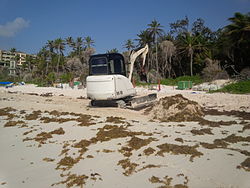 Carol B reported in April 2015 that the Crane Resort had managed to install a small digger on Crane Beach to tackle the weed.
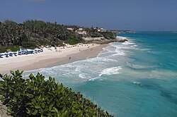 No Sargassum Weed on Crane Beach on November 25th 2015.
 A boat working on the Crane boom in late January 2016.
 Crane boom from the ocean
 Boom and Chain under water
 Part of Crane Boom chain goes Walkabout on Crane Beach North


There is no Sargassum on Crane Beach in December 2018 in spite of no protective measures.
Facilities
[edit]Compressed diving air and cylinder testing is available from Caribsupply [dead link] at their manufacturing plant at Clapham near the Banks Brewery.
Nitrox is available from Oceansports Technical Diving (Barbados) LTD [dead link]
Hazell's Water World - Diver supply Barbados Carlisle Bay, Bay Street, Bridgetown (Across St. Patrick’s cathedral) +1 (246) 426 4043: www.diversupplybarbados.com [dead link] Supplies a good range of Diving Gear.

Re-compression Facilities
Barbados has one re-compression facility with a chamber that can accommodate an attendant and the victims, and is at St. Ann's Fort, on the south west corner of the Island; it is staffed around the clock full time by a team by four doctors, trained in Hyperbaric medicine and backed by Barbados Defence Force (BDF) personnel. It is located within the secure perimeter of the BDF at the historic UNESCO World Heritage Centre of "The Garrison", so to be securely logged in as a visitor is a memorable privilege. It can serve a considerable portion of the south eastern Caribbean. It is free for Barbadians, but tourists need international insurance such as IDEC or DAN or a deep wallet as in most countries. Dr Michael Brown from Yorkshire England and trained at the Royal London Hospital in Whitechapel, London, England, one of the original instigators of the chamber as a young man in 1985, still turns out for emergencies, nights and weekends, to deal with decompression victims. His day job is as a Family General Practitioner. He and his colleagues treat victims with skill, compassion and great knowledge. He is not prepared to see experienced divers repeatedly jeopardising their health by repeatedly taking unacceptable risks that they understand and ignore. The chambers also provide therapy for medical or surgical emergencies such as gangrene and severe burns, but sadly there is not the scientific evidence to treat multiple sclerosis which for once there was a fashionable vogue.
If you suspect a bend don't waste time going to hospital, but ☏ +1246 4365483 for advice.
History
[edit]The notorious pirate Sam Lord w:Samuel_Hall_Lord allegedly lured ships onto Cobblers Reef with lights; he operated in the early to mid eighteen hundreds.
The Crane Resort overlooks the middle of the reef from its cliff top; it was previously Crane Beach Hotel founded 1887, and probably started its life as the Marine Villa in 1790 [dead link].
Professor Charles Cleveland Nutting of the University of Iowa made a scientific sudy of the fauna of Cobblers Reef by dredging and fish pots. He enjoyed a stay at the old Crane Beach Hotel, especially the location and the sea food .
In December 2007 Professor Ian MacIntyre and colleagues from the Smithsonian Institution, DC, and the University of Miami published an excellent research paper about the Elkhorn Coral of Cobblers Reef, which he found to be all dead in the top 6 m or less of the Inner Reef. (Smithsonian Atoll Research Bulletin. 1 December 2007) . You will observe that there is no Elkhorn below this depth though plenty of other live hard corals, Gorgonia and sponges.
At about the same time as Professor MacIntyre was working, web designer Clementine Ellasos, a Francophone North American, produced a very informative French-language website about the island, with a full illustrated page about scuba diving around Barbados. It seems an excellent and comprehensive introduction to Barbados for her fellow French-speakers. She has collaborated with commercial aspects of diving in Barbados and also taken part in underwater research projects on the Island. Please see "Baseline survey of coral reefs within Folkestone Marine Reserve – Final Report" [dead link].
Get in
[edit]
Even though locals may do it, solo shore diving on Cobblers Reef cannot be advised, so you need a buddy and perhaps a boat.
Access to the reef using a dive centre The best place to start is with one of the 14 dive centres that have easily found websites on Google "Dive Barbados". Seven refer in their websites to diving on the east coast in summer. None refer to the south east coast. They all operate to PADI and BSAC standards and diving with them should be acceptable to international diving insurance companies such as IDEC or DAN. They are all reviewed by tripadvisor and should be capable of organising diving anywhere on the island.
For example, George, one of the senior instructors at Rogers Scuba Shack speaks of diving with his local friends based in Conset Bay on his days off in the Winter tourist season. The closest centre to the reef is Scotch 'n' Soda based in front of the Sandy Beach Hotel on the south coast, and operated by the very experienced R.A.M. Edghill (known as RAM). Most of the dive centres may have drawbacks relative to Cobblers Reef however, as many are based and keep their boats on the generally calm west coast, a long and uncomfortable boat ride to and from the reef in the tourist season. As commercial organisations, they are very busy in their own areas with divers of varying experience or inexperience staying in hotels or apartments in their vicinity. Most are very close to the cruise liner terminals. To entice them to Cobblers Reef in the winter tourist season would be more expensive than merely the price of the extra gasoline and manpower. As a consequence most commercial dive boat operators seem reluctant to take tourist clients out here during the high (winter) season when strong easterly trade winds are prevalent.
Even in the calm summer months when tourists are far fewer the boat ride from the west coast to Cobblers Reef is unduly long, and they can relocate temporarily to harbours in Oistins or Conset Bay, or charter local boats which are not built as dive boats.
If you want to dive Cobblers Reef with a dive centre (advisable for most) it would be best to come to Barbados in the Summer. Otherwise, you are probably on your own. Fortunately everywhere on the reef is dive-able and where you dive depends more on your point of entry and how much energy or fuel you or the boat owner wish to expend. A hand held waterproof GPS in the boat may be a useful adjunct to your dive computer for logging your dives and repeating them or avoiding repetition. On the other hand, land marks and visible cross bearings may be just as good depending on your eyesight and memory, but less easy to describe to other divers.
Access to the reef not using a centre
Free diving and scuba diving without employing a dive centre has to involve swimming to and from a suitable beach or diving with local divers usually in a pirogue or off-season “ice boat”, or alternatively a sit-on-top kayak.
Treatment in a decompression chamber would be extremely expensive, comparable to the cost of a decent new car, in the event that your insurance company considered that you had breached their terms and conditions. Failure to return to a safe beach or to be picked up by your boat would be even more dangerous.
Harbours. Facilities should include safe shelter in all but Hurricane conditions. Jetty, slipway, crane availability, fuel and fresh water. Adequate Security.
Moorings. Swim or be ferried from the beach.
- Car access ensures launch and retrieve at will.
- Tractor access by Ministry of Agriculture needs to be arranged.
- Other moorings require launch and retrieve from another site.
Beach access. Swim safely to and from the reef with or without SCUBA. Divers may swim out to be picked up by arrangement by a boat launched or moored elsewhere.
Harbours
[edit]There are no harbours inside Cobblers Reef, however there are two significant harbours adjacent to the ends of the Reef.
Oistins
A major port at N13°03.792' W59°32.622' Oistins is only 2.5 km north west of South Point Lighthouse (N13°02.826' W59°31.764'). Facilities do include safe shelter in all but Hurricane conditions. Jetty, slipway, crane availability, Fuel and Fresh Water. Adequate Security. Shops, supermarkets, banks, medical facilities and restaurants, boat and marine engine repair yards. Royal Barbados Police and Barbados Coastguard local headquarters. Government offices. Accommodation, entertainment and hotels, public beaches and Bardbados Golf Club in the vicinity.
Conset Bay
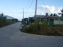
At N13°10.788' W59°27.978' Conset Bay is a small fishing village, community and harbour. Facilities do include safe shelter in all but strong northerly winds. Jetty, slipway, boat crane availabile, fuel and fresh Water. Adequate security, local shops, restaurants and bars, locally provided accommodation in the vicinity.
Air Fills
Even if you have access to a car it is probably better use of your valuable time on the Island to pay a local driver to take your tanks to be filled after the dives, unless you are diving sporadically. This applies to Oistins, Consett Bay and all points in between.
Oistins is much nearer to Caribsupply gas services at Clapham (7 km) than is Conset Bay (20 km) equivalent to a round trip difference of about 26 km by car for each set of air fills.
Bus services to Oistins and Conset Bay
It is quite feasible to use buses to get to boat diving trips, as attested by regular visiting divers and locals, but it is easier if you do not have to transport your tank and weight belt as well as your other gear, however a car is recommended. Car Rentals are widely advertised on line, and some regular visitors even keep a car on the island.
Both harbours can be accessed by routine bus services, but there are far more buses going to and through Oistins on far more routes than to Conset
Oistins is served by bus routes 12A, 12D, 12F, 13, 13B, 26, 27, 27H, 28, 30A, 31, 31A, 32, 34, and 54. Route 26 from Oistins goes through Six Roads and passes within a mile of Conset Bay.
Conset Bay is reached on a rural route (Highway 4) from Bridgetown, service number 9 which does not go through Six Roads.
Both route 26 from Oistins and route 9 from Bridgetown stop at Thickets, Three Houses, Three Houses Park, Blades Hill and both terminate at College Savannah, though only route 9 calls in at Conset Bay, so a change of bus could be useful coming from the direction of Oistins to Consett Bay. Detailed routes and timetables are published .
If driving to Conset Bay take the sign to College Savannah and past St Marks Church a very prominent landmark. Stay on roads with regular "Out of City" bus stops. Do not take either of the two Right turns off Highway 3 going north west. They are both signed "Conset Bay" but they are barely fit for a horse .
 Avoid this turning to Conset Bay at 13° 10′ 05.85″ N, 59° 28′ 12.78″ W.
 Also avoid this turning to Conset Bay at 13° 10′ 07.97″ N, 59° 28′ 17.41″ W.
 The Port of Oistins before the dive at 7 a.m. The ship takes crude oil from Barbados to Trinidad and returns added value refined fuels.
 The German owned Valletta registered Oil Tanker Murray Star was pictured in the Port of Oistins on 3rd March 2015 having sailed from Cul-de-Sac St Lucia. By 9th March she had almost reached her next destination Freeport Bahamas. http://www.marinetraffic.com/ais/details/ships/shipid:149310/mmsi:215178000/im
 A distant view of the Port of Oistins.
 Even in January boats are moored in Conset Bay. A small boat heads for the channel in rough conditions.
 Late afternoon in January the Boat Yard at Consett Bay is quiet.
 Patrick the proud owner saw the camera and asked the photographer to take a picture of him with his boat at Conset Bay.
 The offshore reef protects Conset Bay, boats and jetty from all but the worst weather. Boats get hauled up if a hurricane is forecast.


Moorings
[edit]Small boats can be secured on permanent moorings off Silver Rock Beach, Long Beach, Foul Bay, Crane Beach North or Long Bay all inside Cobblers Reef but sea conditions are often challenging. These five beaches provide the shortest access to Cobblers Reef, but the boats are all locally and privately owned, generally pirogues and the owners do not publish information. Two of the five beaches have vehicular access and may be suitable for launching as well as mooring or storing boats on land.
Moorings with Car access
Long Beach
At N133.702'° W59°29.922' Long Beach is very long and attractive but also can be lonely and deserted, and occasional acts of serious violence have been reported here. The drive to Long Beach is not very easy, because once you leave the black top it is liable to be quite muddy after rain, and the final stretch is soft sand. Although boats might be moored here it is probably too near Oistins to be worth while as well as not easily watched. A further drawback is that this is a significant turtle nesting beach, being probably the most desolate though very beautiful, beach on the island. It should be practical to shore dive from here and return safely, due to the length of the beach, though the reef seems more interesting further north east towards the Grantley Adams Airport.
Bus 13B from Bridgetown via Oistins terminates at Long Beach, but the Bus Stop is a considerable walk from any part of the actual beach.
More information might be required to recommend it as a mooring beach but it is quite popular with Kite Surfers. In general its negative points probably outweigh its value as a potential dive access, by boat, road and swimming from the beach, and boats are not generally moored here, even though it would be possible. Bajans do not favour it or use it for mooring in spite of the theoretical possibilities.
Most diving on the reef off Long Beach is done from Oistins when the wind and seas preclude a longer boat drive.
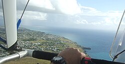
 Long Beach to the south east of the Grantley Adams runway from Paul Nutting's microlight. It is much longer than Long Bay to the north east.
 Windswept and sand-blown the enormous Long Beach is often deserted.
 Long beach is usually empty apart from Kite surfers. Two can just be seen to the right.
 Landmark, but don't follow this sign to Long Beach. Take the road to the left (north) of the track illustrated.
 Follow the Black Top north east towards Long Beach past the no littering sign.
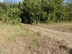 This track can be very muddy after rain.
 Looking back at the landmark trees before Long Beach. You are almost there.


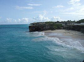
Foul Bay Beach
At N13°06.066' W59°27.036' Foul Bay Beach, about midway between the Port of Oistins and Conset Bay, has the best vehicular and Boat Trailer access to the waters inside Cobblers Reef, but it is marginally compromised by soft sand at the finish and often big surf. By co-operative action and manpower the locals overcome both these difficulties. Pirogues may be stored or moored here.
Foul Bay is reached by bus route 27 from Speightstown in the north west of the Island via Holetown, Bridgetown, Hastings, Worthing, St Lawrence Gap, Oistins, the Airport, and St Martins Church. It is also visited by Route 26 from Oistins via the Airport, Rock Hall, Gemswick and St Martins. It can also be approached by route 12A from Sam Lords Castle, via Bel Air, the Crane and Stoutes Gas Station and shop at Kirtons.
None of the bus-stops are less than 500 m from the beach at Foul Bay down steepish rocky steps, but blue charter buses park for their clientele in the car park on the beach, particularly at weekends and bank holidays. The routine buses are for the benefit of the very fortunate "Foul Bay Community" rather than for beach-goers who don't like to walk.
The strength of the current often results in shore dives that set out from Crane Beach finishing at Foul Bay where there is a shower and a car park and you might even get a lift back to your hotel or apartment. In case you might have to walk back from Foul Bay make sure you swim carrying some flipflops or wear diving boots with soles to protect your bare feet from the very hot "black-top".
Both Foul Bay and Long Beach are safe for swimming to and from the reef, though Foul Bay surf may often turn the swimmer or diver over two or three times. It is almost 6 km between the two beaches with mainly high cliffs, sharp with coral rock and crashed by surf, so if the current takes you past Foul Bay, you could be in for a long swim.
 Inshore of Cobblers Reef between Foul Bay and Long Beach seen from a Microlight there are no real beaches just high cliffs. Salt Cave Point sticks out above professional pilot Paul Nugent's left hand.
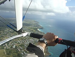 Foul Bay is Centre, with the Inner Reef to the Right, with surprisingly little surf on top. Squall coming. Green Point under the pilot's hand.
 Foul Bay and the cliffs to the south west from an American Airlines window.
 Foul Bay Road comes down the hill then swings left behind the trees, coming onto the beach towards the right of the picture.
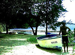 Pirogues are often stored at the end of the road on Foul Bay beach here and the parking is shaded.
 Foul Bay on a calm day. Note the large rock that had recently fallen from the headland.
 Foul Bay from KB's deck at north end of the beach. Cobblers Reef is left background.
 View of Foul Bay from the southern end in 2004. Note there were only two new Crane buildings then.


The inner reef is threaded by a handful of channels, which shallow draught boats can navigate in all but the roughest weather. One of the safest is under the Crane resort cliffs. It is known as the “Foul Bay Channel” (N13°06.096' W59°26.304') which is Centre of the Satellite view. The Fathom can be seen to the bottom right of the Satellite view.
The Foul Bay channel was widened and deepened, and the road to Foul Bay was built in the 1960s to allow the landing of the High Altitude Research Project (HARP) guns, which were then transported overland by temporary rail tracks to their present site (see below).
Foul Bay is the large bay (bottom left in the satellite view) to the south of Crane Beach (top left) and in spite of its name is one of the most beautiful beaches on the Island. It was named as a "Foul" anchorage exposed to the almost persistent onshore winds, currents, strong surf and jagged coral, as well as poor holding qualities for the anchor of an Eighteenth or Nineteenth Century wooden sailing ship.
 This Satellite view shows the Foul Bay Channel.
 View of the Foul Bay Channel and the Crane Resort from a plane window in 2008.
 These ocean conditions allowing easy viewing of the channel.


Moorings with Ministry of Agriculture tractor access
Silver Rock Beach
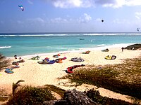
At N13°2.982' W59°30.816' Silver Rock Beach is accessed via pedestrian tracks from the nearby road. Four wheel drive trucks or tractors also get down. It is the home of Barbados Kite Surfing and Brian Talma the Barbados Olympic Surfing Champion and a suitable beach for mooring boats and swimming to and from the reef, but it may be too busy, so be wary of Kite Surfers. The Ministry of Agriculture can arrange launchings and retrievals of boats as well as emergency retrievals for a modest fee.
Silver Rock beach is well under a kilometre from the Silver Sands bus stop. The following buses go to Silver Sands 30A, 31, 31A, 32. In addition routes 27 and 13 pass Silver Rock Beach.
 Boats may be moored on silver Rock Beach but access from the road is down a track.
 "Boo" studies Silver Rock Beach from the Reef.
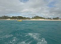 Brian Talma "de Action Man" usually moors his yellow pirogue off Silver Rock Beach.


Moorings without car or tractor access
Silver Sands Beach
At N13°02.838' W59°31.032' Silver Sands Beach, approached via a walkway near the hotel (closed as of 2014), is suitable for swimming to and from the reef, but boats do not often seem to be moored there, but there seems no reason why not unless it is too close to Oistins to be worthwhile.
The following bus routes stop at Silver Sands 30A, 31, 31A, 32, 27 and 13. Numerous white taxi-vans also terminate at Silver Sands.
 Sadly Silver Sands beach and hotel are still deserted in January 2014. The beach is suitable for mooring a boat and swimming to and from the Reef.

Crane Beach North aka Ginger Bay and Shanty Beach
At N13°06.696' W59°26.472' Crane Beach North has access from the Road at both ends by steps. This large and quiet beach used to be part of Crane Beach until it was separated from the smaller and now very busy Crane Beach by a large rocky groin below the joint public access road. This road gives the easiest public access to Crane Beach North and the only public access to the Crane Beach. Parking may be difficult but the 12A bus passes the top of the access road. From the direction of Bridgetown get off the bus about 100 m after passing Cutters of Barbados on the left. The north eastern access steps are harder to approach by car and quite a bit further from the bus route.
The inside of Cobblers reef was viewed from a Microlight flown by professional pilot, Paul Nugent (e-mail: airsportsbarbados@gmail.com) on an unusually calm day in January 2013. Note the approaching squall. The normal surf along the top of the Inner Reef is much less than usual and largely disguised by the edge of the pilot's windshield (the fault of the photographer not the pilot).
Two boats used to be permanently moored below the Ginger Bay apartments, indeed "Tiny" Moore, apart from removing his boat for a week due to Hurricane Ivan in September 2004, always kept "Navijeb" there till his disappearance in July 2007. It was pulled ashore on Foul Bay beach in 2006 so the engine could be loaded into a truck for servicing.
In December 2013 there is again a fishing boat moored in Crane Beach North where Tiny Moore used to keep his boat. It belongs to Little Pic. He fishes pots and palangs and gets some fairly good hauls of spiny lobster and fish.
 Inside of Cobblers Reef from a Microlight flown by Paul Nugent. Crane Beach North is centre left above the lowest rock promontary.
 "Tiny" Moore's boat off Crane Beach North in December 2005.
 The Public Steps at Crane Beach North were viewed by a diver.
 Little Pic fishes pots and palangs inside the reef from Crane Beach North.


Long Bay At N13°07.542' W59°25.782' Long Bay by Sam Lords Castle (N13°07.548' W59°25.866') is traditionally an excellent beach to moor boats, beach boats and swim to and from the Reef. The footage from 1992 shows the activity that used to occur on this now largely deserted beach . It does not have vehicular access and you need to use pedestrian tracks and steps from the Car Park, but this always worked very well previously.
Bus routes 12A and 27 terminate near the Castle grounds and you can walk down to the beach. Sam Lords Castle is well signed up for driving.
 Sam Lords Castle a Cobblers Reef Landmark viewed from a Microlight. Long Bay to the Right.
 Several boats used to be moored on Long Bay before Sam Lords Castle burnt down to the masonry.


Beach Access and return
Philip's Beach
The little beach south west of Silver Sands (N13⁰02.782' W59⁰31.336) is usually popular with swimmers and walkers. It is quite suitable for shore diving the inner reef, or coming ashore but boat traffic is often heavy. Beware out currents on the reef.
 This beach south west of Silver Sands is often used by swimmers.

The Crane Beach
At N13°06.456' W59°26.586' the Crane Beach is very safe for swimming to and from the Reef. In spite of its historic role as a local harbour (hence the name “Crane”) pirogues do not seem to have been moored there for a long time, though boats may still approach the beach to pick up or drop off passengers. It is very safe for this purpose also. In years gone by local divers used to drop off empty tanks near the stepping-stones at the north end, before mooring up at the other end of Crane Beach North, making less of a trek to the car with the tanks. However some years ago a cruise-ship passenger visiting the beach with a group of fellow passengers, watched as a tank floated steadily towards him and tried and catch it when standing chest high in the rough surf.
Although empty aluminium diving tanks float and may visually resemble balloons or footballs in the ocean in terms of their motion, their momentum is proportional to their mass (which relates to their weight on earth not floating in water), and their velocity, which in this context is determined by the speed that the seas float them into a collision with a static object or human being. The seas will keep the tank's velocity very close to that of the waves, giving a momentum of collision comparable to an empty but heavy tank being swung fast and unpredictably on a bungee pendulum.
Inevitably a bump to the head occurred, which enraged his ship-mates, though fortunately he was not seriously hurt. This was a clearly a dangerous practice in the circumstances compounded by stupidity of the victim.
One solution to this risk was to rope all the tanks together on the boat and drop them off in rapid sequence, immediately followed by a diver who could keep them all together and shout loudly at any one who looked as though they were foolish enough to try and catch one. This seemed to work better and give everyone a more sporting chance, but the beach is too busy these days. Even if a diver wears a tank on his back while swimming into a crowded beach with strong surf he may be a potential hazard to bathers in the event that the waves bowl him over.
Back in the days when Crane Beach was quiet boat owners preferred Crane Beach North which was easier for them to access and oversee, and nowadays the Crane Beach is too busy for a pirogue to comfortably operate except well beyond the surf. Apart from the public access shared with Crane Beach North, the Crane Beach can be reached by the private steps and elevator through the Resort.
In February 2015 the Crane Beach was voted the 'Best Caribbean Beach' for USA TODAY 10Best Readers' Choice.
 Crane Beach is very safe but boats are not usually moored here.

Falmouth Beach
At N13°06.828' W59°26.376' Falmouth Beach is accessed by public steps from the road at the north end and by private steps which are often patrolled by large dogs at the south end. Get off the 12A bus by the road sign for Falmouth and Bel Air. Walk down the road about 600 m and Falmouth Beach is at the bottom of the road to the right. Alternatively parking is not usually difficult. It is very safe for swimming to and from the reef, and for picking up and dropping off divers from pirogues.
 Falmouth Beach is a safe Beach to swim to and from the Reef.

Bel Air Beach aka Dawlish Beach
At N13°06.906' W59°26.316' Bel Air Beach is reached by steps from the road. Get off the 12A bus by the road sign for Falmouth and Bel Air. Walk down the road about 600 m and Bel Air Beach is at the bottom of the road to the left. It is very safe for swimming to and from the reef or for picking up and dropping off divers from a pirogue.
 Bel Air Beach is also very safe.

Small Beach South of Sharks hole
At N13°710' W59°26.090 there is a small beach south of Sharks Hole (For Sharks Hole see below). It is reached by a public access quite close to that of Sharks Hole. It lies below some extremely beautiful properties but the public has access along the cliff top here, and cars may be parked to the north. On the unusually calm January day shown here the beach is larger than usual, but at high tide or when the ocean is rough, the surf may pound against the low rocks thus obliterating it.
 Small beach south of Sharks Hole from a microlight. When the tide or surf is high the surf may pound on the low rocks.

Bottom Bay
It is best to drive to Bottom Bay, which is reached by a road running south east from Highway 5 between Well House and Merricks. The road is clearly signed to the right when coming from Bridgetown. The nearest bus route is number 10 from Bridgetown to Bayfield, via Six Roads. Get out near the road sign to Bottom Bay about a kilometre after Well House. You must then walk about a kilometre down to the Car Park. You approach Bottom Bay at N13°08.196' W59°25.56' down steps from the car park, and it is safe to swim to and from the reef, but the reef is much further out into the ocean here making for a considerably longer swim. It is probably the first safe retreat going south from Kitridge Point.
 Bottom Bay. The track from the car park is behind the rocks on the right. Note the Castle centre background and the Harrismith ruins right background.
 Surroundings of and approaches to Bottom Bay in the center.


Beaches that may be suitable for retreat from the Ocean but not recommended for access
Beaches between Long Beach and Foul Bay
There are three or four small coves between Long Beach and Foul Bay which are not recommended for access to the reef. Getting ashore onto one might be easier than getting up to the cliff top.
The beach 500 m north east of Long Beach (N13°04.039', W59°29.305') is fairly easy to approach from the ocean and the 74-year-old photographer scrambled up and down easily without diving gear, but a decent walk to the car. A closer view is shown. To approach it from the land drive along Maloney Drive Christchurch almost to the end of the road. Take the off-road track to the north past a farm and after about a kilometre you will see the beach north east of Long Beach from above.
 The small beach 500 m north east of Long Beach is practicable for a diver to swim ashore and get up the low cliffs at the left end.
 A closer view of the small beach north east of Long Beach. Exit up to the left.
 Drive along Maloney Drive Christchurch almost to the end of the road. Take the off-road track to the north past a farm and after about a kilometre you will see the beach north east of Long Beach from above.
 The beach north east of Long Beach is easy to access from the Ocean.
 Back track the photographer's footprints to the exit and entrance of the beach north east of Long Beach. An easy scramble up or down without diving gear, but a good walk to the road.


About a kilometre further north east is another small beach (N13°04.417', W59°28.759'), just under the north eastern end of the Grantley Adams International Airport runway, Note the distinctive rock from the left hand end. To approach it from land continue south westerly from Penny Hole (see below) and brave the Defence Force Danger Ground (see below). It lies enclosed in these unforgiving cliffs. Targets of the Barbados Defence Force line the skyline. The rock on the left (viewed from the sea) can be seen on the right from the land. From above the beach reveals some unwelcoming rocks and the photographer could not spot an obvious way up or down. Furthermore above the beach is the firing range. Probably a bad choice except in dire emergency.
 This little beach is about a kilometre north east of the previous beach. A practicable exit for a stranded diver. Note the rock at the left.
 The beach lies enclosed in these unforgiving cliffs. Targets of the Barbados Defence Force line the skyline.
 The rock on the left (viewed from the sea) can be seen on the right from the land.
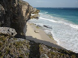 From above the beach reveals some unwelcoming rocks and the photographer could not spot an obvious way up or down.


The small cove (N13°04.890' W59°28.158') near Rock Hall, Gemswick known as Penny Hole to locals and to the 19th-century British Admiralty, appears from the satellite view to have the easiest ascent or descent. This can be approached on the 26 bus between Oistins an College Savanah, getting off and walking to the right past the Rum Shop labelled "A MANS BEER". Go right at the end of this Lane, past the large orange and pink house, then turn left down a grassy track towards the ocean. Black bellied sheep often roam freely here. These 2 houses make an excellent land mark from the Reef due to their altitude. The approach from the ocean is rocky and usually washed with surf. A young man living at the top of the cliff claimed that the ascent from the cove to the grassy ledge was just about feasible, but a descent could not be recommended. Local divers recognise this as an adequate escape route, problematic approach from the ocean in big surf, but the ascent manageable.
 Turn right from the bus route past this Rum Shop.
 Go right past the pink house then down left.
 Black Bellied Sheep often roam freely here.
 The houses near Rock Hall form an excellent land mark from the Reef to approach Penny Hole.
 Landmark houses centre right viewed from Fathom. Penny Hole further right rising from ocean. Note to the left the second little beach about 1.5 km further south west.
 Rocky approach from the reef.
 Descent not recommended, ascent just feasible.


The little beach (N13°05.673' W59°27.179') about 200 m south of Foul Bay known locally as Little Bay, is seen centre right of the picture of the cliffs and caves south west of Foul Bay. It can be useful for tank or free divers to swim to if they are carried past Foul Bay before the boat picks them up. On the sloping beach they can easily be spotted from a boat, and can the swim out as it approaches. It would be hard to recommend it as a shore diving launch unless you lived in the apparently abandoned house at the top of the cliff. The house is approached from St Martins Church via the right hand fork (get off Bus 12A here). The cliffs adjacent to the beach are near vertical, but the 45 degree ramp up or down is rugged and not very suitable for carting diving gear up or down. Locals say they may go up or down for beach fishing.
 Several Kilometres of steep, jagged cliffs to the south west of Foul Bay. Oliver's cave, Ocean City is topped by a precarious house centre. Little Bay is right of Centre. Part of Foul Bay is extreme right. Viewed from The Fathom Reef, Cobblers Reef, Barbados.
 This apparently abandoned house is directly above Little Bay.
 Little Bay is approached from St Martin's Church via the right hand fork.
 Zigzag your way to this derelict house on the cliff top.
 Little Bay is surrounded by near vertical cliffs, 25 to 30 m high.
 The tricky 45-degree ramp between Little Bay and the derelict house does not appear suitable for carting diving gear up and down. Best to wait for the boat.


The next three beaches are always or usually unsuitable for accessing or returning from the reef.
Sharks Hole
At N13°07.224' W59°26.034' is probably the safest swimming beach on the south east coast but totally unsuitable for getting to and retreating from the Reef.
 Sharks Hole is possibly the safest swimming beach on this coast, but of little use for access to and retreat from the reef.
 There does appear to be a small exit channel to the south of Sharks Hole but this was an unusually calm day.


Cave Bay
At N13°08.022' W59°25.632' Cave Bay is recognisable from the reef by the Harrismith Ruins. The sand is usually embedded with large and sharp rocks, however in March 2013 there was generally a lot of sand on south east coach beaches and most of the rocks in Cave Bay were covered. Colonel Sid the fisherman, who landed a Blue Marlin of 120 kg on rod and Line from Billfisher III in March 2013 did some good snorkelling there, including seeing some large Rays. If you did make a safe exit to the Reef it might still be wiser to swim back to Bottom Bay because the rocks will surely return [dead link]. Indeed by January 2014 sand movement had exposed these troublesome rocks again, reinforcing the problems of diving to or from this lovely beach.
 Note the extensive Rocks that made entering and leaving the water in Cave Bay in 2004 very difficult.
 In March 2013 sand now covers most of the very troublesome rocks in Cave Bay.
 The Harrismith Ruins and a very sandy Cave Bay Beach in March 2013.
 By January 2014 sand movement had again exposed the troublesome rocks in Cave Bay.


Palmetto Bay
At N13°08.233' W59°25.506'Palmetto Bay like Cave Bay is a very pretty beach approached by steps from rough tracks on the cliff top above. It is easier to enter and leave the water at low tide when the line of rough sharp rocks near the low water mark are uncovered. At other times entry and particularly exit can be troublesome and even painful. In most years they would not be recommended for a return trip to the reef, because the level of the tide would change during the swim.
 Note the inhospitable line of submerged rocks in Palmetto Bay. Pilot Paul Nugent.
 The rocks viewed from the cliff top are completely uncovered at low water. Shore Diving not advised.


Swim to the reef, sit-on-top kayak, pirogue or ice boat
[edit]A sit-on-top kayak is a good way to explore the inner reef, to check out the Back side. They can be used most times of the year inside Cobblers Reef but are usually more challenging in the high tourist season (December to April). Ricky is collecting conch inside Cobblers Reef with his sit-on-top kayak in January 2013.
Most diving on this reef appears to be done by Bajan boat owners, using a pirogue with an outboard engine, and their fortunate diving buddies who are to hand when conditions are right. The Pirogue Betty seen from the cliffs is dwarfed by the surf on the Inner Reef.
The diver's view of Betty was taken later that day. Big Rob from Ottawa regularly snorkels from Crane Beach out to the white water of the Reef to free dive and inspect the Cannons in the Foul Bay Channel but on one occasion he swam off promptly when he saw the two spear fishermen dropped in from the pirogue. He then swims back to the even rougher surf on Foul Bay Beach that can turn you over two or three times and dump you on sand as hard as rock. Local freedivers often swim to the inner reef to catch fish, a swim of about 20 minutes each way. A young man approached two freedivers as they were about to swim to the inner reef in February 2013 and confidently asserted "You won't see anything out there", quite a common misapprehension among tourists.
Scuba diving without a boat is feasible, but requires about two and a half hours to swim there and back with a tank and equipment, including diving to the bottom of the inner reef. Paul Doyle the Canadian proprietor of the Crane Resort made this swim a few years ago with one of his regular clients. For those so inclined it may be repeated later the same day. Divers without easy access to a boat may find this strenuous method the most practical method of diving the inner reef. Tanks and weight belts are relatively easy to rent. Shore diving the Fathom is not recommended, due to the distance from land and "out" currents.
Ice Boats are generally only available for diving in the high summer when they are not required for catching dolphin, marlin, tuna or flying fish.
 Ricky on his two-seater Sit on Top Kayak. The Conchs took the photographer's seat for the paddle home from Cobblers Reef.
 Pirogue Betty on Inner Cobblers Reef.
 Pirogue Betty as seen later by a diver.
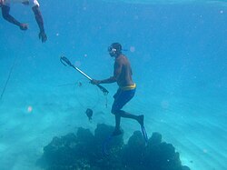 Two spear fishermen from the pirogue.
 Rob swam off rapidly when he saw two spear fishermen from the pirogue.
 Ice boat Chris Dee, Captain Diver Abram Innes and divers all shipshape to return from Cobblers Reef.


There appear to be fewer boats moored on the beaches than ten years ago, perhaps because the owners feel less secure, whereas Oistins and Conset Bay are well overlooked. A boat moored on Crane Beach North is ideally centrally located and adjacent to the Foul Bay Channel, to exploit diving on the Reef but one has not been permanently moored here for about six years since "Tiny" Moore disappeared.
The skipper and crew of local divers will determine where you will enter the water, though obviously you can express your preferences, and take good note. Fishermen should make excellent boat handlers, but without good diving experience or good advice from local divers their choices may not be so good [dead link]. Their most critical requirement is judging where the current has taken the divers in relation to the boat and being able to spot them quickly in often very rough seas. Unless the boat is anchored the top current will move the boat faster than the divers, and the wind usually exaggerates this divergence.
You can take these skills as a given when diving with a centre.
Where the Fathom meets the Inner reef off Kitridge Point is one of the more interesting locations as there are numerous caves and many Yellow tail snappers, lobsters and porgies. This is very definitely a boat-dive due to the distance from safety, the nature of the shoreline and out-currents.
Local freedivers from a boat based further south sometimes swim back to Long Bay for convenience. This Archived Chart based on Waterproofed Hand Held GPS (Etrex) and the local British Admiralty Chart shows 3 scuba dives. The First (Dive 1) conducted by "Tiny" the boat owner and his English companion was aborted after 5 minutes due to exceptionally poor visibility and a very powerful out-current that detached the anchor. Fortunately Brugge was manning the boat so Dive 2 took place and was completed on the same tank further "down". Brugge dropped off freediving with a spear gun as indicated, ensuring the boat was still securely anchored. "Tiny" and buddy returned with catch and decompressed for about an hour and re-entered the water for dive 3 after ensuring the anchor was again secure.
On regaining the boat the tank divers felt some concern for Brugge who was nowhere to be seen. By the time the tank divers returned to Crane Beach public access, Brugge had swum ashore and landed all his thirty pounds of fish at the Castle (Long Bay), walked to the Crane and sold them all en route before catching the bus home. "Tiny" and his companion had to struggle back with their catch of about twenty pounds up the Crane Beach public access. Often the guys cleaned their fish at the "pipe" (public water tap) near the Church of the Nazarene in preparation for selling them.
 Four dives near the top of the Fathom 2007.
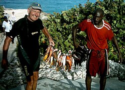 The divers were pleased to reach the Crane Beach Public access with their catch.
 Go'frey on the right often cleaned and filleted fish very expertly for other divers by the Crane pipe,


Diving with local divers needs to be by personal negotiation, and they are not generally impressed by paper qualifications, so it may take some time to gain their confidence. One way of achieving this may be making repeated safe swims to and returns from the reef, perhaps over more than one visit. Local diving may be cheaper than using dive centres. They might even rent you a couple of tanks. The alternative for regular visitors is to leave tanks and weight belt on the island. If you are fortunate enough to live here, perhaps it might be considerably easier, but then you probably wouldn't need this guide. Local divers are not looking for recruits and though we need them they don't need us. They don't advertise or publish but have informal networks which need to be joined.
Do not enter the water if they decide to leave no-one in the boat unless you are close enough to swim to a safe beach, taking into account the prevailing current.
If you decide to dive independently or with local divers it is at your own risk. This article does not try to endorse the safety or danger of what you might be attempting, and almost certainly your insurance would be voided in the event of problems, but it has been done and is described. Local divers are better supported than visitors, have a free chamber, are young and very fit, and may not use insurance. Their fishing is subsistence rather than industrial.
The diving information for this article is based on these non-commercial methods of access during more than a score of visits to the Island over a seventeen years and all seasons.
The Ministry of Agriculture offers a scheduled launch and haul-out service for registered and inspected fishing boats and an emergency haul out service by tractor at Oistins, Silver Sands Beach, Skeates Bay and Conset Bay for a modest fee [dead link]. Foul Bay does not appear to be included, so boats there require local arrangements, often based on man-power.
See
[edit]Ancient & modern landmarks
[edit]Various ancient and modern landmarks can be viewed from the reef including the new Crane Resort Buildings, Sam Lords Castle, and the Harrismith Ruins as well as the lighthouses at either end. One of the most spectacular natural landmarks is Oliver's Cave, Ocean City St Philip. It measures almost 35 m high and over 100 m wide. A house is perched precariously on top and locals wonder how long it can survive.
 Old and new Crane buildings from Cobblers Reef
 Sam Lords Castle seen by a diver above Cobblers Reef.
 Harrismith Ruins above Cave Bay seen from Cobblers Reef.
 East Point Lighthouse on Ragged Point from the northern end of Cobblers Reef.
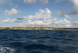 To the south west of Foul Bay, Oliver's cave, Ocean City is topped by a precarious house, Centre of picture. Little Bay is right of Centre. Part of Foul Bay is extreme right. Viewed from The Fathom.
 Olivers Cave, Ocean City, St Philip Barbados is a natural landmark from The Fathom Reef, Cobblers Reef Barbados. It is difficult to visualise the cave from the Cliff top. The house is precariously perched on top of the undercut rocks. Locals do not how long it will survive.


The HARP Project
[edit]Overlooking the reef but perhaps requiring a decent telescope to scrutinise them from the Fathom are the intriguing remains of the infamous HARP (High Altitude Research Project) w:Project_HARP, now within the Defence Force firing range beneath the Grantley Adams International Airport. This was the brain child of Dr Gerald Bull who was later assassinated allegedly by Mossad because he was by then working for Saddam Hussein on Project Babylon w:Project_Babylon. Prototypes seized by UK customs officers in Iraq in 1991 now reside in the Royal Armories at Portsmouth, the Imperial War museum at Duxford and the Royal Artillery Museum in Woolwich. At least two of the guns and the red flag can be discerned from the fathom, above and to the right of a large right angled triangle in the cliff. To see them close up you may need to brave the red flag as they are all inside the Danger zone, though the Red Flag does come down, but they are also visible on NASA Satellite imagery.
 Both the HARP project and one of the small beaches between Foul Bay and Long Beach lie within this danger zone.
 This smaller HARP gun is rusting away.
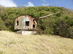 This bigger HARP gun is about 250 m past the barrier. It resembles a US 6 inch Naval gun and turret from the Second World War.
 This enormous gun is well within the danger zone. Rich and John are both over 190 cm tall and nearer the camera. The guns were transported overland via a purpose-built railway that is no longer extant. A second barrel was shipped to the site in 1965 and attached and strengthened with external bracing to allow it to be raised from the horizontal.
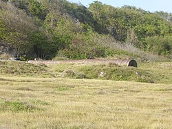 Dr Bull's experimental barrel has bore of about 750 mm.From this perspective it appears to be bent.
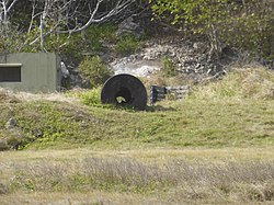 An engineered reinforement of the central portion of the barrel creates the illusion.
 Two of the guns and the red flag can be discerned in this grainy long shot from the Fathom. Note the right angled triangle in the cliff below and to the left as a marker.
 The HARP guns can be seen in this NASA imagery.
 The Red Flag sometimes comes down.


Diving with locals
[edit]Most diving on this coast is done by locals, so visitors wishing to dive from a boat will usually need to make friends with them and pay their way. Diving with local divers needs to be by personal negotiation, and they are not generally impressed by paper qualifications, so it may take some time to gain their confidence. One way of achieving this may be making repeated safe swims to and returns from the reef, perhaps over more than one visit. Local diving may be cheaper than using dive centres. They might even rent you a couple of tanks. The alternative for regular visitors is to leave tanks and weight belt on the island. If you are fortunate enough to live here, perhaps it might be considerably easier, but then you probably wouldn't need this guide. Local divers are not looking for recruits and though we need them they don't need us. They don't advertise or publish but have informal networks which need to be joined.
Chartering a boat and skipper by a group might be feasible, but is not guaranteed to be productive [dead link]. To be successful such a charter would need to be marshalled by a minimum of one local diver, and preferably more. Dive shops may come to the east coast in summer but most of the visitors then are returning Nationals with their own local networks. Many local boats are laid up ashore during the winter tourist season and launched in the later summer.
Local techniques vary considerably from those practised by visitors:
- Local divers mostly do not need GPS because they cannot dive out of sight of traditional landmarks (cross fixes) because of the ocean depth.
- They do not need depth sounders because they can see down to where they want to dive and know the terrain.
- Marine radio is rare in the smaller pirogues because of salt water, they mostly carry cell phones in a plastic case or wrapped in a couple of freezer bags on the boat.
- Many won't use dive computers because they restrict the depth, duration and number of their dives. In fact their first dive would "lock" their computer out. They usually use up more than half a tank at 40 m and then gradually ascend towards decompression depth of 6 m. A dive computer will be automatically locked out and will not function for 24 hr following a violation of the officially recommended decompression schedules designed for the average human. If you violate them there is no point carrying a dive computer, like most of us do. These guys are hardy, physiologically at the more efficient extremes of metabolism than many of us, take more risks than an insurance company would accept, and rely on their experience and an efficient decompression chamber. It works for them most of the time and commercial dive insurance may be out of their reach or requirements.
- They don't use weight belts because a full and heavy tank is adequate.
- They don't use a Buoyancy Compensator (BC) because an empty and buoyant tank suffices and a BC slows them down.
- Wet suits slow them down and compromise their buoyancy.
- They don't need a compass because the current, the sun and the configuration of the reef tell them direction.
- They don't use Nitrox which allows greater time at moderate depths, but by increasing gas consumption at that depth, shortens the over-all dive-time. They get an excellent dive using a 10 litre aluminium tank with compressed air.
- They don't carry a second ("octopus") regulator as required for buddy diving, because it would slow them down, and increase the risk of free-flow of air. w:Buddy_diving
- They do rely on a contents gauge, depth gauge and watch.
- They don't carry a Surface Marker buoy (SMB) which would slow them down, but hook a dive flag on the point of their spear. Boat handlers probably prefer a large blow-up SMB in seas rougher than illustrated below.
- They wear Kevlar gloves to cope with spiny lobsters or poisonous spines of other fish.
- Spear fishing with SCUBA is legal. They carry a sharpened wire loop to thread their fish on.
- Technology provided by visiting well wishers is soon discarded as redundant.
- Solitary boat diving is not uncommon inside the reef.
- Most locals do double dives often leaving Oistins or the beach at 07:00 local time, so sitting in a small boat for an hour after the first dive in the sea conditions on Cobblers Reef may render many European and North American divers seasick even if they abstain from alcohol the night before.
Any European diving with the locals soon leaves them behind at 40 m while his computer steadily brings him towards the surface. One of the challenges for the visitor is to complete the dive at the same time and close to the local divers. Midway through the dive the computer-programmed diver may be 20 m above his buddies, often more than the visibility range. Chains of bubbles may be the best guide, but often the current makes them less accessible. Different currents at different depths increases the risk of separation and not being picked up, not a good prospect in the face of the cliffs and currents.
Drifting for an hour past South Point in a strong "down and out" current before being found by the boat is a nerve wracking experience. Probably the best solution is to dive with the crew of an "Ice Boat". These boats go to sea for a week or more, till the fish holds are full or the ice dissipated. They mainly catch Dolphin (Mahi mahi), Tuna or Billfish, from December through May or June, so the boats are well equipped although Spartan, and the skippers and crew very competent. In the summer some of these spend their time spear fishing with local friends. They seem pretty selective or judgemental about taking visiting divers, but for the fortunate visiting diver it is a wonderful experience.
To dive Cobblers Reef in the tourist season, unless shore-diving, you probably need to dive from a small pirogue. Your buddies will almost certainly be legally spearfishing, both for subsistence and to help pay the bills. Their catch is entirely eaten promptly and there is no by-catch.
Do not enter the water if they decide to leave no-one in the boat unless you are close enough to swim to a safe beach, taking into account the prevailing current.
If you decide to dive independently or with local divers it is at your own risk. This article does not try to endorse the safety or danger of what you might be attempting, and your insurance might be voided in the event of problems, but it has been done and is described. Local divers are better supported than visitors, have a free chamber, are very fit, and may not use insurance. Their fishing is subsistence rather than industrial.
The diving information for this article is based on these non-commercial methods of access during more than a two dozen visits visits to the Island over a fifteen or more years and all seasons.
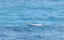 No-one in Carline's dive boat. He's collecting conch.
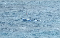 He's back now. All is well.
 Landmarks replace GPS. 3 km out is too deep.
 Assessing depth through a mask at the surface. About 25 m , ideal to start a dive on the top of the Edge.
 A Pirogue with divers and no radio about to pick up the diver in the water.
 Depth gauge, contents gauge,watch. No compass, no computer, no BC, no weight belt, no wet suit, no octopus regulator.
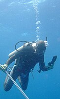 Unusually "Tiny" had no fish as he did his safety stop.
 Free diving off Crane Beach Ivan soon caught a small "Sea Cat", a small "Conger", a Surgeon Fish and a Grunt.
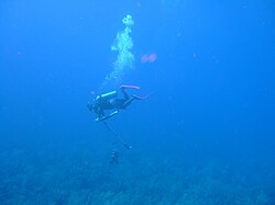 Korey adds a Barracuda to his catch.
 Unusually Korey failed to make a killing headshot on this 1.5-m barracuda 30 m down the Fathom. The powerful but mortally wounded fish pulled the barbless spear from its neck, slowly circled and darted at Korey, inflicting these wounds.
 "Tiny" has added a few pounds of Jacks and a Parrot Chub to his Wire.
 Roy Padmore fishing on the Fathom in 20 m of visibility off Ocean City, St Philip in January 2017.
 Not all divers on Cobblers Reef are fishermen.
 Good to be picked up by Ice Boat Chris Dee P73 driven by Captain Theodore. skippered by Captain Abram. There was a strong down and out current off South Point.
 Local divers use dive-flags on their spears as an aid to being spotted, even on this very calm August day.
 Roger C. and pirogue owner "Tiny" after diving on Cobblers Reef.


Independent diving on Cobblers Reef
[edit]It is suggested that at least two experienced divers charter a pirogue and boat owner to drive it, preferably normally based in Oistins or Conset Bay so as to know the reef and its conditions. Oistins is easier for tank refills. During the high, tourist, winter season fishing for Flying Fish, Marlin and Dolphin is at its peak so competition for boat and crew, and price for a dive-boat might be steeper.
Recommended accommodation would be adjacent to a suitably safe beach for boat pick-up and drop-off. There are various hotels, villas and private apartments that might be chosen, but there are not too many hotels on the beach north east of the airport and south west of Kitridge Point now that Sam Lords has been tragically destroyed and the Merrick's Bay development failed to materialise.
All divers should take a blank weight belt and all their normal warm water gear. A three mm shortie suit should suffice at any time of year, plus BC, mask, fins, snorkel and SMB with 6 m of line for your stops. Don't forget dive computer and under water camera each, and one waterproof GPS for the party. You can download all the data each night before dinner. A lightweight waterproof jacket can reduce chill factor caused by wind and spray. Virgin Atlantic Airways allow each diver a free 23-kg bag of diving gear on outward and home-bound flights in addition to their allotted quota.
Ask the boat owner or his colleague to rent sufficient lead for each diver's requirements and two tanks each. Tanks will normally be 10-litre aluminium 208 bar Air, giving a good hour's dive each. Tell him to meet the party each morning at the chosen beach at 08:00 with a complement of full tanks and weight belts and sufficient fuel for a safe margin. You will need to swim out to the boat through the surf. You will dive at 09:00 and again at 11:00 and return to the beach before 13:00. The boat should return to Oistins before 14:00. Tell the owner to organise a driver to take all the empty tanks to refill at Clapham ready for the next day. The suggested schedule can of course be varied to suit all concerned. The sun rises at about 06:00 and sets at about 18:00, and the gas services close at 17:00.
You probably won't want to dive every day for two weeks unless you leave your wives and children at home, but the charter might need to cover this possibility. Whilst you would have no obligation to make two dives a day, the logistics would make this choice favorable. A larger group could share the costs and dive more more or less frequently as they required, but this might or might not compromise the smoother running of the deal.
Don't expect to see all this stuff every dive, but every trip into the ocean has been exciting. The information and photos published were accumulated over about 15 years and 26 visits usually averaging 4-6 weeks and often longer, up to 8 weeks at a time. Some visits were solo because the accommodation used was too Spartan (diver-friendly) for ladies or because arrangements didn't suit them.
At least one knowledgeable local diver would enhance your organisation, chartering and selection of dive sites, and also sharpen up location of divers on the surface, the most important safety factor on this coast. He would probably rely on landmarks rather than GPS for locating dive sites. Don't rely on the boat owner or fishermen unless you are sure they are experienced divers [dead link].
No recommendations are made as to boats, skippers and local dive-marshalls because they do not advertise, and availability and suitability will vary not just from year to year, but from season to season. You will need to build up your own contacts. Visiting divers can share out the cost and availability of diving with friends if you don't want to use a full charter and if you organise yourselves. Don't expect the boat owner/driver or the marshall to weigh up your suitability or safety for this kind of diving. All they would do is drive the boat, pick you up from the ocean when you swim out from the beach, bring the tanks and lead you require and help you locate suitable dive-sites. If you select them adequately they should help you ensure safe pick-ups of divers after you surface, but you would need to ensure that you all surface in a safe location, within your safe decompression margins. If you need more assistance than this then you should employ your own individual professional dive instructors. In particular have adequate International Diving Insurance and comply with their requirements.
If you want to truly dive independently then fly in all your gear freely as Sports Gear, including a tank and weight belt, limit 23 kg, with Virgin Atlantic or some other suitably accommodating airline. Alternatively buy or rent them here. Fill your tanks at Clapham. Choose a suitable beach for you and your buddy to shore dive from such as the Crane Beach where you can exit through the usually visible Foul Bay Channel. If the ocean is calmer then swim straight over the white water on top of the Inner Reef. Dive to the bottom at 40 m and return with steady natural decompression. The total expedition might take 2½ hours unless you have to swim back to Foul Bay then you might need a lift or a taxi. You need to note all the warnings and advice related to diving here and take your own responsibility. Unfortunate or unwise people may be at serious risk here and you might easily void the terms of any insurance policies you own.
Any Bajan with a suitable boat in a suitable location and good diving knowledge or experience, please edit in your details and you might make a modest amount of money and some friends and also have a lot of fun, but don't let your clients down after they book their flights and accommodation and pay you a significant deposit up-front.
Dive sites
[edit]There are essentially four dive sites on Cobblers Reef and all four stretch along the whole length of the reef parallel to each other. Five more specific sites may be listed and other contributors could add to them.
The four main sites are well illustrated by the profile:
- Inside the Inner Reef.
- Outside the Inner Reef.
- Inside the Fathom.
- Outside the Fathom.
Additionally there are:
- The submerged coral island to the south west of Foul Bay, known locally as the High Hill.
- The cannon site in the Foul Bay Channel.
- The solitary cannon outside and just below the top of the Inner Reef off Crane Beach North (Ginger Bay).
- The Iron wreckage close to another solitary cannon inside the Inner Reef to the east of Bottom Bay.
- The junction of the Fathom and the Inner Reef to the east of Kitridge Point.
Inside the Inner Reef
[edit]The top of the reef changes direction approximately due east of Palmetto Bay (N13°08.233' W59°25.506') at approximate position N13°08.160' W59°24.300'. At this point it is about 2 km from the cliffs, and to the north runs in a north westerly direction, to the south runs in a south westerly direction. By Kitridge Point (N13°08.893' W59°25.251') it is only about 1000 m offshore.
The southern extremity of the top of the Inner Reef is at approximate position N13°02.220' W59°31.98', where it is about 800 m offshore. To the west it takes a north north westerly direction, closing towards the shore line.
All the ground inside the Inner Reef is very shallow, less than 10 m deep and is suitable for free diving. Where you dive depends on where you choose to enter the ocean, though a boat would be useful for safety and access at the two extremes of the reef and in the long stretch between Foul Bay and Long Bay. Visibility is often less than 5 or 6 m due to stirred up sand and particles, but occasionally can be surprisingly good. GPS fixes are not generally used here.
The predominant live hard coral inside the reef is Lettuce Leaf Coral and varieties of Brain Coral, though scanty fire coral also exists. Purple Sea Fans are quite common often attached to old dead coral. Conchs and Sea Urchins occur inside the Inner Reef, conchs mainly on the deeper sand, Urchins on hard ground or occasionally on waterlogged tree trunks. It is (as of 2013) illegal to take the edible White Urchins known locally as "Sea Eggs", but there are far fewer than there were ten years ago. Conchs were recorded at N13°05.820' W59°26.700' off the headland north east of Foul Bay.
Octopus known locally as Sea Cats are still quite common in the rocky holes just inside the Reef often as shallow as one to 2 m. They seem particularly common off Crane Beach North but were recorded at N13°08.934' N59°25.050' off Kitridge Point. Juvenile fish of various species live in the rocky ground. Clumps of coral, partly live may exist close to the beach, and there is one about 50 m out from the north end of Crane Beach North. This occasionally is home to a small spiny lobster or Sea Cat, and hosts many juvenile fish of different species. Spiny Lobsters were recorded at N13°05.262' W59°27.018', due south of Foul Bay just inside the Reef. These positions and many others are well known to local divers who locate them by land-sightings.
Large fish may occur anywhere, but an 11-kg barracuda was taken on handline from a pirogue about 200 m off the swimmers on the Crane Beach a few years ago and barbecued that evening for a large party. A similar fish may occasionally be seen inside the Foul Bay Channel. Jacks and Cavalles may be seen chasing fry in the shallows. A large shoal of Bermuda Chubs can be noticed in the Foul Bay Channel just inside the top of the Inner Reef near Latitude N13°06.012' W59°26.418'.
Large and small Sting Rays are common particularly on the sandy ocean bed where they hunt for molluscs. Beautiful spotted Eagle Rays are common in mid water often in pairs. They can often be seen close in from the cliff tops, as well as shoals of long thin Garfish. Sharks are occasionally caught on Palangs (anchored long-lines) inside the reef, but don't seem to bother swimmers.
Hawksbill Turtles are common inside the reef, both under the cliffs and close to the beaches. They roam all over Cobblers Reef and come up to breathe every twenty minutes or so.
Outside the Inner Reef
[edit]The outside of the Inner Reef is popular with free divers and tank divers who swim from the beaches. It is generally easy to exit through the Foul Bay channel and in less rough weather it is quite feasible to swim through the white water over the top of the reef, with or without a tank. The return swim is usually faster.
Boat handlers who are familiar with the Inner Reef may also put divers in round this side. However many do not seem comfortable with this face unless the ocean is very calm. Divers decompressing nearer the top of the Inner Reef might easily drift into even shallower water before they surface, thus potentially jeopardising the boat that needs to pick them up. The diver would be encouraged to swim out to perform his or her stops, and continue swimming out after surfacing.
The top 10 to 15 m takes the full fury of any Atlantic weather, but the surge has usually dissipated down at 15 m behind the shelter of the top of the Fathom. In consequence the top 15 m is very different from either face of the Fathom, being very broken up and pitted with small caves and crevices. It is a good part of the reef for shore based divers, whether free or SCUBA to see spiny lobster. Below 8-10 m hard corals and gorgonia are prolific. Below 35 m it forms a steeper edge before disappearing into sand at about 40 m. The sand goes deeper still.
The Fathom and the Inner Reef merge at approximately N13°08.400' W59°24.000'. A dive site was recorded at N13°09.312' W59°25.062', just to the north of Kitridge point, entering in very shallow water and dropping down below to 20 m in very good visibility and a strong "down and out current". The coral was very healthy with three or four lobsters seen.
Another dive was recorded at N13°07.548' W59°24.744', again starting in shallow water near the outside of the surf. Lobster and "Red Chubs", the local name for Red female Parrot Fish, were seen with plenty of hard coral and Gorgonia.
A dive was recorded at N13°06.774' W59°25.596' outside Sam Lords Castle dropping in at about 12 m and following the reef down below the "Edge" at about 40 m before making a leisurely ascent back to 20 m, prior to decompressing at 6 m depth away from the reef. The usual range of coral, Gorgonia, lobster and fish as reported for the reef were seen.
Three more dives were logged just outside the Foul Bay Channel around N13°05.910' W59°26.376' starting in about 12 m and dropping quickly to 40 m, and another further south at N13°5.484' W59°26.634'.
A dive was recorded seaward of Green Point at N13°04.902' W59°27.132' starting in 20 m depth, the reef being readily seen from the boat, otherwise it would not be sensible to jump in. It was recorded that there were a lot of Red Chubs a favourite meal for many Bajans.
Another dive was recorded off Salt Cave Point at N13°04.476' W59°27.756'. All the dives for which the position was logged were selected by the Bajan diver-boat owner "Tiny" Moore using land sightings and judging the depth by eye. His boat was moored in Crane Beach North and the Inner Reef was crossed through the Foul Bay Channel.
On most dives no position is recorded, nor is there any need, as the Reef can be dived anywhere. The Coral and Gorgonia stay in their place. Yet everwhere else the Turtles, Fish and Lobster move around.
Inside the Fathom
[edit]This face is quite different from the other three for at least four reasons:
- It is steeper than the other three faces.
- It faces north west, rather than south east.
- Because of the first two factors it is much darker, with the sun not getting round to the base until after mid day.
- Below the top few metres it is out of the Atlantic surge and is the calmest site, with less current.
In consequence it tends to be dusty.
It is possibly the least dived part of the reef, but hard corals, fish and crustacea are quite abundant. The bottom of this face is quite a good place to see Nurse sharks hiding their heads in caves. Gorgonia seem less evident than on the outer faces of the Inner Reef and the Fathom, perhaps because the milder oceanic current inside is less stimulating to them than outside.
The position of three dives were recorded here, one at N13°06.866' W59°25.163' opposite Sam Lords Castle where a nurse shark was recorded, the next at N13°05.688' W59°26.136' opposite the Foul Bay Channel, and another at N13°05.032' W59°26.679' opposite the south west end of Foul Bay Beach. Most dive positions were not recorded.
Outside the Fathom
[edit]This face is very bright and clean with very healthy coral particularly to the north east. There is usually a "down" current from north east to south west, and often it is too strong to make much progress against in the water, particularly nearer the top. Gorgonians and sponges are profuse but well interspersed with a variety of hard corals. Medium-sized fish are every where and lobster to be found at all depths. The bottom 10-15 m form a steeper edge, mainly composed of living hard coral, and at this depth caves may be found, where grouper, snapper, lobster and the occasional nurse shark may be seen.
The position of seven dives was recorded here based on Crane Beach North:
- N13°06.648' W59°25.362' opposite Bel Air
Where a Reef shark measuring about 1.6 m swam aggressively at "Tiny" Moore as he dropped from the boat to the top of the Fathom, but "Tiny" had no fish so the shark lost interest and turned rapidly away.
- N13°06.456' W59°25.488' opposite Falmouth Beach
- N13°05.958' W59°25.914' opposite Crane Beach
- N13°05.838' W59°25.980' opposite Crane Beach
- N13°04.452' W59°26.821' opposite Oliver's Cave.
- N13°04.842' W59°26.844' opposite Green Point
- N13°04.452' W59°27.210' opposite Salt Cave Point
- N13°04.464' W59°27.228' opposite Salt Cave Point
A number of other dives were made from Oistins to the Fathom as far as Long Bay to the north, but mainly south west of the Crane.
- N13°06.972' W59°24.996' opposite Sam Lords Castle
- N13°06.006' W59°25.836' opposite Crane Beach
- N13°05.292' W59°26.352' opposite Foul Bay
- N13°04.512' W59°27.150' opposite Salt Cave Point
- N13°04.104' W59°27.618' opposite GAI Airport
Where a Nurse Shark about 1.8 m long lay head in a cave at about 30 m here.
- N13°03.534' W59°28.278' opposite GAI Airport
- N13°02.808' W59°29.334' opposite Long Beach
- N13°02.238' W59°30.144' opposite Silver Rock
Diving at this last site can create a problem due a strong "down" current through the dive, becoming a "down and out" current after surfacing over very deep water. If the boat takes a long time to find the diver, he would have little chance of swimming ashore.
The position of most dives outside the Fathom are not recorded and these are only quoted as examples. you can dive virtually anywhere, subject to depth and safety.
Additional specific dive sites
[edit]- The submerged coral island to the south west of Foul Bay, known locally as the High Hill. This is well known to Captain-Diver Abram Innes and was well known Boat Owner-Diver "Tiny" Moore. The following position is approximate and you may need to look for it to the south of Foul Bay. N13°04.800' W59°270'
- The cannon site in the Foul Bay Channel. This position is quite accurate. You can also see the landmarks to locate them under Features. There are two in the channel which were seen again in March 2013. Another 15 have been seen in the past on the reef round about. You will need to look for them. N13°05.994' W59°26.382'.
- The solitary cannon outside and just below the top of the Inner Reef off Crane Beach North (Ginger Bay). This position is approximate N13°06.600' W59°26.400'. You will need to cross the top of the reef to look for it but it is in less than 4 m of water.
- The iron wreckage close to another solitary cannon inside the Inner Reef to the east of Bottom Bay. This position is approximate inside the top of the Inner Reef in about 6 m of water. N13°07.800' W59°24.600' and you will need to look around for them.
- Near the junction of the Fathom and the Inner Reef to the east of Kitridge Point, inshore and north there is a whole series of caves and fissures in about 6 m of water. They usually contain dozens of large silver Porgies and Yellow Tail Snappers. The position is quite accurate, N13°08.460' W59°24.060'. Drop the shot at N13°08.436' W59°24.042' on the sand at the bottom of the Reef where the two components meet. You will be in about 21 m deep, so swim fairly steeply up the reef to the north west for about 100 m or less.
Marine life
[edit]Plants
[edit] Red Algae often grows if coral becomes bleached.

Coral and Sessile animals
[edit]Carbon dating shows that most of the Elkhorn Coral on top of Cobblers Reef died in a huge storm about 4,000 years ago. The remainder died about 350 years ago due to silting associated with clearance of the trees by the early British settlers. Fortunately other Corals and Gorgonians are mainly healthy below 5 to 10 m.
One otherwise excellent book underestimates the extent of healthy hard corals on both Inner and Outer Reefs, (Braithewaite et al 2008. Barbados A Coral Paradise. Miller Publishing Barbados. Diagram page 36.) They limit hard coral to the bottom of the outside of the Inner Reef, the bottom of the inside of the Outer Reef and the bottom of the outside of the Outer Reef. The remainder of these three surfaces they refer to as Gorgonian Pavement [dead link] Gorgonia are indeed exuberant and thankfully very healthy in these zones, but they are either interspersed with very healthy clumps of hard coral, or mostly excluded by sheets of contiguous healthy hard coral. The main environmental challenge here is wave and current energy rather than pollution, even temperature is less of a threat on this side of the island.
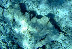 Dead Elkhorn Coral can be seen among the rubble inside the Inner Reef.
 Healthy American Staghorn Coral on the Fathom. The white tips are normal and not a sign of disease.
 Living Plate Coral with some Sponges spread for many metres up the outside of the Inner Reef almost to the surface.
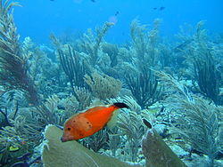 Amid the exuberant Gorgonian pavement on the Fathom at least 11 clumps of healthy hard coral can be seen in this picture.
 A closer view confirms clumps of healthy hard coral living on the old dead coral substrate.
 Mustard Hill Coral is very healthy on the Fathom and the Inner Reef.
 Two large corals competing for space on the Fathom.
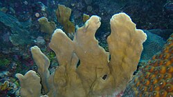 Lettuce Leaf coral is the predominant live coral in the shallow turbulent water inside the Inner Reef.
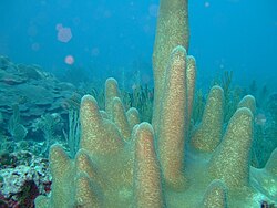 Pillar Coral on the Inner Reef. Note the "mushroom" of Plate Coral in the background.
 Fire coral is quite healthy on both Reefs.
 The healthy hard coral on the Inner Reef is worth studying close-up.
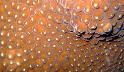 Flash throws them into relief, restores some colour and adds a sparkle.
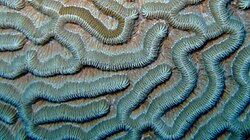 A totally different design.
 The polyps of Mustard Hill Coral seem particularly active on the Inner Reef.
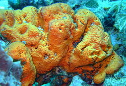 Colourful sponges are found widely on both reefs.
 This large Barrel Sponge is competing with Fire Coral, Brain Coral and a Sea Whip.
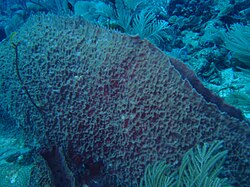 Note the sprig of Fire Coral colonising this established Barrel Sponge.
 Sea fans resist the powerful wave action on the seaward side of both reefs and thrive in it. Red has been leached from the purple colour of this specimen by the depth.
 Sea Rods are common on both reefs especially deeper below the main surge.
 Corky Sea Fingers are one of the predominant Gorgonia on the Fathom.
 This pliant branching Gorgonian on the Fathom relishes the tough water movement.
 Sea Whips are very common on the fathom especially in the main surge above 20 m.
 Feather Stars are best appreciated close-up.
 Tubeworms may be seen on healthy corals.
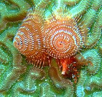 Close-up Tubeworms are beautiful.
 In December 2013 healthy hard corals spread up the Fathom below GAIA from 25 to 15 m.
 Close up even in December 2013 the hard corals are flourishing on the fathom below the airport.


Invertebrates
[edit] This large Polychaete worm on Cobblers Reef was about a metre long and 15 mm thick. It could crawl at about 10 cm per second to bury its head in a hole.
 A pair of Arrow Crabs outside the Fathom.
 Two shrimps living on the Fathom.
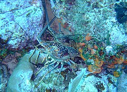 Spiny Lobsters are still common enough on both Inner and Outer Reefs. They may often be seen in pairs.
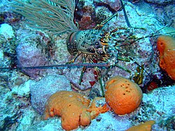 More typically the lobsters are solitary.
 Many people stung by Jelly Fish don't see them.
 Ivan the Crane Beach life guard showed the photographer this Sea Cat or Octopus off Crane Beach. In daylight they hide tight in Rocky holes inside the white water of the Inner Reef.
 This scallop or clam on the Fathom was open when the photographer pressed the shutter, but the delay in many digital cameras allowed it to close before the shot was completed.
 Could that be a conch 10 m down on the sand inside the Inner Reef off Foul Bay?
 Swimming down through the sandy water confirms a Hemet Conch.
 This beautiful shellfish was returned alive after being phographed. Note the claw protruding from inside.
 This large Queen Conch was on sandy ground outside the Inner Reef.
 Not only is the shell of this Cobblers Reef Conch spectacular, but well prepared the meat is as tasty as a lobster.
 Sea Eggs usually inhabit rocky ground inside the Inner Reef.
 This collection of urchins has found a niche in what would be inhospitable sandy ground by colonising a waterlogged tree trunk.
 Sand dollar shells may be found on sandy ground inside the Inner Reef.
 Live sand dollars may be less frequent.
 Korey collected 20 lobsters, a baracuda and an octopus in 2 hours diving on the Fathom off South Point Lighthouse in December 2013.


Fish
[edit] Atlantic Stingrays, unlike those in the Red Sea do not have blue spots. They frequent sandy or gravelly terrain inside Cobblers Reef. They are known locally as Skeates, named for English Skates.
 Cobblers Reef Eagle Rays are spectacular. Although truly wild like the Reef, they appear tame and friendly.
 Two Eagle Rays swim above their shadows inside Cobblers Reef
 This scorpion fish was so well camouflaged that the photographer almost rested his hand on the dead coral in front of its head. Their sting is said to be extremely painful.
 Flying Gurnards are often seen on the sand inside the Inner Reef.
 Some flounders are better camouflaged than this one which has just moved.
 Grey Angel Fish are usually friendly out on "The Fathom".
 Juvenile French Angel Fish living on a small coral head in high energy water 50 m off Crane Beach.
 These brightly coloured File Fishes are popular in some aquaria.
 Scrawled File Fish named for the delicate blue tracery seem as friendly as other varieties.
 This Queen Trigger Fish swam close to the top of the outside of the Fathom.
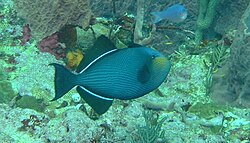 Black Trigger Fish seem quite timid on this reef, perhaps because they are popular eating locally.
 Spotted drums don't usually appear in fish markets and local divers don't seem to shoot them, but they often appear shy.
 These Yellow Tail Snappers were photographed off the Florida Keys in 1981 amid healthy Elkhorn Coral. The snappers are still fairly common on Cobblers Reef but radio carbon dating shows that most of the Elkhorn was dead on the Reef hundreds of years ago.
 The Graysby is related to the Grouper and reported to be good eating. Fortunately they are still quite common on the Fathom.
 Large solitary Baraccudas can often be seen swimming inside Cobblers Reef not far from the swimming beaches.
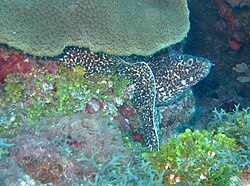 Moray Eels are known locally as Congers, the name the early settlers used for the familiar cold water marine eels.
 It is hard to see how these Grunts living in a cave on the Outside of the Inner Reef can move.
 At this depth the Squirrel Fish would not appear red without the use of Flash.
 This Box Fish was caught by flash just inside Cobblers Reef.
 The diver was performing his mandatory decompression stops at 6 m off the Grantley Adams Airport when this metre-long African Pompano casually swam by.
 A Trumpet Fish hovers motionless above the Fathom.
 Adult male Stoplight Parrotfish, known locally as Parrot Chubs, are regularly seen on both reefs.
 Juvenile and female stoplight parrot fish look quite different. Locals call some of them "Red Chubs".
 Other juvenile or female stoplight Parrot Fish are known in Barbados as "Brown Chubs"
 Bermuda Chubs are a completely different species. This shoal often congregates in the turbulent and turbid waters at the top of Inner Cobblers Reef.
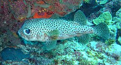 This Porcupine Fish in the Foul Bay Channel is a variety of Puffer Fish.
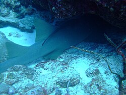 Nurse Sharks can often be seen resting in caves on the Fathom during the day. Almost 2 m long and safe from a lethal head shot from a fisherman.
 James and Duane caught these two Tiger sharks off Bath Beach 2 km north west of Consett Bay in August 2007 on Palangs or anchored long lines.


In August 2007 James and Duane caught 2 fairly large Tiger Sharks off Bath Beach on palangs a few kilometres north of Ragged Point. James occasionally found them "a nuisance" when free diving for fish from his boat on the Fathom.
Caribbean Reef Sharks are commoner outside the Fathom than closer in, but a local freediver was knocked off his Kayak by such a fish inside the Inner Reef. Fortunately although frightened he was unscathed. Unlike Red Sea and Indian Ocean reef sharks they do not have white tips to their fins . Shark attacks have not occurred on the island in living memory.
A diver needs to be lucky to spot a Hammerhead or a Manta , both of which are common in the Red Sea and Indian Ocean. Grouper still can be seen in holes on the Fathom and a large Grouper was caught in January 2013 by a spearfisherman from Conset .
Local divers and fishermen also use nets laid above the reef to catch the "running" fish like parrot chubs, or pots made of chicken wire and canes. The nets and pots may either be cleared by divers or by hauling.
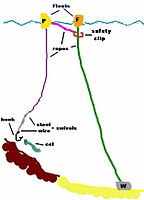 A palang is an anchored longline very effective for catching sharks with a hook often baited with locally caught "conger"
 Nets are often laid on Cobblers Reef to be hauled by fishermen, or dived by divers. They are a good reason for divers to carry a diving knife.
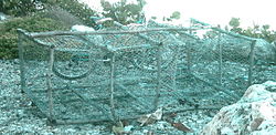 Fishpots are made of chicken wire and canes. This one was awaiting service on the Crane Beach public access road.
 Brugge, one of the best free divers on the island, hauling a pot with Tiny on Cobblers Reef in Tiny's boat "Navijeb".
 Now cleared of its catch the pot is sent down to "work" again.
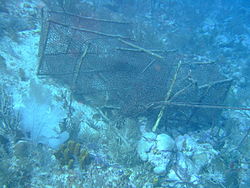 Broken, empty, no buoy attached this pot is abandoned.
 Photographed from 37 m, this pot at 45 m is still working.
 This pot is being returned from below the airport for repairs.
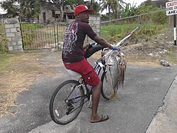 David cycling home to St Martin's from Crane with his Horse-Eye Jack and string of Sea Cats.


Reptiles
[edit]Cobblers Reef Hawksbill Turtles are wild and in contrast to the tame specimens hand fed to pose for tourists on the West Coast [dead link]. Thankfully there are no snakes, alligators or crocodiles.
 These Cobblers Reef Hawksbill Turtles are wild.
 This one was surprised at the human, before turning rapidly away.


Mammals
[edit]The Ocean was relatively calm one Saturday in March 2003, while a mother Humpback Whale jumped repeatedly just near the Foul Bay Channel while watching her baby swimming on the surface. Her fluke was impressive. She swam close to her calf. Notice the large white flipper underwater and the exhaled spray.These grainy stills were extracted from long range footage from an old camcorder.
In January 2007 James photographed 2 large killer whales 23 km off Cobblers Reef. Killer whales unlike Humpbacks and Sperm whales are unusual in the Caribbean region. They were attacking and devouring a smaller whale. The head was retrieved and identified as an extremely rare Pygmy sperm whale.
 Humpback Whale near Foul Bay Channel on Cobblers Reef
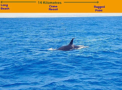 James was fishing outside the Fathom when he spotted a Killer Whale. The south east coast of Barbados is in the background.
 Then a second Killer Whale appeared.
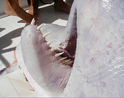 They were attacking and devouring a smaller whale later identified by the head which was retrieved as a quite rare Pygmy Sperm Whale.


Alien invaders
[edit]There has been a damaging invasion of two alien species of fish into the North Atlantic Ocean, Gulf of Mexico and Caribbean Sea. It allegedly followed the accidental escape from an aquarium in Florida following Hurricane damage. At least two related species of Lion Fishes are involved, Pterois volitans the Red Lionfish, File:Three_Red_Sea_Lion_Fish.jpg which were photographed where they should be in the Red Sea in May 2011, and Pterois miles the Devil Firefish. They seem to have few marine predators but perhaps shark and grouper. yet they feed voraciously on indigenous species.
More recently they arrived in Barbados and one was shot by a spear fisherman while "lurking in 100 feet of water off the coast of Ragged Point Lighthouse in St Philip" [dead link]. Many local professional divers and spear fishermen are now actively killing them on sight and Lion Fish are being killed regularly on the Reef by local divers.
 RAM Edghill spotted this alien Red Lion Fish 25 m down not far from South Point Barbados in February 2013.
 These two Lion Fish were spotted at 28 m down the Fathom in December 2013 below the GAIA and rapidly destroyed by Korey. 2 more alien invaders a few metres away rapidly followed suit. Probably a losing battle.
 Korey in action at 28 m down the Fathom off GAIA in December 2013.


In December 2013 the situation appeared to have deteriorated, but by February 2015 it was not obviously worse, they are still to be seen and perhaps killed and even eaten. The female gender of these invaders are said to produce 200 eggs every 4 days. They seem to be succeeding. In 5 minutes at 25 m below the GAIA on the fathom, a pair of them and two singles were recorded within 5 minutes and destroyed by Korey. His buddy "Boo" apparently found them quite tasty, and the Government is said to be encouraging their consumption as an economical dietary asset. They are not easy for shootist-divers to transport underwater or by boat due to the risk of being seriously stung. This should be but probably will not be a serious warning to people who transport flora and fauna to places they are not meant to be (eg the Romans bringing Rabbits and Sycamores to England or Victorians transporting Grey Squirrels to England).
Sea monsters?
[edit] Is this a sea monster stalking these surfers inside Cobblers Reef? Note the eyes, snout and pointed tail. But a very large log could be just as dangerous.

Features
[edit]Several iron cannon can be found on the inner reef - the most obvious remains of numerous wooden ships that were wrecked here in the days of sail or jettisoned by them in an attempt to save the ship.
There is one off Bottom Bay near the remains of an old iron wreck, and another iron cannon off Ginger Bay (photograph and location needed but seen by photographer in 2006). They are well known local fishermen and divers. There are at least 17 cannons near the Foul Bay channel which the solitary photographer counted but did not photograph in March 2003. He visited the site either with buddies or alone at least once every year since then.
In February 2008 11-year-old Sebastian B swam out to the cannons with his father Davis B both in bare feet and the photographer with fins. Sebastian is now a 17 year old international Rugby player.
 This cannon can be seen on the Inner Reef between Sam Lord's and Bottom Bay.
 Nearby is the growth-encrusted broken remains of this iron wreckage off Bottom Bay. Note the pair of cogs or gear wheels in the left foreground. This picture was taken with a relatively early digital camera in July 2004.
 The size of the large cannon can be gauged from this sandy picture of Roger C. inspecting it in March 2006.
 11 year old Sebastian and his father swam 1,500 m and back in rough seas to view some of the cannon in the Foul Bay Channel on Cobblers Reef in February 2008.
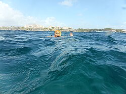 Rob from Ottawa has located the large cannon in the Foul Bay channel in March 2015. Note the Crane Resort landmarks and the GPS position.
 The large cannon in the Foul Bay Channel is directly below Rob. Note the GPS position.


The next picture indicates the landmarks that need to be lined up to find the Foul Bay Channel cannons. The left edge of the first new Crane building needs to be lined up with the vertical buttress on the right hand side of the second new Crane building. The arrows show that they are not lined up in this position and in fact a gap can be seen between the buildings.
 The camera man is too far south or too far to the left.
 Closer view
 Now the marks are lined up


If you swim or drive a boat along this line away from the cliffs toward the reef in due course you will pass through the appropriate part of the channel and find two of the cannons just where the channel is starting to descend to the outer side of the Inner Reef. You need to swim around a little more perhaps 60 m further in to the ocean to find the remainder.
Depending on the state of the current you might have to finish your expedition on Foul Bay Beach to the south west followed by a 2-km walk back on the very hot "blacktop". Take flip flops or organise a lift. Roger Goddard, Barbadian proprietor of Cutters of Barbados, made this swim and walk with his brother David and the photographer in 2003.
Henry Kaiser, w:Henry Kaiser the musician and Underwater Cinematographer, swam out to see two of the Foul Bay Cannons in Feb 2013.
 Henry swam to view the large cannon in Foul Bay.
 Then across to a smaller cannon nearby.


The photographer again counted all seventeen in February 2014 with Davis B, the father of Sebastian, now a 17 year old International Rugby Player and John G.
 In February 2014 Davis B indicates that he can see five cannons from his position on the backside of the channel.
 Here are two of them close to the photographer.
 These three were behind and below the photographer in the previous shot.
 These three were about 10 m to the south east.
 Davis is examining a short fat cannon several metres to seaward.


To show pictures of the remaining six pictures could become repetitive except in a research project.
Other activities
[edit]Divers and their families are usually interested observing other activities on and around the dive sites. On Cobblers Reef these include Surfing, Kite surfing, Wind Surfing, Body Surfing, Stand up Paddling, Snorkelling, Sailing and Ocean Racing, Kayaking, Spear Fishing, Rod Fishing, swimming the horses, Green Monkey watching and flying a Microlight 500 m above the reef.
 Is this an August club outing or an impromptu breakdown service by the Inner Reef?
 Surfing on the Crane beach requires patience, timing, skill and fitness of the participating locals.
 Dane surfing on a rough day on Foul Bay.
 The free divers surfaced outside the inner reef to see this kite surfer in fairly severe conditions.
 He came round to look at the divers as they swam towards the beach.
 The annual festival includes Kite Surfing, sail boarding and Stand-up Paddle Surfing.
 Stand-up Paddle Surf racing.
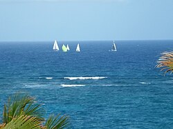 The yachts pass 3 km off shore well clear of the Fathom in the Round Barbados race 2013.
 This Hobie Cat took a short cut inside the Inner Reef.
 In 2014 the yachts were more spaced out by the time the English owned Arctic Idea passed the Crane 2 km off-shore.
 The English Solent based Stormforce Palpatine passing the Crane outside the Fathom to win the 2015 Round the Island Yacht Race.
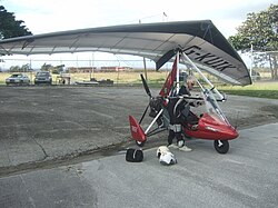 Professional pilot Paul Nugent getting ready to explore Cobblers Reef from 500 m with a seat for his pillion passenger-photographer behind.
 Rock fishing in July inside the calm reef.
 Carline in X50 was line fishing for barracuda off the fathom while the divers on P73 were decompressing between dives.
 A calm March day off Grantley Adams Airport for charter boat rod fishing.
 Colonel Sid is into a decent Wahoo (known locally as King Fish) on the boat Billfisher II.
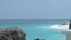 Horses enjoy a cooling swim inside the reef on a calm August day viewed from Bel Air.
 Green monkeys eating prickly pears at the Crane Resort overlooking Cobblers Reef.


Stay safe
[edit]Strong currents, swell, surge and sharp, shallow coral at the top of the reef may increase the hazards of a dive. If the dive is planned well and executed according to plan, decompression should not be a problem, because the dive should finish just outside the top of the reef. A strong down and out current near South Point is probably the most hazardous, due to the shape of the island.
The inside of the Fathom can be a good site for a late afternoon dive, but make sure you are safely ashore before dark. Swimming from the Fathom via the Inner Reef to a safe beach in the gathering gloom and difficult currents and surge can feel serious and a boat is strongly recommended.
Read
[edit]Published data about this reef is either scanty or selective, but these publications are very well worth reading:-
- Charles Cleveland Nutting. Iowa State University. 274pp, Report on the Barbados-Antigua Expedition, 1918, .
- I. G. Macintyre , P. W. Glynn, M. A. Toscano. The destruction of a large Acropora palmata bank-barrier reef and subsequent depletion of this reef-building coral off Barbados, Wisconsin. Smithsonian Atoll Research Bulletin. 1 December 2007.
- Colleen Ryan & Brian Savage. "The Complete Diving Guide. The Caribbean. Volume I." 1997. Complete Dive Guide Publications, Corinth, Vermont.
- Lucy Agace "Barbados Dive Guide", 2005, Miller Publishing Company of Barbados. [dead link]
- Angelique Braithwaite, Hazel Oxenford and Ramon Roach, "Barbados A Coral Paradise", Miller Publishing Company, Edgehill, St. Thomas, Barbados. 2008, [dead link].
- Alistair Reynolds "Barbados Diving Holiday" . [dead link]
- Matt Mindham, "Wrecks, Reefs and Relaxation", [dead link]
- Paul Critcher, "Realguide Eastern Caribbean hotspots" page 92 BSAC DIVE magazine July 2004' [dead link]
- David Hopley editor, "Encyclopedia of Modern Coral Reefs, Structure, form and process". Barbados, David Hopley and Ian G MacIntyre, Cobblers Reef pp 100,101. Springer publisher PO box 17 3300 AA Dordrecht, The Netherlands.
- Clementine Ellasos, "Ile Barbade .com" All you always wanted to know about Barbados, in French:
- André Miller, "The Ins and Outs of Barbados 2014, the People Edition" pp 216 - 221. (Miller Publishing Co. Ltd. Edgehill, St Thomas, Barbados.)