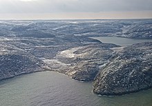
Northern Quebec is a region in Quebec. It is sparsely inhabited with a number of logging and mining towns and hydro electric projects. It covers an area greater than 800,000 km², making it larger than Turkey, but has a population of less than 200,000 (2016), three-quarters of whom live in Abitibi-Témiscamingue in the extreme southwest of the region.
Many of the region's inhabitants belong to the Cree First Nation (mostly in the south), or to the Inuit people (mostly in the far north).
Regions
[edit]
| Abitibi-Témiscamingue Excellent hunting and fishing, and vast expanses of wilderness |
| Baie-James A northern, sparsely developed region bordering James Bay |
| Nunavik The northernmost, least accessible region of Quebec, whose population is mostly Inuit (Indigenous) |
Cities
[edit]- 1 Chibougamau — a small town on the shore of Lake Gilman; its past development has relied on mining
- 2 Kuujjuaq — the largest village in Nunavik
- 3 Rouyn-Noranda — the "capital of copper"
- 4 Wemindji — a small community at the mouth of the Maquatua River
Understand
[edit]Northern Quebec covers more than half of Quebec and is the least populated region of the province.
Geologically, the region is part of the Canadian Shield, an area that was heavily glaciated leaving it with many lakes, mostly thin soil, and many outcrops of ancient rock. Geographically, it is part of a world-girdling belt of sub-arctic Boreal forest.
Northern Quebec is the ancestral land of several indigenous peoples including the Algonquin of Abitibi-Témiscamingue, the Cree of Baie-James, and the Inuit of Nunavik who make up the majority of that sub-region's population.
Talk
[edit]Abitibi-Témiscamingue is primarily French-speaking, with almost 95% that language, and only 3.5% speaking English as a mother tongue, and 1.5% speaking Algonquin.
The rest of the region is linguistically diverse: the most common mother tongues in 2011 were French (35%), Cree (34%), Inuktitut (25%), and English (4%). 51% of residents reported being able to speak French, the official language of the province, and 63% could speak English.
Get in and around
[edit]By car
[edit]From Montreal, Autoroute 15 will take you directly to Rouyn-Noranda.
There is a limited network of roads in the Baie-James region which reaches most of the few, small communities. The main road of the region is the 620-km-long James Bay Road, a paved extension of Route 109 from Matagami to Radisson. The 407-km-long gravel Route du Nord connects the James Bay Road to Route 167 near Chibougamau. The 666-km-long gravel Trans-Taiga Road branches off the James Bay Road to Caniapiscau, the northernmost connecting road in eastern North America.
The few provincial routes are concentrated in the far south of the region, including Route 109 to Matagami, Route 113, which ends near Chibougamau, and Route 167 to Mistissini.
There are no roads to Nunavik from the south. There are isolated roads in and around villages, as well as an isolated road running from the Raglan Mines to Deception Bay, connecting to Salluit.
By bus
[edit]- Autobus Maheux. Offers service from Montreal to Val-d'Or and Rouyn-Noranda. There is also service from Chisasibi to Val-d'Or, via Matagami and Amos.
By plane
[edit]The Rouyn-Noranda Airport receives flights every day from Val-d'Or and Montreal. All villages in Nunavik have their own airport, with the Kuujjuaq Airport functioning as a regional hub.
See
[edit]
History buffs can take a self-guided walking tour of the old districts of Rouyn-Noranda, which also is home to an interesting Russian Orthodox Church.
Val-d'Or, true to its name "valley of gold", offers sights related to mining which include a decommissioned mine, an operating mine, a museum, and a preserved mining village.
Visit a Cree community in Baie-James such as Wemindji.
In Nunavik, you can visit Old Chimo, an old settlement a few kilometres downstream from Kuujjuaq. In Inukjuac, the Daniel Weetaluktuk museum displays contemporary Inuit artwork and 200 archaeological and historical objects.
Do
[edit]
Abitibi-Témiscamingue offers lush forests dotted with 22,000 lakes and rivers. The Aiguebelle National Park, La Vérendrye Wildlife Reserve, the Val-d’Or Recreational Forest and Opémican National Park should be your starting points for outdoor sports and recreation, like hiking, canoeing, kayaking, cycling, mountain biking, snowshoeing, cross-country skiing or downhill skiing. La Vérendrye Wildlife Reserve, between Val d'Or and Grand Remous, is one of the largest contiguous reserves in Québec.
Rouyn-Noranda hosts festivals year-round for those interested in fireworks, emerging music, guitar music, film, and fake documentaries.
Fishing in the rivers and lakes along the James Bay Road, including Atlantic salmon and sea-run trout fishing, is permitted with a Quebec fishing permit. In the areas surrounding the Cree communities, you must have a guide to fish. Generally there are signs in areas where fishing is prohibited to non-natives. Caribou hunting is also available.
Through most of the region, on clear nights, the aurora borealis (Northern Lights) is often visible
Stay safe
[edit]Go next
[edit]

