
User:Pbsouthwood/Gallery of aerial photographs from CDS&M
Gallery of aerial photographs from CDS&M on Wikivoyage Shared
[edit]Image credit template
[edit]{{Imagecredit|credit=Chief Directorate of Surveys and Mapping |captureDate=2001 |location=, Cape Peninsula, Cape Town |source= |caption=Aerial view of the dive site at |description=}} Data of the Chief Directorate of Surveys and Mapping appears on website http//w3sli.wcape.gov.za Reproduced under Government Printer’s Copyright Authority No.11458 dated 1 September 2009
Aerial photos from DGS&M
[edit] Ankers and Balcony (Rooi-els)
 Antipolis and Klein Pannekoek (Oudekraal)
 Bakoven Rock (Camps Bay)
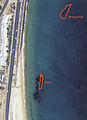 Bato and Brunswick wrecks (Simon's Town)
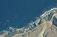 Blousteen (Rooi-els)
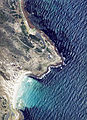 Bordjiesrif (Cape Point)
 Castle Rocks (Simon's Town)
 Clifton Rocks (Clifton)
 Clan Stuart wreck (Simon's Town)
 Coral Gardens (Rooi-els)
 Cow and Calf and Vogelsteen (Gordon's Bay)
 Dale Brook (St James)
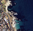 Froggy Pond and Fisherman's Beach (Simon's Town)
 Granger Bay (Table Bay)
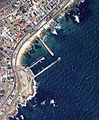 Kalk Bay harbour (Kalk Bay)
 Klein Pannekoek (Oudekraal)
 Ledges (Gordon's Bay)
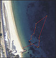 Long Beach (Simon's Town)
 Lorry Bay (Gordon's Bay)
 Miller's Point (Simon's Town)
 Noah's Ark (Simon's Town)
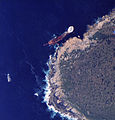 Boss 400 wreck (Duiker Point)
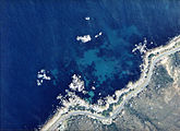 Justin's Caves and Geldkis (Oudekraal)
 Partridge Point (Simon's Town)
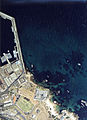 Phoenix shoal (Simon's Town)
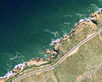 Pinnacle (Gordon's Bay)
 Quarry (Glencairn)
 Spaniard Rock (Simon's Town)
 Rocky Bay (Simon's Town)
 Boulders Beach (Simon's Town)
 Shark Alley (Simon's Town)
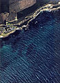 Spaniard Rock (Simon's Town)
 Sunny Cove (Fish Hoek)
 Tony's Reef (Gordon's Bay)
 Troglodyte's Cove (Gordon's Bay)
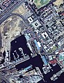 Two Oceans Aquarium (Waterfront)
 Windmill Beach (Simon's Town)
 Percy's Hole and Kruis (Rooi-els)
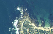 Rooi-els Point (Rooi-els)
 Whirlpool (Rooi-els)
 Penguin point and Photographers' Reef (Simon's Town)
 Coral gardens and Groot Pannekoek (Oudekraal)
 SAS Pietermaritzburg wreck site (Simon's Town)
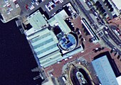 Two Oceans Aquarium buildings (Waterfront)
 Blue Rock Quarry (Gordon's Bay)


Image:Container Bay Aerial.jpg