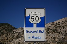
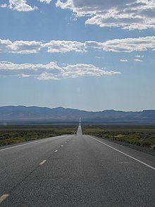
Central Nevada in Nevada is the region surrounding the Loneliest Road in America, including small settlements, mountain ranges and large plateaus in between. Those who live here welcome the few tourists they get, so don't feel afraid to explore this otherwise largely uninhabited part of the state.
Cities
[edit]- 1 Austin - small former mining town
- 2 Baker - small community that is a good jumping-off point for climbing Wheeler Peak
- 3 Ely - large town with several restaurants and other facilities
- 4 Eureka - small mining town
- 5 Fallon - large town with several hotels; is closer to the Carson City area than Central Nevada
Other destinations
[edit]- 1 Great Basin National Park is in one of Nevada's largest mountain ranges; the centerpiece of this park is Wheeler Peak, one of the highest mountains in the contiguous United States. The park is also known for its bristlecone pine forests, caves, and juniper forests.
- 2 Humboldt-Toiyabe National Forest is near the town of Austin. It encompasses much of the mountainous part of Central Nevada, and the hills and mountains here are covered with the juniper trees, which can survive in the alpine regions. The area can get extremely cold in winter; therefore it often snows in these mountains.

- 3 Sand MountainYou can come here and listen to the singing sand or else take a walk up this immense Great Basin dune. Watch out for ATVs tracking hither and yon. On the access road to the mountain there is also a side road to the Sand Springs Pony Express Station Historical Marker with some ruins. Directions: on north side of Hwy 50 about 25 mi (40 km) southeast from Fallon. Tel: 775-885-6000.
- 4 Shoe Tree Art or a monstrosity? A large cottonwood tree encumbered with seemingly thousands of shoes of passersby.
- 5 Cold Springs Pony Express Station Walk among the ruins of an old pony express station.

- 6 Hickison Petroglyph Recreation Area Short trail enables you to view petroglyphs of prehistoric people.
Understand
[edit]Nevada is known for its deserts, but Central Nevada isn't limited to this ecosystem. Instead the region includes alternating mountains and valleys known as "basin and range" topography. The western portion of Central Nevada, exiting the Carson City area, is the driest, and this is the region where many salt flats are found, similar to those encountered in Death Valley. Going east the terrain becomes less like desert, and instead forested at the higher elevations. The far eastern part of Central Nevada includes the highest peak in Central Nevada, Wheeler Peak, and more rocky outcrops; east of Wheeler Peak, the terrain continues to be varied all the way to the Rocky Mountains.

Mountain ranges in Central Nevada mostly run north to south and are similar in appearance to the eastern side of the Sierra Nevada. Between these mountains are dry valleys where farming is a rare sight, and even ranching is quite rare. The valleys are mostly dominated by sagebrush and in some wetter locations oak trees, while lower mountains are covered in juniper trees.
Central Nevada is known for being part of the "Great Basin" because all of the valleys in this area are basins; water that flows into them either evaporates or collects in lakes rather than draining to an ocean. However, there are not many rivers in Central Nevada, so any lakes in the area are either dry, seasonal, or murky.
Most of the towns in the area are small and are not experiencing the growth that is noticed in other parts of Nevada, and in fact the population of the few towns in Central Nevada fell in the 2010s. Most roads in the region are very quiet; the U.S. Route 50, for example, is known as the "loneliest road in America" because it receives little traffic.

Get in
[edit]The Central Nevada region is best accessed from the west, where interstates I-80 and I-580 exist. I-50 enters Central Nevada from the east and west.
Get around
[edit]The main road through Central Nevada is U.S. Route 50, which is known as the "Loneliest Road in America". It was built in the early 20th century along the route of the Pony Express. The road is this way because Central Nevada is almost uninhabited, there is only one national park, and much of the traffic between Reno and Salt Lake City takes the Interstate 80, built in 1982. Today the Loneliest Road connects the few small towns in Central Nevada, and it is the route most travelers take across the region (there are few others). Access to Baker and most of Great Basin National Park requires leaving the Loneliest Road.
You can get complete understanding of Central Nevada by, as the locals say, "surviving" the Loneliest Road. The road leads through dry valleys, high mountain passes, and goes straight through most of the towns along the route.

Go next
[edit]- Western Utah - this region of Utah includes similar terrain to Central Nevada, but includes more farming and ranching in valley areas.
- Canyon Country - this region of Utah is known for its dramatic rock formations.


