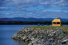
Chaudière-Appalaches is a region in Quebec. This region, with its coastal, agricultural and mining vistas, showcases the many faces of Québec's nature and culture. By following the coast, you will come across some of the most beautiful villages in Québec, characterized by their distinctive architecture and watermills. In this bird-watchers' paradise, you can observe flocks of snow geese during their spring and fall migrations. And in the backcountry valleys, you can taste maple products, bicycle amid the symphony of fall colours and, in summer and winter alike, practise your favourite sport in one of the region's beautiful parks. Make a stop in Saint-Jean-Port-Joli, the sculpture centre, where you will discover one aspect of Quebec's cultural landscape!
Regions
| Beauce one of the most prolific maple syrup producing regions in the world |
Cities
- 1 Montmagny — a base for exploring Grosse Isle
- 2 Saint-Georges — the main centre of the Beauce region
- 3 Saint-Jean-Port-Joli — a centre for sculpture
Other destinations
- 1 Grosse Isle — historic quarantine station for inbound ships from Ireland and Europe
Understand
Chaudière-Appalaches is a consistently overlooked part of Quebec, but it is an extensive and beautiful region. A peculiarly strong local accent is used by a small percentage of the population of Chaudière-Appalaches. There are numerous opportunities for the pursuit of winter sports; snowshoeing, cross-country skiing, snowmobiling, skiing and ice skating are all readily at your disposal.
La Beauce is a cultural and historical region of the Chaudière Valley with a strong identity. The Beauceron territory has more than 100,000 inhabitants. Beauce is one of the most fertile regions of Chaudière-Appalaches.
Despite cold winters and a lot of rainfall, the region's humid continental climate also ensures very mild and pleasant summers, conducive to a number of outdoor activities. As for the vegetation, it mainly consists of a mixed forest that covers 74% of the area. Three bioclimatic domains are present: that of maple to linden , that of maple to yellow birch and that of balsam fir to yellow birch.
History
The Côte-du-Sud (south shore) was one of the first regions to be colonized as part of New France in the 1650s. By the end of the French regime, the region's population was about 10,000 of the 60,000 inhabitants of New France. During the 19th century, the lack of land for the populous south shore forced the inhabitants to emigrate. With the advent of the railway, the opening of new settlement lands (e.g. the Lac Saint-Jean in the middle of the 19th century and Abitibi in the 1930s) made the area a land of emigration. As a result, the population stopped growing and even decreased.
Get in
From Waterville, Maine and other points south, US 201 crosses the Appalachian mountains and reaches the US-Canadian border at the southern end of the region, becoming Route 173 (Route du President Kennnedy). From Quebec City, cross the Saint Lawrence River on the Pont Pierre-Laporte, entering the region on Autoroute 73.
The Trans-Canada Highway from Montréal and Lévis passes through Berthier-sur-Mer and Montmagny on the south shore of the St. Lawrence River en route to Rivière-du-Loup.
Saint-Georges also has a regional airport.
By bus
- Autobus A1, ☏ +1-418-332-3555. Bus route operating several days per week between Quebec City and Thetford Mines including a stop in Sainte-Foy. Travel time to Thetford Mines from Quebec City 1.5-1.75 hours.
- Autobus Breton, ☏ +1-418-228-8096, toll-free: +1-800-550-7496. Operates a daily bus route between Quebec City and the city of Saint-Georges including a stop in Sainte-Foy. Travel time to Saint Georges from Quebec City is 2.25-2.5 hours.
Get around
By boat
Croisières Lachance runs seasonally from Berthier-sur-Mer to Grosse-Île and Île-aux-Grues; total cost per-person for boat and national historic site admission is about $60/person.
L'Isle-aux-Grues – Montmagny Ferry, seasonal, free, provincially-operated car ferry. Runs 2-4 times daily, depending on tides.
By air
Air Montmagny (☏ +1 418-248-3545) operates on-demand charter flights year-round from Montmagny to the small landing strips on Île-aux-Grues and Grosse-Île.
See

Grosse-Île National Historic Site was a quarantine station for Irish fleeing the Great Potato Famine of the 1840s.
Saint-Georges is often considered the metropolis of the proudly independent Beauce region. It has an 19th-century church and a miniature village.
Do
Sugaring off in early spring in the centrepiece of the maple syrup harvest. Visit a cabane à sucre or the Festival beauceron de l'Érable (Beauce maple festival) in late March.
Eat
The Beauce region produces 90% of the world's maple syrup, and no visit to the region would be complete without a trip to one of many "cabanes à sucre" or sugar shacks.


