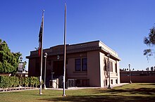
Appearance
Calexico is a city in Imperial County in California, located just across the U.S.-Mexican border from Mexicali.
Get in
[edit]By car
[edit] Imperial Ave From
  Calexico is located at the southern end of Highway 111, 9 mi (14 km) south of its junction with I-8 (Exit 120 of I-8), east of El Centro.
By plane
[edit]- 1 Calexico International Airport (CXL IATA). For private pilots this is a common place for traveling to and from Baja to file customs and entry forms.
Nearest airport for commercial flights by Mokulele Airlines is at Imperial Airport (IPL IATA) located 15 mi (24 km) north in El Centro. The next nearest airport for commercial flights is in San Diego International Airport (SAN IATA) where travelers can rent a car or take a Greyhound bus to Calexico. From Mexico the nearest airport for commercial flights is in Mexicali (MXL IATA)
By bus
[edit]- 2 Greyhound, (bus station) 123 E 1st St (E 1st St & Paulin across street from US Border Inspection Station), ☏ +1 760 357-1985, toll-free: +1 800 231-2222. Calexico is served by Greyhound from Los Angeles (around 6 hours via Imperial; El Centro, Indio/Palm Springs, San Bernardino); Phoenix (via Yuma, Gila Bend); and San Diego (around 4 hours)
- 3 Imperial Valley Transit (IV Transit), (bus stop) E 3rd St & Pauline Ave (Bus stop at SE of intersection of E 3rd St & Pauline Ave), ☏ +1 760 482-2900. Operates buses to El Centro (Rt #1); Brawley (Rt #32) and Imperial Valley College (IPVC) (#21). From Brawley the #31 bus goes to Calexico.
Get around
[edit]See
[edit]Do
[edit]- Most visitors to Calexico arrive on foot from the sister city Mexicali. From downtown Calexico it's a short walk to the border crossing and several tourist areas on the other side. U.S. citizens do not require a passport, only proof of citizenship, for short trips to the border area of Mexico, but you will need a passport, passport card, or enhanced driver's license to reenter the U.S.
Buy
[edit]Eat
[edit]Drink
[edit]Sleep
[edit]- 1 Best Western John Jay Inn, 2421 Scaroni Rd, ☏ +1 760 768-0442.
- 2 Holiday Inn Express, 2501 Scaroni Rd, ☏ +1 760 768-6048.
Cope
[edit]
Consulates
[edit] Mexico, 408 Heber Ave, ☏ +1 760 357-3863, fax: +1 760 357-6284.
Go next
[edit]| Routes through Calexico |
| Palm Springs ← El Centro ← | N |
→ |


