The New River and Greenbrier Valleys region is in West Virginia.
Cities
[edit]- 1 Beckley
- 2 Bluefield
- 3 Bramwell
- 4 Fayetteville
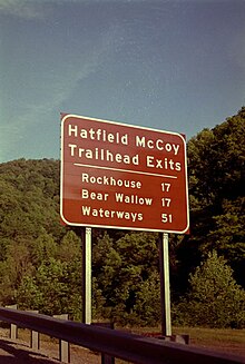
- 5 Gilbert (West Virginia) — provides access to the Hatfield-McCoy ATV trail system
- 6 Hinton (West Virginia)
- 7 Lewisburg — historic town popular for its quaint shopping and Civil War connections
- 8 Mullens — a former railroad, lumber and coal mining town on the Guyandotte River, near Twin Falls Resort State Park
- 9 Oak Hill
- 10 Pineville
- 11 Princeton
- 12 Welch
- 13 White Sulphur Springs — home of the Greenbrier resort
Other destinations
[edit]For the outdoors enthusiast, the Monongahela National Forest with recreation areas like Blue Bend Camping and Swimming areas and Lake Sherwood are excellent choices. Both offer rustic camping opportunities. Blue Bend was built by the CCC during the 1930s. The flagstone paved beaches of this wonderful swimming hole are unique and the water is cool and refreshing all summer long.
Understand
[edit]Get in
[edit]Get around
[edit]See
[edit]- Hinton Railroad Museum, in Hinton.
Do
[edit]Collect fossils
[edit]- Gap Mills. Just short of two and a half miles east of Keenan and just over two miles west of the unincorporated community of Gap Mills are road cuts where late Mississippian fossils can be collected from the Greenbrier Group. The most common fossils here are the brachiopod Inflatia inflata. Other local fossils include the blastoid Pentremites, the bryozoan Fenestella, corals, crinoids, gastropods, and trilobites.
- Waiteville: About 3 miles to the southwest of town is a roadcut at the side of Route 635 where middle Silurian fossils can be collected from the Rose Hill Formation. Fossils are very common here but are fragmentary. Like the Perry site, they are often brightly colored in hues of orange, yellow, or, less commonly, pink. Local fossils include bivalves, brachiopods, bryozoans, straight-shelled nautiloids, ostracodes, Tentaculites, and trilobites, especially Calymene cresapensis.
Hatfield-McCoy Trails
[edit]
The Hatfield-McCoy Trail System is a statutory corporation created by West Virginia legislation for the purpose of economic development through tourism in nine southern West Virginia counties. As of March 2007, the Hatfield-McCoy Trail System totals several hundred miles of off-road trails in five of its nine project counties. Each of its six trail systems are open to ATV's, Dirt Bikes, select Utility Vehicles (UTVs), Mountain Bikes, Horses, and Hikers. Many of the trail systems also offer community connecting trails that allow visitors to access “ATV friendly towns” to experience the charm of southern West Virginia.
The six Hatfield-McCoy trail systems are Browning Fork, Buffalo Mountain, Dingess Rum, New Indian Ridge, Little Coal, and Pinnacle Creek Trails. No matter which trail system you choose, Hatfield-McCoy Trail visitors can expect to find a variety of trails ranging from easiest to most difficult. These are not your typical “flatlander” trails however and can be a challenge for a first time rider. For this reason, visitors may choose from a list of ATV guided tour and rental providers. You can find a listing of these providers and a complete list of lodging facilities by visiting our accommodations page of this web site.
The overall goal of the Hatfield-McCoy Trails project is to develop a world class trail system with an emphasis on safety in each of its nine project counties throughout southern West Virginia. Project estimates have concluded that once the trails are developed and linked through each of the project counties, there may be as much as 2000 miles of total trails. Long-term plans for the Hatfield-McCoy Trails also include a 4x4 park in Kanawha County and designated trail areas for equestrian and other non-motorized users.
- Hatfield-McCoy Trails, toll-free: +1-800-592-2217. Open daily, sunrise to sunset. Over 500 miles of trails available for ATV riding. Permits are $27.50(resident) and $47.00 (non-resident).


