Appearance


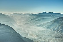
The Parvati Valley is in Himachal Pradesh.
Understand
[edit]Parvati valley is located in Kullu district of Himachal Pradesh. A lush green valley offering numerous treks of different grades. From the town of Bhuntar which is at the confluence of Beas and Parvati Rivers, the Parvati River goes east all the way up to Mantalai.
Following the road there are few villages on the way Jari, Kasol, Burshaini to name some of them. The sheer beauty of the valley makes you immovable. Several tributaries including the Dibibokiri and Tosh Nallah drain themselves up in the roaring Parvati.
Get in
[edit]Get around
[edit]See
[edit]Do
[edit]- 1 Manikaran Hot Spring (at the banks of the Parvati River). At a height of over 1700 metres, the geothermal spring is accessible from the nearby town of Kasol. Bathing in the hot spring is only allowed during daylight hours.
- 2 Kheerganga Hot Spring. This hot spring requires a moderate trek of around 6 hours. The closest village connected by road is the village of Barshaini.

