
Grand Coulee
.jpg)

Grand Coulee is a city in the Columbia River Plateau of Washington State.
Get in
[edit]Don't confuse the town of Coulee City on the south shore of Banks Lake along a major US highway for Grand Coulee. The town with the dam is further north and in a more remote part of the state.
From the west: US Hwy 2 east to WA State Hwy 155 north. In the Seattle Metro area, there are short cuts to US Hwy 2 from Bothell on WA State Hwy 522, and Duvall (east of Redmond) on WA State Hwy 203. Otherwise, take the I-5 Fwy exit #194 in Everett where US Hwy 2 begins. Distance from Seattle: 230 miles
From the east: US Hwy 2 west to WA State Hwy 174 west (but runs northwest). Distance from Spokane: 88 miles
Understand
[edit]The small segment of the Columbia River at Grand Coulee flows north. This is the opposite of the river's normal flow from Canada to the Pacific Ocean. Photography can be a challenge due to the massive size of the dam, and the inability to get far enough away before passing the relatively short horizon. If possible, bring a wide-angle lens, and avoid the hours of the day when the sun is just barely above the dam face. Unfortunately, most of the time you'll be looking south and directly into the sun while viewing the dam.
Get around
[edit]See
[edit]
- 1 Grand Coulee Dam, ☏ +1 509-633-9265. This massive dam built in 1941 extends for nearly a mile across the mighty Columbia River, the dam is the largest hydroelectric producer in the country. It creates a 130-mile-long Lake Roosevelt, a National Recreation Area.


- 2 Lake Lenore Caves. These caves on the Grand Coulee were formed by water erosion on volcanic rock, which makes them geologically interesting.
- 3 Steamboat Rock State Park, 51052 Hwy 155, Electric City (On the north shore of Banks Lake, 16 miles north of Coulee City.), ☏ +1 509-633-1304. 6ː30AM-dusk.
- 4 Northrup Canyon. A homestead just north of Steamboat Rock.
Do
[edit]While the roots of its scenic beauty date back to the ice age floods, the formation and management of the lake is distinctly modern. With the closing of Grand Coulee Dam’s gates in 1942, the resulting reservoir (called Franklin D. Roosevelt or Lake Roosevelt for short) extends north over 150 miles and provides over 630 miles of shoreline. The shoreline within the Lake Roosevelt National Recreation Area is managed by the National Park Service. The shorelines within the Colville and Spokane reservations are managed by the respective tribes.
- Backpacking and Day Hiking. Immediately around the Lake Roosevelt, Fort Spokane, Spring Canyon and Kettle Falls have the most accessible and well documented trails. In the general vicinity, however, are also state parks and national forests with both easy and difficult trails that provide breathtaking views of the area’s geology and terrain.
- Beach Walking. Via boat or by foot, there are hundreds of secluded beaches, coves, and inlets to explore. Particularly when lake levels fall, however, tribal artifacts from the period before the dam was built can become exposed. It is everyone’s responsibility to protect these cultural treasures. As a result, it is strictly forbidden to disturb or remove artifacts from these sites.
- Boating. Water-skiing, canoeing, sailing and fishing are just some of the on-water activities the lake offers. Access to the lake is made easy by 23 boat ramps and 4 full service marinas. Because lake levels fluctuate daily, always compare the lake level and boat launch elevations before starting out. In summer months, the lake level is generally high enough to meet the needs of all boat launch requirements. For boat rental information, contact a marina.
- Camping. There are 17 National Park Service (NPS) campgrounds reachable by car, and 10 by boat. Additionally, the Spokane Indian Tribe maintains 11 campgrounds, and the Colville Confederated Tribes maintain 7 campgrounds. With the exception of group camping at Park Service sites, most campgrounds operate on a “first-come-first-served” basis. Shoreline camping one quarter of a mile from developed NPS campgrounds is permitted along the lake.
- Casinos. Each of the tribes bordering the lake operate Vegas style casinos with a variety of games.
- Colville Tribal Museum Store. Located at Coulee Dam, chronicles the cultural history of the twelve tribes of the Confederated Tribes of the Colville Indian Reservation.
- Golfing. From the fairways of Dear Meadows golf course, you can enjoy panoramas of the lake below. Within an hour of the lake, there are also the Big Bend, Banks Lake, Colville and Wilbur golf courses
- Tour the Grand Coulee Dam. Tours of the largest dam in North America are available during the summer. The Visitor Center opens at 8:30 am and closes between 5:00 pm and 11:00 pm, depending on the season. There are also unguided historical walking trails in the vicinity.
- Horseback Riding. Enjoy the scenic trails of the area by contacting K-Diamond-K Guest Ranch at (888) 345-5355 and the Bull Hill Ranch at (877) BULL-HILL.
- Houseboats. House boat rentals are a popular way for friends and family to enjoy the lake’s natural beauty without sacrificing modern luxury.
- Keller Heritage Center. Consisting of a museum, a lookout tower, trappers’ cabins, a blacksmith’s shop and more, the Heritage Centerprovides visitors a complete history of the area. Open May through September.
- Kettle Falls Historic Center. An interpretive center and other exhibits allow you to learn about 9,000 years of human history. Exhibits range from the Native American fishermen to white settlers.
- Laser Light Show. As colorful lasers reflect off the dam’s spillway, music and narration tell the story of Grand Coulee Dam in a unique and entertaining way. Viewable from several locations around the dam, the Laser Light Show plays once a night from the end of May to the end of September. There is no cost to view the show.
- Observing Wildlife. While hiking, boating or just relaxing, wild animals may be seen. Among those with four legs, black bear, elk, bobcats and deer (which are commonly seen along the shoreline) roam the area. When looking skyward, osprey, golden and bald eagles, hawks and smaller birds are year round residents. Seasonally, migrating Canada geese, ducks and swans visit.
- Ranger Guided Programs. During the summer, the NPS offers several programs at their campgrounds. These include the living history program at Fort Spokane (a demonstration of black powder weapons and military drills from the 19th century), guided and non-guided nature walks, guided canoe trips and exhibits.
- St. Paul's Mission. Located in Kettle Falls, this 1846 church is one of the oldest in Washington. A trail with exhibits is nearby.
- Star Gazing. The wide open and unpopulated nature of the region make it ideal for star gazing. Northern Lights can be particularly well seen from the Kettle Falls area. Rangers provide a great summer program and demonstrations allowing star gazer's a unique opportunity to view the night skies.
Buy
[edit]Eat
[edit]Drink
[edit]Sleep
[edit]- Trailwest Motel, 108 Spokane Way, ☏ +1 509-633-3155, toll-free: +1-866-633-8157.
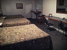
Trailwest Motel room interior

Go next
[edit]- Dry Falls Interpretive Center. From US Hwy 2, turn at WA State Hwy 17 at the SW corner of Banks Lake, then 4 miles south. Just inside Sun Lakes State Park (below). During the last ice age, Dry Falls occasionally carried more water by volume than all the rivers of the world combined (known as the Missoula Flood). State parks Discover Pass is required.
- [dead link] Summer Falls State Park (about 10 miles south of Coulee City).
- Sun Lakes-Dry Falls State Park (7 miles SW of Coulee City). At the foot of Dry "Falls. Offers camping and lakefront shoreline.
| Routes through Grand Coulee |
| Ends at |
N |
→ Coulee City → Ends at |